Saint-Vitte
Saint-Vitte is a commune in the Cher department in the Centre-Val de Loire region of France.
Saint-Vitte | |
|---|---|
Location of Saint-Vitte 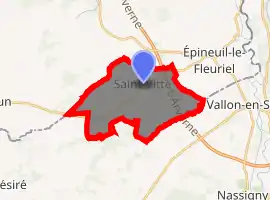
| |
 Saint-Vitte  Saint-Vitte | |
| Coordinates: 46°32′52″N 2°32′06″E | |
| Country | France |
| Region | Centre-Val de Loire |
| Department | Cher |
| Arrondissement | Saint-Amand-Montrond |
| Canton | Châteaumeillant |
| Government | |
| • Mayor (2008–2014) | Marie-Claude Tucker |
| Area 1 | 16.38 km2 (6.32 sq mi) |
| Population (2017-01-01)[1] | 131 |
| • Density | 8.0/km2 (21/sq mi) |
| Time zone | UTC+01:00 (CET) |
| • Summer (DST) | UTC+02:00 (CEST) |
| INSEE/Postal code | 18238 /18360 |
| Elevation | 184–277 m (604–909 ft) (avg. 322 m or 1,056 ft) |
| 1 French Land Register data, which excludes lakes, ponds, glaciers > 1 km2 (0.386 sq mi or 247 acres) and river estuaries. | |
Geography
A small farming area comprising the village and two hamlets situated in the valley of the small river Queugne, about 36 miles (58 km) south of Bourges at the junction of the D4 with the D4e and D173 roads. The commune borders the department of Allier and the A71 autoroute passes through the eastern part of the commune. The small river Boeuf forms most of the commune’s northern border
Population
| Year | Pop. | ±% |
|---|---|---|
| 1962 | 216 | — |
| 1968 | 244 | +13.0% |
| 1975 | 202 | −17.2% |
| 1982 | 176 | −12.9% |
| 1990 | 138 | −21.6% |
| 1999 | 136 | −1.4% |
| 2008 | 138 | +1.5% |
Sights
- The church of St. Vitte, dating from the sixteenth century.
See also
References
- "Populations légales 2017". INSEE. Retrieved 6 January 2020.
External links
| Wikimedia Commons has media related to Saint-Vitte. |
- A photo of Saint-Vitte (in French)
- Annuaire Mairie website (in French)
- Saint-Vitte on the Quid website (in French)
| Authority control |
|---|
This article is issued from Wikipedia. The text is licensed under Creative Commons - Attribution - Sharealike. Additional terms may apply for the media files.