Saint-Georges-de-Poisieux
Saint-Georges-de-Poisieux is a commune in the Cher department in the Centre-Val de Loire region of France.
Saint-Georges-de-Poisieux | |
|---|---|
Location of Saint-Georges-de-Poisieux 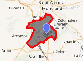
| |
 Saint-Georges-de-Poisieux  Saint-Georges-de-Poisieux | |
| Coordinates: 46°41′14″N 2°28′46″E | |
| Country | France |
| Region | Centre-Val de Loire |
| Department | Cher |
| Arrondissement | Saint-Amand-Montrond |
| Canton | Châteaumeillant |
| Intercommunality | Berry Grand Sud |
| Government | |
| • Mayor (2008–2014) | Daniel Fourre |
| Area 1 | 15.61 km2 (6.03 sq mi) |
| Population (2017-01-01)[1] | 456 |
| • Density | 29/km2 (76/sq mi) |
| Time zone | UTC+01:00 (CET) |
| • Summer (DST) | UTC+02:00 (CEST) |
| INSEE/Postal code | 18209 /18200 |
| Elevation | 152–218 m (499–715 ft) (avg. 223 m or 732 ft) |
| 1 French Land Register data, which excludes lakes, ponds, glaciers > 1 km2 (0.386 sq mi or 247 acres) and river estuaries. | |
Geography
A farming area comprising two villages and a couple of hamlets situated in the valley of the river Cher, about 12 miles (19 km) southeast of Bourges on the D143 road at its junction with the D64 and the D951 roads. The A71 autoroute passes through the northern part of the commune.
Population
| Year | Pop. | ±% |
|---|---|---|
| 1962 | 275 | — |
| 1968 | 308 | +12.0% |
| 1975 | 292 | −5.2% |
| 1982 | 302 | +3.4% |
| 1990 | 373 | +23.5% |
| 1999 | 357 | −4.3% |
| 2008 | 395 | +10.6% |
Sights
- Two churches, of St. Paul and St. Georges, both dating from the twelfth century.
- The sixteenth-century château of Poisieux.
See also
References
- "Populations légales 2017". INSEE. Retrieved 6 January 2020.
External links
| Wikimedia Commons has media related to Saint-Georges-de-Poisieux. |
- Annuaire Mairie website (in French)
| Authority control |
|---|
This article is issued from Wikipedia. The text is licensed under Creative Commons - Attribution - Sharealike. Additional terms may apply for the media files.