Jars, Cher
Jars is a commune in the Cher department in the Centre-Val de Loire region of France.
Jars | |
|---|---|
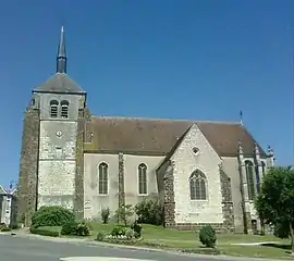 The church of Saint-Agnan, in Jars | |
Location of Jars 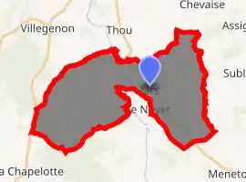
| |
 Jars  Jars | |
| Coordinates: 47°23′46″N 2°41′01″E | |
| Country | France |
| Region | Centre-Val de Loire |
| Department | Cher |
| Arrondissement | Bourges |
| Canton | Sancerre |
| Intercommunality | CC Pays Fort Sancerrois Val de Loire |
| Government | |
| • Mayor (2008–2014) | Jacques Rincheval |
| Area 1 | 37.34 km2 (14.42 sq mi) |
| Population (2017-01-01)[1] | 507 |
| • Density | 14/km2 (35/sq mi) |
| Time zone | UTC+01:00 (CET) |
| • Summer (DST) | UTC+02:00 (CEST) |
| INSEE/Postal code | 18117 /18260 |
| Elevation | 204–364 m (669–1,194 ft) (avg. 360 m or 1,180 ft) |
| 1 French Land Register data, which excludes lakes, ponds, glaciers > 1 km2 (0.386 sq mi or 247 acres) and river estuaries. | |
Geography
An area of forestry and farming, comprising the village and several hamlets situated in the valley of the river Sauldre, some 24 miles (39 km) northeast of Bourges, at the junction of the D923, D55 and the D47 roads.
Population
| Year | Pop. | ±% |
|---|---|---|
| 1962 | 547 | — |
| 1968 | 596 | +9.0% |
| 1975 | 552 | −7.4% |
| 1982 | 554 | +0.4% |
| 1990 | 522 | −5.8% |
| 1999 | 505 | −3.3% |
| 2008 | 486 | −3.8% |
Sights
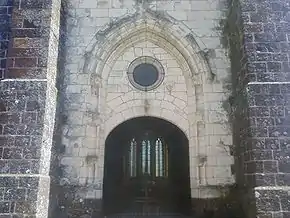
Church entrance
- The church of St. Aignan, dating from the fifteenth century.
- Traces of the castle of Nancray.
- An eighteenth-century house, the "Tisserands" and mill at the hamlet of Plansons-d'en-Bas.
- A fifteenth-century manorhouse with twin towers from an old gateway.
See also
References
- "Populations légales 2017". INSEE. Retrieved 6 January 2020.
External links
| Wikimedia Commons has media related to Jars (Cher). |
- Official website of the commune (in French)
| Authority control |
|
|---|
This article is issued from Wikipedia. The text is licensed under Creative Commons - Attribution - Sharealike. Additional terms may apply for the media files.