Saint-Saturnin, Cher
Saint-Saturnin is a commune in the Cher department in the Centre-Val de Loire region of France.
Saint-Saturnin | |
|---|---|
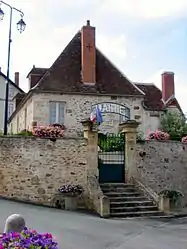 The town hall in Saint-Saturnin | |
.svg.png.webp) Coat of arms | |
Location of Saint-Saturnin 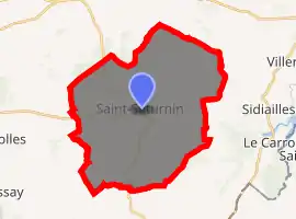
| |
 Saint-Saturnin  Saint-Saturnin | |
| Coordinates: 46°30′30″N 2°14′19″E | |
| Country | France |
| Region | Centre-Val de Loire |
| Department | Cher |
| Arrondissement | Saint-Amand-Montrond |
| Canton | Châteaumeillant |
| Government | |
| • Mayor (2014–2020) | Gérard Durand |
| Area 1 | 39.04 km2 (15.07 sq mi) |
| Population (2017-01-01)[1] | 422 |
| • Density | 11/km2 (28/sq mi) |
| Time zone | UTC+01:00 (CET) |
| • Summer (DST) | UTC+02:00 (CEST) |
| INSEE/Postal code | 18234 /18370 |
| Elevation | 282–442 m (925–1,450 ft) (avg. 380 m or 1,250 ft) |
| 1 French Land Register data, which excludes lakes, ponds, glaciers > 1 km2 (0.386 sq mi or 247 acres) and river estuaries. | |
Geography
An area of streams, forestry and farming comprising the village and several hamlets situated by the banks of the small river Cotet, about 44 miles (71 km) south of Bourges at the junction of the D3 with the D111 and the D162 roads. The commune shares a border with the department of Indre.
Population
| Year | Pop. | ±% |
|---|---|---|
| 1962 | 729 | — |
| 1968 | 830 | +13.9% |
| 1975 | 683 | −17.7% |
| 1982 | 605 | −11.4% |
| 1990 | 513 | −15.2% |
| 1999 | 466 | −9.2% |
| 2007 | 428 | −8.2% |
| 2012 | 417 | −2.6% |
| 2014 | 416 | −0.2% |
Sights
- The parish church of St. Saturnin dates from the twelfth century with significant restoration work in 1729 and 1929.[2]
See also
References
- "Populations légales 2017". INSEE. Retrieved 6 January 2020.
- Base Mérimée: église paroissiale, Ministère français de la Culture. (in French)
External links
| Wikimedia Commons has media related to Saint-Saturnin (Cher). |
- Annuaire Mairie website (in French)
- Saint-Saturnin on the Quid website (in French)
| Authority control |
|---|
This article is issued from Wikipedia. The text is licensed under Creative Commons - Attribution - Sharealike. Additional terms may apply for the media files.