Bessais-le-Fromental
Bessais-le-Fromental is a commune in the Cher department in the Centre-Val de Loire region of France.
Bessais-le-Fromental | |
|---|---|
.JPG.webp) Dam at Goule Pond | |
.svg.png.webp) Coat of arms | |
Location of Bessais-le-Fromental 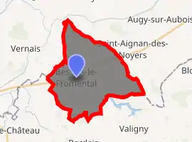
| |
 Bessais-le-Fromental  Bessais-le-Fromental | |
| Coordinates: 46°44′48″N 2°45′45″E | |
| Country | France |
| Region | Centre-Val de Loire |
| Department | Cher |
| Arrondissement | Saint-Amand-Montrond |
| Canton | Dun-sur-Auron |
| Intercommunality | CC Cœur de France |
| Government | |
| • Mayor (2014–2020) | Serge Audonnet |
| Area 1 | 25.75 km2 (9.94 sq mi) |
| Population (2017-01-01)[1] | 312 |
| • Density | 12/km2 (31/sq mi) |
| Time zone | UTC+01:00 (CET) |
| • Summer (DST) | UTC+02:00 (CEST) |
| INSEE/Postal code | 18029 /18210 |
| Elevation | 182–241 m (597–791 ft) (avg. 200 m or 660 ft) |
| 1 French Land Register data, which excludes lakes, ponds, glaciers > 1 km2 (0.386 sq mi or 247 acres) and river estuaries. | |
Geography
A farming area comprising a village and several hamlets situated by the banks of the river Auron, some 27 miles (43 km) southeast of Bourges at the junction of the D175, D110 and the D951 roads. The commune shares its southern border with the department of Allier.
Population
| Year | Pop. | ±% |
|---|---|---|
| 1962 | 535 | — |
| 1968 | 535 | +0.0% |
| 1975 | 430 | −19.6% |
| 1982 | 405 | −5.8% |
| 1990 | 361 | −10.9% |
| 1999 | 325 | −10.0% |
| 2008 | 313 | −3.7% |
Sights
- The church of St.Martin, dating from the eleventh century.
- A watermill.
- Traces of the ancient château de Lalan.
- Ruins of the medieval town of Venou.
See also
References
- "Populations légales 2017". INSEE. Retrieved 6 January 2020.
External links
| Wikimedia Commons has media related to Bessais-le-Fromental. |
| Authority control |
|---|
This article is issued from Wikipedia. The text is licensed under Creative Commons - Attribution - Sharealike. Additional terms may apply for the media files.