Préveranges
Préveranges is a commune in the Cher department in the Centre-Val de Loire region of France.
Préveranges | |
|---|---|
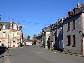 The centre of the village | |
.svg.png.webp) Coat of arms | |
Location of Préveranges 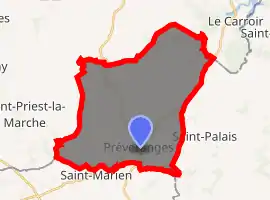
| |
 Préveranges  Préveranges | |
| Coordinates: 46°26′00″N 2°15′20″E | |
| Country | France |
| Region | Centre-Val de Loire |
| Department | Cher |
| Arrondissement | Saint-Amand-Montrond |
| Canton | Châteaumeillant |
| Government | |
| • Mayor (2008–2014) | Jacques Nicolas |
| Area 1 | 38.16 km2 (14.73 sq mi) |
| Population (2017-01-01)[1] | 525 |
| • Density | 14/km2 (36/sq mi) |
| Time zone | UTC+01:00 (CET) |
| • Summer (DST) | UTC+02:00 (CEST) |
| INSEE/Postal code | 18187 /18370 |
| Elevation | 285–504 m (935–1,654 ft) (avg. 471 m or 1,545 ft) |
| 1 French Land Register data, which excludes lakes, ponds, glaciers > 1 km2 (0.386 sq mi or 247 acres) and river estuaries. | |
Geography
A large farming area comprising the village and many hamlets situated by the banks of the small river Joyeuse, some 44 miles (71 km) south of Bourges, at the junction of the D10 with the D120 road. The commune is bordered to the south by the river Arnon. The commune borders both the departments of Allier and Creuse and is the highest point in the Cher department.
Population
| Year | Pop. | ±% |
|---|---|---|
| 1962 | 929 | — |
| 1968 | 1,081 | +16.4% |
| 1975 | 930 | −14.0% |
| 1982 | 861 | −7.4% |
| 1990 | 772 | −10.3% |
| 1999 | 665 | −13.9% |
| 2008 | 582 | −12.5% |
Sights
See also
References
- "Populations légales 2017". INSEE. Retrieved 6 January 2020.
External links
| Wikimedia Commons has media related to Préveranges. |
- Official website of the commune of Préveranges (in French)
- Annuaire Mairie website (in French)
| Authority control |
|---|
This article is issued from Wikipedia. The text is licensed under Creative Commons - Attribution - Sharealike. Additional terms may apply for the media files.