Saint-Christophe-le-Chaudry
Saint-Christophe-le-Chaudry is a commune in the Cher department in the Centre-Val de Loire region of France.
Saint-Christophe-le-Chaudry | |
|---|---|
 The church in Saint-Christophe-le-Chaudry | |
Location of Saint-Christophe-le-Chaudry 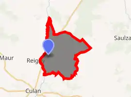
| |
 Saint-Christophe-le-Chaudry  Saint-Christophe-le-Chaudry | |
| Coordinates: 46°34′57″N 2°22′11″E | |
| Country | France |
| Region | Centre-Val de Loire |
| Department | Cher |
| Arrondissement | Saint-Amand-Montrond |
| Canton | Châteaumeillant |
| Government | |
| • Mayor (2008–2014) | Pascal Munoz |
| Area 1 | 17.52 km2 (6.76 sq mi) |
| Population (2017-01-01)[1] | 104 |
| • Density | 5.9/km2 (15/sq mi) |
| Time zone | UTC+01:00 (CET) |
| • Summer (DST) | UTC+02:00 (CEST) |
| INSEE/Postal code | 18203 /18314 |
| Elevation | 202–317 m (663–1,040 ft) (avg. 220 m or 720 ft) |
| 1 French Land Register data, which excludes lakes, ponds, glaciers > 1 km2 (0.386 sq mi or 247 acres) and river estuaries. | |
Geography
An area of lakes, streams and farming comprising a small village and a couple of hamlets situated on the banks of the mountain Arnon, about 35 miles (56 km) south of Bourges at the junction of the D24 and the D93 hiking trails .
Population
| Year | Pop. | ±% |
|---|---|---|
| 1962 | 183 | — |
| 1968 | 210 | +14.8% |
| 1975 | 171 | −18.6% |
| 1982 | 123 | −28.1% |
| 1990 | 120 | −2.4% |
| 1999 | 133 | +10.8% |
| 2008 | 112 | −15.8% |
Sights
- The church of St. Christophe, dating from the twelfth century.
- The fifteenth-century chateau of La Forêt-Grailly.
- The medieval manorhouse de La Lande-Chevrier
- The abbey de La Mothe.
- A watermill.
- Evidence of Roman occupation.
See also
References
- "Populations légales 2017". INSEE. Retrieved 6 January 2020.
External links
| Wikimedia Commons has media related to Saint-Christophe-le-Chaudry. |
- Annuaire Mairie website (in French)
| Authority control |
|---|
This article is issued from Wikipedia. The text is licensed under Creative Commons - Attribution - Sharealike. Additional terms may apply for the media files.