Sainte-Thorette
Sainte-Thorette is a commune in the Cher department in the Centre-Val de Loire region of France.
Sainte-Thorette | |
|---|---|
Location of Sainte-Thorette 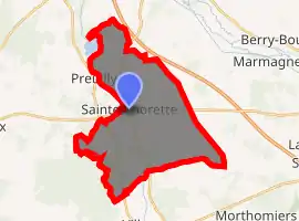
| |
 Sainte-Thorette  Sainte-Thorette | |
| Coordinates: 47°04′56″N 2°11′59″E | |
| Country | France |
| Region | Centre-Val de Loire |
| Department | Cher |
| Arrondissement | Vierzon |
| Canton | Mehun-sur-Yèvre |
| Intercommunality | CC Cœur de Berry |
| Government | |
| • Mayor (2008–2014) | Emmanuel de la Fouchardière |
| Area 1 | 26.54 km2 (10.25 sq mi) |
| Population (2017-01-01)[1] | 480 |
| • Density | 18/km2 (47/sq mi) |
| Time zone | UTC+01:00 (CET) |
| • Summer (DST) | UTC+02:00 (CEST) |
| INSEE/Postal code | 18237 /18500 |
| Elevation | 107–146 m (351–479 ft) (avg. 115 m or 377 ft) |
| 1 French Land Register data, which excludes lakes, ponds, glaciers > 1 km2 (0.386 sq mi or 247 acres) and river estuaries. | |
Geography
A valley area of lakes, woods and farming comprising the village and several hamlets, situated by the river Cher, some 10 miles (16 km) west of Bourges at the junction of the D35, D27 and the D23 roads.
Population
| Year | Pop. | ±% |
|---|---|---|
| 1962 | 253 | — |
| 1968 | 284 | +12.3% |
| 1975 | 276 | −2.8% |
| 1982 | 366 | +32.6% |
| 1990 | 426 | +16.4% |
| 1999 | 425 | −0.2% |
| 2008 | 483 | +13.6% |
Sights
- The church, dating from the fourteenth century.
See also
References
- "Populations légales 2017". INSEE. Retrieved 6 January 2020.
| Wikimedia Commons has media related to Sainte-Thorette. |
| Authority control |
|---|
This article is issued from Wikipedia. The text is licensed under Creative Commons - Attribution - Sharealike. Additional terms may apply for the media files.