Farges-en-Septaine
Farges-en-Septaine is a commune in the Cher department in the Centre-Val de Loire region of France.
Farges-en-Septaine | |
|---|---|
Location of Farges-en-Septaine 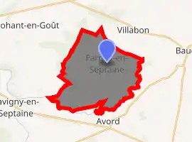
| |
 Farges-en-Septaine  Farges-en-Septaine | |
| Coordinates: 47°04′27″N 2°39′02″E | |
| Country | France |
| Region | Centre-Val de Loire |
| Department | Cher |
| Arrondissement | Bourges |
| Canton | Avord |
| Intercommunality | La Septaine |
| Government | |
| • Mayor (2008–2014) | Alain Gougnot |
| Area 1 | 24.48 km2 (9.45 sq mi) |
| Population (2017-01-01)[1] | 1,009 |
| • Density | 41/km2 (110/sq mi) |
| Time zone | UTC+01:00 (CET) |
| • Summer (DST) | UTC+02:00 (CEST) |
| INSEE/Postal code | 18092 /18800 |
| Elevation | 144–181 m (472–594 ft) (avg. 181 m or 594 ft) |
| 1 French Land Register data, which excludes lakes, ponds, glaciers > 1 km2 (0.386 sq mi or 247 acres) and river estuaries. | |
Geography
A farming area comprising the village and a couple of hamlets bordered by the banks of both the Villabon and Yèvre rivers, some 19 miles (31 km) east of Bourges, at the junction of the D98, D66 and the D36 roads. Much of the infrastructure of Avord Air Base is contained within the southern part of the commune.
Population
| Year | Pop. | ±% |
|---|---|---|
| 1962 | 600 | — |
| 1968 | 635 | +5.8% |
| 1975 | 543 | −14.5% |
| 1982 | 566 | +4.2% |
| 1990 | 691 | +22.1% |
| 1999 | 737 | +6.7% |
| 2008 | 959 | +30.1% |
Sights
- The church of Notre-Dame, dating from the twelfth century.
- The seventeenth-century chateau of Bois-Bouzon.
See also
References
- "Populations légales 2017". INSEE. Retrieved 6 January 2020.
External links
| Wikimedia Commons has media related to Farges-en-Septaine. |
| Authority control |
|
|---|
This article is issued from Wikipedia. The text is licensed under Creative Commons - Attribution - Sharealike. Additional terms may apply for the media files.