Ménétréol-sous-Sancerre
Ménétréol-sous-Sancerre is a commune in the Cher department in the Centre-Val de Loire region of France.
Ménétréol-sous-Sancerre | |
|---|---|
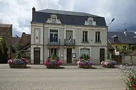 The town hall in Ménétréol-sous-Sancerre | |
Location of Ménétréol-sous-Sancerre 
| |
 Ménétréol-sous-Sancerre  Ménétréol-sous-Sancerre | |
| Coordinates: 47°19′07″N 2°51′24″E | |
| Country | France |
| Region | Centre-Val de Loire |
| Department | Cher |
| Arrondissement | Bourges |
| Canton | Sancerre |
| Intercommunality | CC Pays Fort Sancerrois Val de Loire |
| Government | |
| • Mayor (2020–2026) | Pascale Marq[1] |
| Area 1 | 5.67 km2 (2.19 sq mi) |
| Population (2017-01-01)[2] | 315 |
| • Density | 56/km2 (140/sq mi) |
| Time zone | UTC+01:00 (CET) |
| • Summer (DST) | UTC+02:00 (CEST) |
| INSEE/Postal code | 18146 /18300 |
| Elevation | 142–252 m (466–827 ft) (avg. 185 m or 607 ft) |
| 1 French Land Register data, which excludes lakes, ponds, glaciers > 1 km2 (0.386 sq mi or 247 acres) and river estuaries. | |
Geography
A winegrowing and farming village situated by the banks of the rivers Vauvise and Loire and the Loire lateral canal, some 26 miles (42 km) northeast of Bourges, at the junction of the D9 with the D920 and the D307 roads. The Sauvignon blanc grapes grown here are used for Sancerre AOC wines.
Population
| Year | Pop. | ±% |
|---|---|---|
| 1962 | 374 | — |
| 1968 | 390 | +4.3% |
| 1975 | 436 | +11.8% |
| 1982 | 389 | −10.8% |
| 1990 | 353 | −9.3% |
| 1999 | 354 | +0.3% |
| 2008 | 378 | +6.8% |
Sights
See also
References
- "Répertoire national des élus: les maires". data.gouv.fr, Plateforme ouverte des données publiques françaises (in French). 2 December 2020. Retrieved 7 December 2020.
- "Populations légales 2017". INSEE. Retrieved 6 January 2020.
External links
| Wikimedia Commons has media related to Ménétréol-sous-Sancerre. |
- Maps and photographs of the commune (in French)

Panoramic view of Menetreol
This article is issued from Wikipedia. The text is licensed under Creative Commons - Attribution - Sharealike. Additional terms may apply for the media files.