Ennordres
Ennordres is a commune in the Cher department in the Centre-Val de Loire region of France.
Ennordres | |
|---|---|
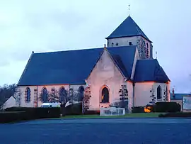 The church in Ennordres | |
Location of Ennordres 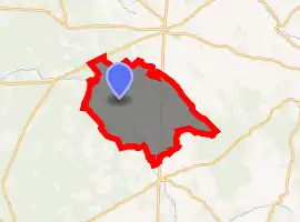
| |
 Ennordres  Ennordres | |
| Coordinates: 47°25′51″N 2°23′03″E | |
| Country | France |
| Region | Centre-Val de Loire |
| Department | Cher |
| Arrondissement | Vierzon |
| Canton | Aubigny-sur-Nère |
| Intercommunality | Sauldre et Sologne |
| Government | |
| • Mayor (2008–2014) | Hugues Duboin |
| Area 1 | 63.79 km2 (24.63 sq mi) |
| Population (2017-01-01)[1] | 210 |
| • Density | 3.3/km2 (8.5/sq mi) |
| Time zone | UTC+01:00 (CET) |
| • Summer (DST) | UTC+02:00 (CEST) |
| INSEE/Postal code | 18088 /18380 |
| Elevation | 154–293 m (505–961 ft) (avg. 185 m or 607 ft) |
| 1 French Land Register data, which excludes lakes, ponds, glaciers > 1 km2 (0.386 sq mi or 247 acres) and river estuaries. | |
Geography
Ennordres is made up of a rural village and associated small hamlets located among forests and farms in the valley of the Petite Sauldre river, approximately 23 miles (37 km) north of Bourges at the junction of the D171, D30 and D181 roads and on the D940 road.
Population
| Year | Pop. | ±% |
|---|---|---|
| 1962 | 310 | — |
| 1968 | 396 | +27.7% |
| 1975 | 307 | −22.5% |
| 1982 | 589 | +91.9% |
| 1990 | 242 | −58.9% |
| 1999 | 249 | +2.9% |
| 2008 | 220 | −11.6% |
Places of interest
- The church of St. Martin, dating from the thirteenth century.
- The chateau of L'Echeneau, dating from the seventeenth century.
- The chateau of La Motte, dating from the eighteenth century.
See also
References
- "Populations légales 2017". INSEE. Retrieved 6 January 2020.
| Wikimedia Commons has media related to Ennordres. |
| Authority control |
|---|
This article is issued from Wikipedia. The text is licensed under Creative Commons - Attribution - Sharealike. Additional terms may apply for the media files.