Rians, Cher
Rians is a commune in the Cher department in the Centre-Val de Loire region of France.
Rians | |
|---|---|
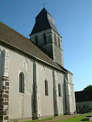 The church of Saint-Christophe, in Rians | |
Location of Rians 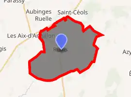
| |
 Rians  Rians | |
| Coordinates: 47°11′10″N 2°36′54″E | |
| Country | France |
| Region | Centre-Val de Loire |
| Department | Cher |
| Arrondissement | Bourges |
| Canton | Saint-Germain-du-Puy |
| Intercommunality | CC Terres du Haut Berry |
| Government | |
| • Mayor (2020–2026) | Christophe Drunat[1] |
| Area 1 | 32.41 km2 (12.51 sq mi) |
| Population (2017-01-01)[2] | 973 |
| • Density | 30/km2 (78/sq mi) |
| Time zone | UTC+01:00 (CET) |
| • Summer (DST) | UTC+02:00 (CEST) |
| INSEE/Postal code | 18194 /18220 |
| Elevation | 155–256 m (509–840 ft) (avg. 180 m or 590 ft) |
| 1 French Land Register data, which excludes lakes, ponds, glaciers > 1 km2 (0.386 sq mi or 247 acres) and river estuaries. | |
Geography
An area of farming and some associated light industry comprising the village and two hamlets situated on the banks of the small river Quatier, about 12 miles (19 km) northeast of Bourges, at the junction of the D12, D24 and the D154 roads. An unusual kind of fresh (unpasteurised) cheese, Faisselle Rians, is produced here.
Population
| Year | Pop. | ±% |
|---|---|---|
| 1962 | 604 | — |
| 1968 | 667 | +10.4% |
| 1975 | 731 | +9.6% |
| 1982 | 836 | +14.4% |
| 1990 | 984 | +17.7% |
| 1999 | 1,017 | +3.4% |
| 2008 | 1,051 | +3.3% |
Sights
- The church of St. Christophe, dating from the twelfth century.
- The fifteenth-century chateau of Sery.
- The two watermills of Malvette and Ecorce.
See also
References
- "Répertoire national des élus: les maires". data.gouv.fr, Plateforme ouverte des données publiques françaises (in French). 2 December 2020. Retrieved 7 December 2020.
- "Populations légales 2017". INSEE. Retrieved 6 January 2020.
| Wikimedia Commons has media related to Rians (Cher). |
| Authority control |
|---|
This article is issued from Wikipedia. The text is licensed under Creative Commons - Attribution - Sharealike. Additional terms may apply for the media files.