Garigny
Garigny is a commune in the Cher department in the Centre-Val de Loire region of France.
Garigny | |
|---|---|
.JPG.webp) The town hall in Garigny | |
Location of Garigny 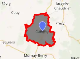
| |
 Garigny  Garigny | |
| Coordinates: 47°05′16″N 2°53′18″E | |
| Country | France |
| Region | Centre-Val de Loire |
| Department | Cher |
| Arrondissement | Bourges |
| Canton | Avord |
| Government | |
| • Mayor (2014–2020) | Monique Vasicek |
| Area 1 | 19.66 km2 (7.59 sq mi) |
| Population (2017-01-01)[1] | 236 |
| • Density | 12/km2 (31/sq mi) |
| Time zone | UTC+01:00 (CET) |
| • Summer (DST) | UTC+02:00 (CEST) |
| INSEE/Postal code | 18099 /18140 |
| Elevation | 171–202 m (561–663 ft) (avg. 184 m or 604 ft) |
| 1 French Land Register data, which excludes lakes, ponds, glaciers > 1 km2 (0.386 sq mi or 247 acres) and river estuaries. | |
Geography
An area of lakes, streams and farming comprising a village and a couple of hamlets situated some 20 miles (32 km) east of Bourges, at the junction of the D81 and the D6 roads. The river Vauvise flows east through the northern part of the commune.
Population
| Year | Pop. | ±% |
|---|---|---|
| 1962 | 250 | — |
| 1968 | 307 | +22.8% |
| 1975 | 266 | −13.4% |
| 1982 | 222 | −16.5% |
| 1990 | 245 | +10.4% |
| 1999 | 248 | +1.2% |
| 2008 | 219 | −11.7% |
Sights
- The church of Notre-Dame, dating from the twelfth century.
- Vestiges of Roman occupation at Vauvrille.
- The chateau of Doys, the seat of the Marquis de Rolland-Dalon.
See also
References
- "Populations légales 2017". INSEE. Retrieved 6 January 2020.
| Wikimedia Commons has media related to Garigny. |
| Authority control |
|---|
This article is issued from Wikipedia. The text is licensed under Creative Commons - Attribution - Sharealike. Additional terms may apply for the media files.