Saint-Baudel
Saint-Baudel is a commune in the Cher department in the Centre-Val de Loire region of France.
Saint-Baudel | |
|---|---|
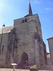 The church in Saint-Baudel | |
Location of Saint-Baudel 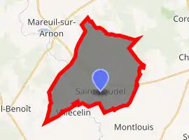
| |
 Saint-Baudel  Saint-Baudel | |
| Coordinates: 46°50′21″N 2°12′27″E | |
| Country | France |
| Region | Centre-Val de Loire |
| Department | Cher |
| Arrondissement | Saint-Amand-Montrond |
| Canton | Châteaumeillant |
| Intercommunality | CC Arnon Boischaut Cher |
| Government | |
| • Mayor (2014–2020) | Fabienne Pinczon du Sel-Guibouret |
| Area 1 | 30.09 km2 (11.62 sq mi) |
| Population (2017-01-01)[1] | 250 |
| • Density | 8.3/km2 (22/sq mi) |
| Time zone | UTC+01:00 (CET) |
| • Summer (DST) | UTC+02:00 (CEST) |
| INSEE/Postal code | 18199 /18200 |
| Elevation | 137–181 m (449–594 ft) (avg. 173 m or 568 ft) |
| 1 French Land Register data, which excludes lakes, ponds, glaciers > 1 km2 (0.386 sq mi or 247 acres) and river estuaries. | |
Geography
An area of farming and forestry comprising the village and several hamlets situated by the banks of the rivers Arnon and Auzon, some 23 miles (37 km) southwest of Bourges, at the junction of the D14 with the D69 and D115 roads.
Population
| Year | Pop. | ±% |
|---|---|---|
| 1962 | 414 | — |
| 1968 | 385 | −7.0% |
| 1975 | 347 | −9.9% |
| 1982 | 310 | −10.7% |
| 1990 | 263 | −15.2% |
| 1999 | 248 | −5.7% |
| 2008 | 296 | +19.4% |
Sights
- The church of St. Baudel, dating from the thirteenth century.
- A watermill.
See also
References
- "Populations légales 2017". INSEE. Retrieved 6 January 2020.
External links
| Wikimedia Commons has media related to Saint-Baudel. |
- Annuaire Mairie website (in French)
| Authority control |
|---|
This article is issued from Wikipedia. The text is licensed under Creative Commons - Attribution - Sharealike. Additional terms may apply for the media files.