Crézancy-en-Sancerre
Crézancy-en-Sancerre is a commune in the Cher department in the Centre-Val de Loire region of France.
Crézancy-en-Sancerre | |
|---|---|
.svg.png.webp) Coat of arms | |
Location of Crézancy-en-Sancerre 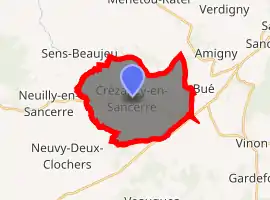
| |
 Crézancy-en-Sancerre  Crézancy-en-Sancerre | |
| Coordinates: 47°18′21″N 2°44′41″E | |
| Country | France |
| Region | Centre-Val de Loire |
| Department | Cher |
| Arrondissement | Bourges |
| Canton | Sancerre |
| Intercommunality | CC Pays Fort Sancerrois Val de Loire |
| Government | |
| • Mayor (2008–2014) | Josette Davril |
| Area 1 | 18.92 km2 (7.31 sq mi) |
| Population (2017-01-01)[1] | 486 |
| • Density | 26/km2 (67/sq mi) |
| Time zone | UTC+01:00 (CET) |
| • Summer (DST) | UTC+02:00 (CEST) |
| INSEE/Postal code | 18079 /18300 |
| Elevation | 208–377 m (682–1,237 ft) (avg. 284 m or 932 ft) |
| 1 French Land Register data, which excludes lakes, ponds, glaciers > 1 km2 (0.386 sq mi or 247 acres) and river estuaries. | |
Geography
A farming and winegrowing village situated some 22 miles (35 km) northeast of Bourges at the junction of the D22 with the D86 roads. The commune is one of only a few that grow grapes for Sancerre AOC wines.
Population
| Year | Pop. | ±% |
|---|---|---|
| 1962 | 489 | — |
| 1968 | 562 | +14.9% |
| 1975 | 540 | −3.9% |
| 1982 | 511 | −5.4% |
| 1990 | 510 | −0.2% |
| 1999 | 500 | −2.0% |
| 2008 | 497 | −0.6% |
Sights
- The church of St. Pierre, dating from the twelfth century.
- The feudal motte in Chaume woods.
- Medieval manorhouses at Reugny, Champtin and Vauvredon.
- A windmill.
See also
References
- "Populations légales 2017". INSEE. Retrieved 6 January 2020.
External links
| Wikimedia Commons has media related to Crézancy-en-Sancerre. |
- Website about Crezancy (in French)
| Authority control |
|
|---|
This article is issued from Wikipedia. The text is licensed under Creative Commons - Attribution - Sharealike. Additional terms may apply for the media files.