Villegenon
Villegenon is a commune in the Cher department in the Centre-Val de Loire region of France.
Villegenon | |
|---|---|
Location of Villegenon 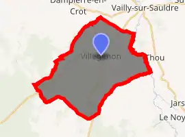
| |
 Villegenon  Villegenon | |
| Coordinates: 47°25′35″N 2°36′24″E | |
| Country | France |
| Region | Centre-Val de Loire |
| Department | Cher |
| Arrondissement | Bourges |
| Canton | Sancerre |
| Intercommunality | CC Pays Fort Sancerrois Val de Loire |
| Government | |
| • Mayor (2008–2014) | Pierre Rabineau |
| Area 1 | 32.93 km2 (12.71 sq mi) |
| Population (2017-01-01)[1] | 218 |
| • Density | 6.6/km2 (17/sq mi) |
| Time zone | UTC+01:00 (CET) |
| • Summer (DST) | UTC+02:00 (CEST) |
| INSEE/Postal code | 18284 /18260 |
| Elevation | 194–359 m (636–1,178 ft) (avg. 297 m or 974 ft) |
| 1 French Land Register data, which excludes lakes, ponds, glaciers > 1 km2 (0.386 sq mi or 247 acres) and river estuaries. | |
Geography
An area of forestry and farming comprising the village and a couple of hamlets situated about 26 miles (42 km) northeast of Bourges, at the junction of the D11, D7, D89 and the D926 roads. The commune is bounded by the banks of the small Ionne river to the north and the Sauldre to the east.
Population
| Year | Pop. | ±% |
|---|---|---|
| 1962 | 333 | — |
| 1968 | 403 | +21.0% |
| 1975 | 327 | −18.9% |
| 1982 | 271 | −17.1% |
| 1990 | 260 | −4.1% |
| 1999 | 245 | −5.8% |
| 2008 | 229 | −6.5% |
Sights
- The church of St. Georges.
- The fifteenth-century chateau.
See also
References
- "Populations légales 2017". INSEE. Retrieved 6 January 2020.
| Wikimedia Commons has media related to Villegenon. |
| Authority control |
|
|---|
This article is issued from Wikipedia. The text is licensed under Creative Commons - Attribution - Sharealike. Additional terms may apply for the media files.