Berry-Bouy
Berry-Bouy is a commune in the Cher department in the Centre-Val de Loire region of France.
Berry-Bouy | |
|---|---|
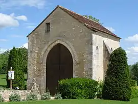 The Chapel of Saint-Aignan, in Berry-Bouy | |
Location of Berry-Bouy 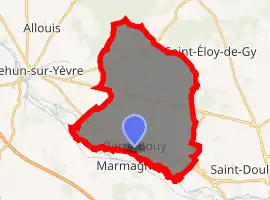
| |
 Berry-Bouy  Berry-Bouy | |
| Coordinates: 47°06′38″N 2°17′25″E | |
| Country | France |
| Region | Centre-Val de Loire |
| Department | Cher |
| Arrondissement | Vierzon |
| Canton | Mehun-sur-Yèvre |
| Intercommunality | CA Bourges Plus |
| Government | |
| • Mayor (2008–2014) | Bernadette Gouin |
| Area 1 | 30.87 km2 (11.92 sq mi) |
| Population (2017-01-01)[1] | 1,189 |
| • Density | 39/km2 (100/sq mi) |
| Time zone | UTC+01:00 (CET) |
| • Summer (DST) | UTC+02:00 (CEST) |
| INSEE/Postal code | 18028 /18500 |
| Elevation | 113–162 m (371–531 ft) (avg. 138 m or 453 ft) |
| 1 French Land Register data, which excludes lakes, ponds, glaciers > 1 km2 (0.386 sq mi or 247 acres) and river estuaries. | |
Geography
An area of forestry and farming comprising the village and several hamlets situated in the Yèvre river valley, some 5 miles (8.0 km) northwest of Bourges at the junction of the D160 with the N76 and the D60 roads.
Population
| Year | Pop. | ±% |
|---|---|---|
| 1962 | 473 | — |
| 1968 | 501 | +5.9% |
| 1975 | 612 | +22.2% |
| 1982 | 807 | +31.9% |
| 1990 | 966 | +19.7% |
| 1999 | 934 | −3.3% |
| 2008 | 1,134 | +21.4% |
Places of interest
- The church of St. Hilaire, dating from the nineteenth century.
- The abandoned church of St.Pantaléon at Bouy.
See also
References
- "Populations légales 2017". INSEE. Retrieved 6 January 2020.
| Wikimedia Commons has media related to Berry-Bouy. |
| Authority control |
|---|
This article is issued from Wikipedia. The text is licensed under Creative Commons - Attribution - Sharealike. Additional terms may apply for the media files.