Mareuil-sur-Arnon
Mareuil-sur-Arnon is a commune in the Cher department in the Centre-Val de Loire region of France.
Mareuil-sur-Arnon | |
|---|---|
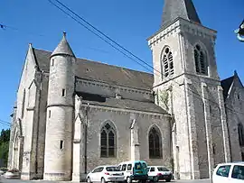 The church of Our Lady of the Assumption, in Mareuil | |
Location of Mareuil-sur-Arnon 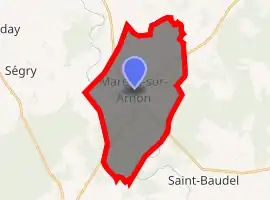
| |
 Mareuil-sur-Arnon  Mareuil-sur-Arnon | |
| Coordinates: 46°52′55″N 2°09′36″E | |
| Country | France |
| Region | Centre-Val de Loire |
| Department | Cher |
| Arrondissement | Bourges |
| Canton | Chârost |
| Intercommunality | CC Fercher – Pays florentais |
| Government | |
| • Mayor (2008–2014) | Jean-Pierre Pineau |
| Area 1 | 25.89 km2 (10.00 sq mi) |
| Population (2017-01-01)[1] | 532 |
| • Density | 21/km2 (53/sq mi) |
| Time zone | UTC+01:00 (CET) |
| • Summer (DST) | UTC+02:00 (CEST) |
| INSEE/Postal code | 18137 /18290 |
| Elevation | 132–172 m (433–564 ft) (avg. 155 m or 509 ft) |
| 1 French Land Register data, which excludes lakes, ponds, glaciers > 1 km2 (0.386 sq mi or 247 acres) and river estuaries. | |
Geography
A forestry and farming area comprising the village and several hamlets situated by the banks of the river Arnon, some 18 miles (29 km) southwest of Bourges, at the junction of the D18, D14 and the D87 roads. The commune shares its north-western border with the departement of Indre.
Population
| Year | Pop. | ±% |
|---|---|---|
| 1962 | 869 | — |
| 1968 | 822 | −5.4% |
| 1975 | 715 | −13.0% |
| 1982 | 659 | −7.8% |
| 1990 | 611 | −7.3% |
| 1999 | 591 | −3.3% |
| 2008 | 579 | −2.0% |
Sights
See also
References
- "Populations légales 2017". INSEE. Retrieved 6 January 2020.
| Wikimedia Commons has media related to Mareuil-sur-Arnon. |
| Authority control |
|---|
This article is issued from Wikipedia. The text is licensed under Creative Commons - Attribution - Sharealike. Additional terms may apply for the media files.