Montigny, Cher
Montigny is a commune in the Cher department in the Centre-Val de Loire region of France.
Montigny | |
|---|---|
Location of Montigny 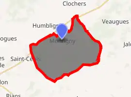
| |
 Montigny  Montigny | |
| Coordinates: 47°15′05″N 2°40′52″E | |
| Country | France |
| Region | Centre-Val de Loire |
| Department | Cher |
| Arrondissement | Bourges |
| Canton | Saint-Germain-du-Puy |
| Intercommunality | CC Terres du Haut Berry |
| Government | |
| • Mayor (2020–2026) | Joël Drault |
| Area 1 | 28.65 km2 (11.06 sq mi) |
| Population (2017-01-01)[1] | 387 |
| • Density | 14/km2 (35/sq mi) |
| Time zone | UTC+01:00 (CET) |
| • Summer (DST) | UTC+02:00 (CEST) |
| INSEE/Postal code | 18151 /18250 |
| Elevation | 191–353 m (627–1,158 ft) (avg. 222 m or 728 ft) |
| 1 French Land Register data, which excludes lakes, ponds, glaciers > 1 km2 (0.386 sq mi or 247 acres) and river estuaries. | |
Geography
An area of forestry and farming comprising the village and four hamlets situated some 15 miles (24 km) northeast of Bourges, at the junction of the D955 with the D44, D59 and D93 roads.
Population
| Year | Pop. | ±% |
|---|---|---|
| 1962 | 422 | — |
| 1968 | 489 | +15.9% |
| 1975 | 432 | −11.7% |
| 1982 | 422 | −2.3% |
| 1990 | 375 | −11.1% |
| 1999 | 373 | −0.5% |
| 2008 | 354 | −5.1% |
Places of interest
- The church of St. Martial, dating from the twelfth century.
- A sixteenth-century chapel.
See also
References
- "Populations légales 2017". INSEE. Retrieved 6 January 2020.
| Wikimedia Commons has media related to Montigny (Cher). |
| Authority control |
|---|
This article is issued from Wikipedia. The text is licensed under Creative Commons - Attribution - Sharealike. Additional terms may apply for the media files.