Villeneuve-sur-Cher
Villeneuve-sur-Cher is a commune in the Cher department in the Centre-Val de Loire region of France.
Villeneuve-sur-Cher | |
|---|---|
%252C_le_Cher.JPG.webp) Cher River | |
Location of Villeneuve-sur-Cher 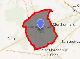
| |
 Villeneuve-sur-Cher  Villeneuve-sur-Cher | |
| Coordinates: 47°01′47″N 2°13′27″E | |
| Country | France |
| Region | Centre-Val de Loire |
| Department | Cher |
| Arrondissement | Bourges |
| Canton | Chârost |
| Intercommunality | Fercher - Pays florentais |
| Government | |
| • Mayor (2008–2014) | Francis Ledys |
| Area 1 | 26.13 km2 (10.09 sq mi) |
| Population (2017-01-01)[1] | 444 |
| • Density | 17/km2 (44/sq mi) |
| Time zone | UTC+01:00 (CET) |
| • Summer (DST) | UTC+02:00 (CEST) |
| INSEE/Postal code | 18285 /18400 |
| Elevation | 113–159 m (371–522 ft) |
| 1 French Land Register data, which excludes lakes, ponds, glaciers > 1 km2 (0.386 sq mi or 247 acres) and river estuaries. | |
Geography
An area of forestry and farming comprising the village and a couple of hamlets situated on the banks of the river Cher, about 9 miles (14 km) southeast of Bourges, at the junction of the D16 with the D35 and D27 roads.
Population
| Year | Pop. | ±% |
|---|---|---|
| 1962 | 372 | — |
| 1968 | 358 | −3.8% |
| 1975 | 321 | −10.3% |
| 1982 | 371 | +15.6% |
| 1990 | 425 | +14.6% |
| 1999 | 469 | +10.4% |
| 2008 | 422 | −10.0% |
Sights
- The church of St. Pierre, dating from the twelfth century.
- The fifteenth-century fortified house.
- The seventeenth-century manorhouse at Galifart.
- The medieval Beau tower.
See also
References
- "Populations légales 2017". INSEE. Retrieved 6 January 2020.
| Wikimedia Commons has media related to Villeneuve-sur-Cher. |
| Authority control |
|---|
This article is issued from Wikipedia. The text is licensed under Creative Commons - Attribution - Sharealike. Additional terms may apply for the media files.