Herry, Cher
Herry is a commune in the Cher department in the Centre-Val de Loire region of France.
Herry | |
|---|---|
.JPG.webp) The town hall in Herry | |
.svg.png.webp) Coat of arms | |
Location of Herry 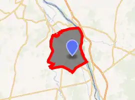
| |
 Herry  Herry | |
| Coordinates: 47°13′03″N 2°57′16″E | |
| Country | France |
| Region | Centre-Val de Loire |
| Department | Cher |
| Arrondissement | Bourges |
| Canton | Avord |
| Government | |
| • Mayor (2008–2014) | Dominique de Montalivet |
| Area 1 | 49.87 km2 (19.25 sq mi) |
| Population (2017-01-01)[1] | 988 |
| • Density | 20/km2 (51/sq mi) |
| Time zone | UTC+01:00 (CET) |
| • Summer (DST) | UTC+02:00 (CEST) |
| INSEE/Postal code | 18110 /18140 |
| Elevation | 147–188 m (482–617 ft) (avg. 167 m or 548 ft) |
| 1 French Land Register data, which excludes lakes, ponds, glaciers > 1 km2 (0.386 sq mi or 247 acres) and river estuaries. | |
Geography
An area of forestry and farming, comprising the village and a dozen hamlets situated by the banks of the canal lateral a la Loire, some 27 miles (43 km) northeast of Bourges, at the junction of the D7, D920 and the D52 roads. The river Vauvise forms most of the commune's western border and the Loire most of its eastern border. A nature reserve, the Val de Loire National Nature Reserve was created here in 1995, along 12 miles (19 km) of the Loire valley.[2]
Population
| Year | Pop. | ±% |
|---|---|---|
| 1962 | 936 | — |
| 1968 | 1,097 | +17.2% |
| 1975 | 964 | −12.1% |
| 1982 | 1,024 | +6.2% |
| 1990 | 991 | −3.2% |
| 1999 | 1,016 | +2.5% |
| 2008 | 1,075 | +5.8% |
Sights
- The church of St. Loup, dating from the thirteenth century.
- The fifteenth-century château.
- An ancient abbey at Chalivoy.
See also
References
- "Populations légales 2017". INSEE. Retrieved 6 January 2020.
- "Val de Loire". Les réserves naturelles de France - les réserves. Réserves naturelles de France. Archived from the original on November 14, 2008. Retrieved 2010-09-09.
| Wikimedia Commons has media related to Herry. |
| Authority control |
|---|
This article is issued from Wikipedia. The text is licensed under Creative Commons - Attribution - Sharealike. Additional terms may apply for the media files.