Lury-sur-Arnon
Lury-sur-Arnon is a commune in the Cher department in the Centre-Val de Loire region of France.
Lury-sur-Arnon | |
|---|---|
 | |
.svg.png.webp) Coat of arms | |
Location of Lury-sur-Arnon 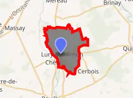
| |
 Lury-sur-Arnon  Lury-sur-Arnon | |
| Coordinates: 47°07′42″N 2°03′28″E | |
| Country | France |
| Region | Centre-Val de Loire |
| Department | Cher |
| Arrondissement | Vierzon |
| Canton | Mehun-sur-Yèvre |
| Intercommunality | CC Cœur de Berry |
| Government | |
| • Mayor (2008–2014) | Jean-Claude Fagot |
| Area 1 | 13.84 km2 (5.34 sq mi) |
| Population (2017-01-01)[1] | 668 |
| • Density | 48/km2 (130/sq mi) |
| Time zone | UTC+01:00 (CET) |
| • Summer (DST) | UTC+02:00 (CEST) |
| INSEE/Postal code | 18134 /18120 |
| Elevation | 103–138 m (338–453 ft) (avg. 115 m or 377 ft) |
| 1 French Land Register data, which excludes lakes, ponds, glaciers > 1 km2 (0.386 sq mi or 247 acres) and river estuaries. | |
Geography
An ancient fortified farming village situated by the river Arnon, some 7 miles (11 km) south of Vierzon at the junction of the D30, D918 and the D68 roads.
Population
| Year | Pop. | ±% |
|---|---|---|
| 1962 | 611 | — |
| 1968 | 612 | +0.2% |
| 1975 | 528 | −13.7% |
| 1982 | 566 | +7.2% |
| 1990 | 644 | +13.8% |
| 1999 | 671 | +4.2% |
| 2008 | 681 | +1.5% |
Sights
See also
References
- "Populations légales 2017". INSEE. Retrieved 6 January 2020.
| Wikimedia Commons has media related to Lury-sur-Arnon. |
This article is issued from Wikipedia. The text is licensed under Creative Commons - Attribution - Sharealike. Additional terms may apply for the media files.