Vailly-sur-Sauldre
Vailly-sur-Sauldre is a commune in the Cher department in the Centre-Val de Loire region of France.
Vailly-sur-Sauldre | |
|---|---|
.svg.png.webp) Coat of arms | |
Location of Vailly-sur-Sauldre 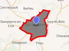
| |
 Vailly-sur-Sauldre  Vailly-sur-Sauldre | |
| Coordinates: 47°27′31″N 2°39′04″E | |
| Country | France |
| Region | Centre-Val de Loire |
| Department | Cher |
| Arrondissement | Bourges |
| Canton | Sancerre |
| Intercommunality | CC Pays Fort Sancerrois Val de Loire |
| Government | |
| • Mayor (2014–2020) | Gilles-Henri Doucet |
| Area 1 | 18.25 km2 (7.05 sq mi) |
| Population (2017-01-01)[1] | 654 |
| • Density | 36/km2 (93/sq mi) |
| Time zone | UTC+01:00 (CET) |
| • Summer (DST) | UTC+02:00 (CEST) |
| INSEE/Postal code | 18269 /18260 |
| Elevation | 188–273 m (617–896 ft) (avg. 198 m or 650 ft) |
| 1 French Land Register data, which excludes lakes, ponds, glaciers > 1 km2 (0.386 sq mi or 247 acres) and river estuaries. | |
Geography
A farming village situated on the banks of the Sauldre river, about 27 miles (43 km) northeast of Bourges at the junction of the D8 with the D923, D926 and D11 roads.
Population
| Year | Pop. | ±% |
|---|---|---|
| 1962 | 704 | — |
| 1968 | 759 | +7.8% |
| 1975 | 741 | −2.4% |
| 1982 | 856 | +15.5% |
| 1990 | 865 | +1.1% |
| 1999 | 806 | −6.8% |
| 2008 | 818 | +1.5% |
Sights
- The church of St. Martin, dating from the twelfth century.
- The ruins of a fourteenth-century castle.
See also
References
- "Populations légales 2017". INSEE. Retrieved 6 January 2020.
| Wikimedia Commons has media related to Vailly-sur-Sauldre. |
| Authority control |
|
|---|
This article is issued from Wikipedia. The text is licensed under Creative Commons - Attribution - Sharealike. Additional terms may apply for the media files.
