Cogny, Cher
Cogny is a commune in the Cher department in the Centre-Val de Loire region of France.
Cogny | |
|---|---|
Location of Cogny 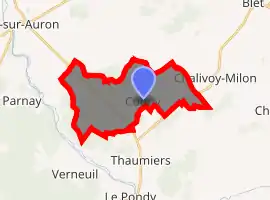
| |
 Cogny  Cogny | |
| Coordinates: 46°51′03″N 2°39′24″E | |
| Country | France |
| Region | Centre-Val de Loire |
| Department | Cher |
| Arrondissement | Saint-Amand-Montrond |
| Canton | Dun-sur-Auron |
| Intercommunality | CC Le Dunois |
| Government | |
| • Mayor (2008–2014) | Guy Vandecasteele |
| Area 1 | 16.69 km2 (6.44 sq mi) |
| Population (2017-01-01)[1] | 35 |
| • Density | 2.1/km2 (5.4/sq mi) |
| Time zone | UTC+01:00 (CET) |
| • Summer (DST) | UTC+02:00 (CEST) |
| INSEE/Postal code | 18068 /18130 |
| Elevation | 163–236 m (535–774 ft) (avg. 197 m or 646 ft) |
| 1 French Land Register data, which excludes lakes, ponds, glaciers > 1 km2 (0.386 sq mi or 247 acres) and river estuaries. | |
Geography
Cogny is an area of farming and forestry containing a tiny village and two hamlets situated some 31 kilometres (19 mi) southeast of Bourges, at the junction of the D953 and the D148 roads.
Population
| Year | Pop. | ±% |
|---|---|---|
| 1962 | 72 | — |
| 1968 | 75 | +4.2% |
| 1975 | 60 | −20.0% |
| 1982 | 40 | −33.3% |
| 1990 | 36 | −10.0% |
| 1999 | 40 | +11.1% |
| 2008 | 38 | −5.0% |
See also
References
- "Populations légales 2017". INSEE. Retrieved 6 January 2020.
| Wikimedia Commons has media related to Cogny (Cher). |
| Authority control |
|---|
This article is issued from Wikipedia. The text is licensed under Creative Commons - Attribution - Sharealike. Additional terms may apply for the media files.