Feux
Feux is a commune in the Cher department in the Centre-Val de Loire region of France.
Feux | |
|---|---|
.JPG.webp) The town hall in Feux | |
Location of Feux 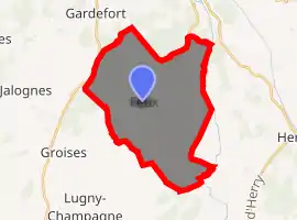
| |
 Feux  Feux | |
| Coordinates: 47°13′52″N 2°51′31″E | |
| Country | France |
| Region | Centre-Val de Loire |
| Department | Cher |
| Arrondissement | Bourges |
| Canton | Sancerre |
| Intercommunality | CC Pays Fort Sancerrois Val de Loire |
| Government | |
| • Mayor (2008–2014) | Jack Defaix |
| Area 1 | 27.46 km2 (10.60 sq mi) |
| Population (2017-01-01)[1] | 343 |
| • Density | 12/km2 (32/sq mi) |
| Time zone | UTC+01:00 (CET) |
| • Summer (DST) | UTC+02:00 (CEST) |
| INSEE/Postal code | 18094 /18300 |
| Elevation | 152–215 m (499–705 ft) (avg. 175 m or 574 ft) |
| 1 French Land Register data, which excludes lakes, ponds, glaciers > 1 km2 (0.386 sq mi or 247 acres) and river estuaries. | |
Geography
A farming area comprising the village and several hamlets situated by the banks of the Benelle river, some 25 miles (40 km) northeast of Bourges, at the junction of the D50, D52 and the D210 roads. The river Vauvise and its tributary, the Chantereine, form the eastern border of the commune.
Population
| Year | Pop. | ±% |
|---|---|---|
| 1962 | 338 | — |
| 1968 | 394 | +16.6% |
| 1975 | 367 | −6.9% |
| 1982 | 375 | +2.2% |
| 1990 | 393 | +4.8% |
| 1999 | 349 | −11.2% |
| 2008 | 345 | −1.1% |
Sights
- The church of St. Anne, dating from the nineteenth century.
- The fifteenth-century presbytery.
- A feudal motte at the Champ de l'Etang.
- Vestiges of a medieval castle, now incorporated in a farm, at Marnay.
See also
References
- "Populations légales 2017". INSEE. Retrieved 6 January 2020.
External links
| Wikimedia Commons has media related to Feux (Cher). |
- Website about Feux (in French)
| Authority control |
|
|---|
This article is issued from Wikipedia. The text is licensed under Creative Commons - Attribution - Sharealike. Additional terms may apply for the media files.