Villequiers
Villequiers is a commune in the Cher department in the Centre-Val de Loire region of France.
Villequiers | |
|---|---|
.svg.png.webp) Coat of arms | |
Location of Villequiers 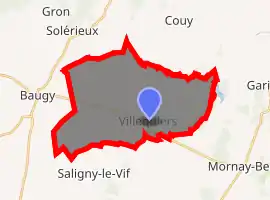
| |
 Villequiers  Villequiers | |
| Coordinates: 47°04′13″N 2°48′20″E | |
| Country | France |
| Region | Centre-Val de Loire |
| Department | Cher |
| Arrondissement | Bourges |
| Canton | Avord |
| Intercommunality | CC La Septaine |
| Government | |
| • Mayor (2020–2026) | Pascal Méreau[1] |
| Area 1 | 29.49 km2 (11.39 sq mi) |
| Population | 479 |
| • Density | 16/km2 (42/sq mi) |
| Time zone | UTC+01:00 (CET) |
| • Summer (DST) | UTC+02:00 (CEST) |
| INSEE/Postal code | 18286 /18800 |
| Elevation | 174–216 m (571–709 ft) (avg. 232 m or 761 ft) |
| 1 French Land Register data, which excludes lakes, ponds, glaciers > 1 km2 (0.386 sq mi or 247 acres) and river estuaries. | |
Geography
An area of forestry and farming area comprising the village and several hamlets situated in the valley of the river Vauvise, about 19 miles (31 km) east of Bourges, at the junction of the D12 with the D93 and D72 roads. The Vauvise flows north-northeast through the eastern part of the commune.
Population
| Year | Pop. | ±% |
|---|---|---|
| 1962 | 504 | — |
| 1968 | 534 | +6.0% |
| 1975 | 527 | −1.3% |
| 1982 | 433 | −17.8% |
| 1990 | 466 | +7.6% |
| 1999 | 446 | −4.3% |
| 2008 | 520 | +16.6% |
Sights
- The church of Notre-Dame, dating from the twelfth century.
- The ruins of a thirteenth-century castle.
- The sixteenth-century chateau and its park.
- The medieval watermill at the hamlet of Berry.
See also
References
- "Répertoire national des élus: les maires". data.gouv.fr, Plateforme ouverte des données publiques françaises (in French). 2 December 2020. Retrieved 7 December 2020.
- "Populations légales 2017". INSEE. Retrieved 6 January 2020.
External links
| Wikimedia Commons has media related to Villequiers. |
- Official commune website (in French)
| Authority control |
|
|---|
This article is issued from Wikipedia. The text is licensed under Creative Commons - Attribution - Sharealike. Additional terms may apply for the media files.