Brécy, Cher
Brécy is a commune in the Cher department in the Centre-Val de Loire region of France.
Brécy | |
|---|---|
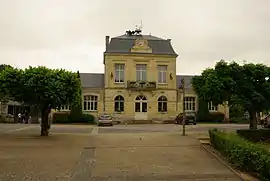 Town hall | |
.svg.png.webp) Coat of arms | |
Location of Brécy 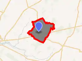
| |
 Brécy  Brécy | |
| Coordinates: 47°07′30″N 2°37′13″E | |
| Country | France |
| Region | Centre-Val de Loire |
| Department | Cher |
| Arrondissement | Bourges |
| Canton | Saint-Germain-du-Puy |
| Intercommunality | CC Terres du Haut Berry |
| Government | |
| • Mayor (2008–2014) | Gilles Bonneau-Popot |
| Area 1 | 39.63 km2 (15.30 sq mi) |
| Population (2017-01-01)[1] | 1,013 |
| • Density | 26/km2 (66/sq mi) |
| Time zone | UTC+01:00 (CET) |
| • Summer (DST) | UTC+02:00 (CEST) |
| INSEE/Postal code | 18035 /18220 |
| Elevation | 149–229 m (489–751 ft) |
| 1 French Land Register data, which excludes lakes, ponds, glaciers > 1 km2 (0.386 sq mi or 247 acres) and river estuaries. | |
Geography
An area of forestry and farming comprising the village and five hamlets situated by the banks of the Tripande river, some 10 miles (16 km) east of Bourges at the junction of the D151 with the D12 and D52 roads. The commune lies on the pilgrimage route known as the Way of St. James.
Population
| Year | Pop. | ±% |
|---|---|---|
| 1962 | 549 | — |
| 1968 | 555 | +1.1% |
| 1975 | 488 | −12.1% |
| 1982 | 503 | +3.1% |
| 1990 | 692 | +37.6% |
| 1999 | 706 | +2.0% |
| 2008 | 794 | +12.5% |
Sights
- The church of St. Germain, dating from the twelfth century.
- The twelfth century chapel at Francheville, originally a Knights Templar commandry.
- Several ancient buildings at the hamlets of Guilly and Francheville.
See also
References
- "Populations légales 2017". INSEE. Retrieved 6 January 2020.
| Wikimedia Commons has media related to Brécy (Cher). |
| Authority control |
|---|
This article is issued from Wikipedia. The text is licensed under Creative Commons - Attribution - Sharealike. Additional terms may apply for the media files.