Humbligny
Humbligny is a commune in the Cher department in the Centre-Val de Loire region of France.
Humbligny | |
|---|---|
Location of Humbligny 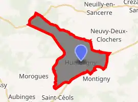
| |
 Humbligny  Humbligny | |
| Coordinates: 47°15′17″N 2°39′45″E | |
| Country | France |
| Region | Centre-Val de Loire |
| Department | Cher |
| Arrondissement | Bourges |
| Canton | Saint-Germain-du-Puy |
| Intercommunality | CC Terres du Haut Berry |
| Government | |
| • Mayor (2008–2014) | Jeannine Maurice |
| Area 1 | 20.86 km2 (8.05 sq mi) |
| Population (2017-01-01)[1] | 190 |
| • Density | 9.1/km2 (24/sq mi) |
| Time zone | UTC+01:00 (CET) |
| • Summer (DST) | UTC+02:00 (CEST) |
| INSEE/Postal code | 18111 /18250 |
| Elevation | 227–428 m (745–1,404 ft) (avg. 434 m or 1,424 ft) |
| 1 French Land Register data, which excludes lakes, ponds, glaciers > 1 km2 (0.386 sq mi or 247 acres) and river estuaries. | |
Geography
A forestry and farming village situated some 15 miles (24 km) northeast of Bourges, at the junction of the D955 and the D44 roads. The village is the highest point in the northern part of the department and the source of two rivers, the Sauldre and Colin.
Population
| Year | Pop. | ±% |
|---|---|---|
| 1962 | 233 | — |
| 1968 | 268 | +15.0% |
| 1975 | 239 | −10.8% |
| 1982 | 221 | −7.5% |
| 1990 | 189 | −14.5% |
| 1999 | 180 | −4.8% |
| 2008 | 180 | +0.0% |
Sights
See also
References
- "Populations légales 2017". INSEE. Retrieved 6 January 2020.
External links
| Wikimedia Commons has media related to Humbligny. |
| Authority control |
|---|
This article is issued from Wikipedia. The text is licensed under Creative Commons - Attribution - Sharealike. Additional terms may apply for the media files.