Jouet-sur-l'Aubois
Jouet-sur-l’Aubois is a commune in the Cher department in the Centre-Val de Loire region of France.
Jouet-sur-l’Aubois | |
|---|---|
.JPG.webp) The town hall in Jouet-sur-l'Aubois | |
Location of Jouet-sur-l’Aubois 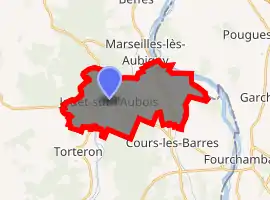
| |
 Jouet-sur-l’Aubois  Jouet-sur-l’Aubois | |
| Coordinates: 47°02′46″N 2°59′21″E | |
| Country | France |
| Region | Centre-Val de Loire |
| Department | Cher |
| Arrondissement | Saint-Amand-Montrond |
| Canton | La Guerche-sur-l'Aubois |
| Intercommunality | Portes du Berry entre Loire et Val d'Aubois |
| Government | |
| • Mayor (2008–2014) | Serge Laurent |
| Area 1 | 17.33 km2 (6.69 sq mi) |
| Population (2017-01-01)[1] | 1,348 |
| • Density | 78/km2 (200/sq mi) |
| Time zone | UTC+01:00 (CET) |
| • Summer (DST) | UTC+02:00 (CEST) |
| INSEE/Postal code | 18118 /18320 |
| Elevation | 160–207 m (525–679 ft) (avg. 180 m or 590 ft) |
| 1 French Land Register data, which excludes lakes, ponds, glaciers > 1 km2 (0.386 sq mi or 247 acres) and river estuaries. | |
Geography
An area of forestry and farming comprising the village and a few hamlets situated by the banks of the rivers Aubois, Loire and the Loire lateral canal, some 22 miles (35 km) east of Bourges at the junction of the D12, D26 and the D920 roads.
Population
| Year | Pop. | ±% |
|---|---|---|
| 1962 | 1,458 | — |
| 1968 | 1,551 | +6.4% |
| 1975 | 1,616 | +4.2% |
| 1982 | 1,488 | −7.9% |
| 1990 | 1,395 | −6.2% |
| 1999 | 1,341 | −3.9% |
| 2008 | 1,506 | +12.3% |
Sights
- The church of St. Germain, dating from the nineteenth century.
- The remains of a 12th-century chapel.
- A medieval motte.
- Some Gallo-Roman remains.
- An old disused factory and forge.
See also
References
- "Populations légales 2017". INSEE. Retrieved 6 January 2020.
| Wikimedia Commons has media related to Jouet-sur-l'Aubois. |
| Authority control |
|
|---|
This article is issued from Wikipedia. The text is licensed under Creative Commons - Attribution - Sharealike. Additional terms may apply for the media files.