Les Aix-d'Angillon
Les Aix-d’Angillon is a commune in the Cher department in the Centre-Val de Loire region of France.
Les Aix-d'Angillon | |
|---|---|
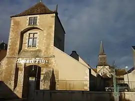 Collegiate Church of St-Germain and another building, in Les Aix-d'Angillon | |
 Coat of arms | |
Location of Les Aix-d'Angillon 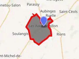
| |
 Les Aix-d'Angillon  Les Aix-d'Angillon | |
| Coordinates: 47°11′56″N 2°34′21″E | |
| Country | France |
| Region | Centre-Val de Loire |
| Department | Cher |
| Arrondissement | Bourges |
| Canton | Saint-Germain-du-Puy |
| Intercommunality | CC Terres du Haut Berry |
| Government | |
| • Mayor (2008–2014) | Claude Leloup |
| Area 1 | 14.68 km2 (5.67 sq mi) |
| Population (2017-01-01)[1] | 1,916 |
| • Density | 130/km2 (340/sq mi) |
| Time zone | UTC+01:00 (CET) |
| • Summer (DST) | UTC+02:00 (CEST) |
| INSEE/Postal code | 18003 /18220 |
| Elevation | 163–211 m (535–692 ft) (avg. 82 m or 269 ft) |
| 1 French Land Register data, which excludes lakes, ponds, glaciers > 1 km2 (0.386 sq mi or 247 acres) and river estuaries. | |
Geography
A small farming town, with a little associated light industry, situated some 11 miles (18 km) northeast of Bourges, at the junction of the D955, D25, D12 and the D46 roads. The small rivers Colin and Quatier flow southward through the commune.
Population
| Year | Pop. | ±% |
|---|---|---|
| 1962 | 1,118 | — |
| 1968 | 1,246 | +11.4% |
| 1975 | 1,945 | +56.1% |
| 1982 | 2,146 | +10.3% |
| 1990 | 2,160 | +0.7% |
| 1999 | 2,006 | −7.1% |
| 2008 | 1,923 | −4.1% |
Sights
See also
References
- "Populations légales 2017". INSEE. Retrieved 6 January 2020.
External links
| Wikimedia Commons has media related to Les Aix-d'Angillon. |
- Official website of Les Aix-d'Angillon (in French)
| Authority control |
|---|
This article is issued from Wikipedia. The text is licensed under Creative Commons - Attribution - Sharealike. Additional terms may apply for the media files.