Aberdeen, South Dakota micropolitan area
The Aberdeen Micropolitan Statistical Area, as defined by the United States Census Bureau, is an area consisting of two counties in South Dakota, anchored by the city of Aberdeen. As of the 2010 census, the μSA had a population of 40,602 (though a July 1, 2017 estimate placed the population at 43,097).[1]
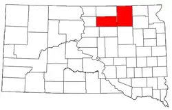
Counties
| Historical population | |||
|---|---|---|---|
| Census | Pop. | %± | |
| 1880 | 353 | — | |
| 1890 | 21,254 | 5,921.0% | |
| 1900 | 20,202 | −4.9% | |
| 1910 | 33,521 | 65.9% | |
| 1920 | 37,845 | 12.9% | |
| 1930 | 40,170 | 6.1% | |
| 1940 | 37,490 | −6.7% | |
| 1950 | 39,892 | 6.4% | |
| 1960 | 40,185 | 0.7% | |
| 1970 | 42,468 | 5.7% | |
| 1980 | 42,121 | −0.8% | |
| 1990 | 39,936 | −5.2% | |
| 2000 | 39,827 | −0.3% | |
| 2010 | 40,602 | 1.9% | |
| 2017 (est.) | 43,097 | [1] | 6.1% |
Communities
- Places with more than 27,500 inhabitants
- Aberdeen (Principal city)
Demographics
As of the census of 2010, there were 40,602 people, 16,493 households, and 9,853 families residing within the μSA. The racial makeup of the μSA was 93.7% White, 0.5% African American, 2.8% Native American, 0.9% Asian, 0.1% Pacific Islander, 0.4% from other races, and 1.7% from two or more races. Hispanic or Latino of any race were 1.4% of the population.
The median income for a household in the μSA was $48,639, and the median income for a family was $63,069. Males had a median income of $39,358 versus $31,007 for females. The per capita income for the μSA was $25,640.
References
- "Metropolitan and Micropolitan Statistical Areas Population Totals: 2010-2017" (HTML). United States Census Bureau, Population Division. July 1, 2017. Retrieved March 22, 2019.
