St. Francis, South Dakota
St. Francis (Lakota: Sápauŋ thí;[6] "Catholic House") is a town on the Rosebud Indian Reservation in Todd County, South Dakota, United States. The population was 709 at the 2010 census.
St. Francis, South Dakota
Sápauŋ thí | |
|---|---|
_from_S_1.JPG.webp) St. Charles Borromeo Catholic Church in St. Francis | |
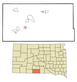 Location in Todd County and the state of South Dakota | |
| Coordinates: 43°8′39″N 100°54′11″W | |
| Country | United States |
| State | South Dakota |
| County | Todd |
| Area | |
| • Total | 0.36 sq mi (0.94 km2) |
| • Land | 0.36 sq mi (0.94 km2) |
| • Water | 0.00 sq mi (0.00 km2) |
| Elevation | 2,989 ft (911 m) |
| Population | |
| • Total | 709 |
| • Estimate (2019)[3] | 566 |
| • Density | 1,563.54/sq mi (603.51/km2) |
| Time zone | UTC-6 (Central (CST)) |
| • Summer (DST) | UTC-5 (CDT) |
| Area code(s) | 605 |
| FIPS code | 46-57140[4] |
| GNIS feature ID | 1257590[5] |
St. Francis took its name from the St. Francis Indian School, which had the name of Francis of Assisi and was operated by the Catholic Franciscan order.[7]
Geography
According to the United States Census Bureau, the town has a total area of 0.36 square miles (0.93 km2), all land.[8]
Saint Francis has been assigned the ZIP code 57572 and the FIPS place code 57140.
Demographics
| Historical population | |||
|---|---|---|---|
| Census | Pop. | %± | |
| 1940 | 273 | — | |
| 1950 | 241 | −11.7% | |
| 1960 | 421 | 74.7% | |
| 1970 | 300 | −28.7% | |
| 1980 | 766 | 155.3% | |
| 1990 | 815 | 6.4% | |
| 2000 | 675 | −17.2% | |
| 2010 | 709 | 5.0% | |
| 2019 (est.) | 566 | [3] | −20.2% |
| U.S. Decennial Census[9] | |||
2010 census
As of the census[2] of 2010, there were 709 people, 189 households, and 139 families living in the town. The population density was 1,969.4 inhabitants per square mile (760.4/km2). There were 211 housing units at an average density of 586.1 per square mile (226.3/km2). The racial makeup of the town was 5.1% White, 0.4% African American, 93.8% Native American, and 0.7% from two or more races. Hispanic or Latino of any race were 1.8% of the population.
There were 189 households, of which 56.6% had children under the age of 18 living with them, 17.5% were married couples living together, 40.7% had a female householder with no husband present, 15.3% had a male householder with no wife present, and 26.5% were non-families. 19.0% of all households were made up of individuals, and 2.6% had someone living alone who was 65 years of age or older. The average household size was 3.75 and the average family size was 4.27.
The median age in the town was 24.1 years. 38.8% of residents were under the age of 18; 13.2% were between the ages of 18 and 24; 24.6% were from 25 to 44; 18.8% were from 45 to 64; and 4.5% were 65 years of age or older. The gender makeup of the town was 51.8% male and 48.2% female.
2000 census
As of the census[4] of 2000, there were 675 people, 183 households, and 131 families living in the town. The population density was 1,860.9 people per square mile (723.9/km2). There were 204 housing units at an average density of 562.4 per square mile (218.8/km2). The racial makeup of the town was 3.26% White, 96.15% Native American, 0.15% Asian, 0.30% from other races, and 0.15% from two or more races. Hispanic or Latino of any race were 1.78% of the population.
There were 183 households, out of which 47.5% had children under the age of 18 living with them, 19.1% were married couples living together, 34.4% had a female householder with no husband present, and 27.9% were non-families. 21.3% of all households were made up of individuals, and 9.3% had someone living alone who was 65 years of age or older. The average household size was 3.50 and the average family size was 4.12.
In the town, the population was spread out, with 42.4% under the age of 18, 9.9% from 18 to 24, 24.9% from 25 to 44, 14.4% from 45 to 64, and 8.4% who were 65 years of age or older. The median age was 23 years. For every 100 females, there were 97.4 males. For every 100 females age 18 and over, there were 99.5 males.
The median income for a household in the town was $18,750, and the median income for a family was $20,000. Males had a median income of $18,333 versus $18,750 for females. The per capita income for the town was $7,026. About 48.6% of families and 57.1% of the population were below the poverty line, including 69.8% of those under age 18 and 35.8% of those age 65 or over.
Politics
Saint Francis has a representative from its district on the Rosebud Tribal Council. Rodney M. Bordeaux is the current Tribal Council President (2019).[10]
References
- "2019 U.S. Gazetteer Files". United States Census Bureau. Retrieved July 30, 2020.
- "U.S. Census website". United States Census Bureau. Retrieved 2012-06-21.
- "Population and Housing Unit Estimates". United States Census Bureau. May 24, 2020. Retrieved May 27, 2020.
- "U.S. Census website". United States Census Bureau. Retrieved 2008-01-31.
- "US Board on Geographic Names". United States Geological Survey. 2007-10-25. Retrieved 2008-01-31.
- Ullrich, Jan F. (2014). New Lakota Dictionary (2nd ed.). Bloomington, IN: Lakota Language Consortium. ISBN 978-0-9761082-9-0.
- Federal Writers' Project (1940). South Dakota place-names, v.1-3. University of South Dakota. p. 60.
- "US Gazetteer files 2010". United States Census Bureau. Archived from the original on 2012-01-25. Retrieved 2012-06-21.
- United States Census Bureau. "Census of Population and Housing". Retrieved June 23, 2016.
- "Rosebud Sioux Tribe President". Retrieved August 29, 2019.
Municipalities and communities of Todd County, South Dakota, United States | ||
|---|---|---|
| City | 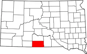 | |
| Town | ||
| CDPs | ||
| Unincorporated communities | ||
| Indian reservation | ||
| Footnotes | ‡This populated place also has portions in an adjacent county or counties | |
| ||

| Authority control |
|---|