Madison, South Dakota
Madison is a city in Lake County, South Dakota, United States. The population was 6,474 at the 2010 census. It is the county seat of Lake County[7] and is home to Dakota State University.
Madison, South Dakota | |
|---|---|
.jpg.webp) | |
| Motto(s): Discover the Unexpected | |
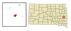 Location in Lake County and the state of South Dakota | |
 Madison, South Dakota Location in the United States | |
| Coordinates: 44°0′28″N 97°6′53″W | |
| Country | United States |
| State | South Dakota |
| County | Lake |
| Founded | 1880 |
| Incorporated | 1885[1] |
| Government | |
| • Mayor | Marshall Dennert |
| Area | |
| • Total | 4.62 sq mi (11.95 km2) |
| • Land | 4.62 sq mi (11.95 km2) |
| • Water | 0.00 sq mi (0.00 km2) |
| Elevation | 1,677 ft (511 m) |
| Population | |
| • Total | 6,474 |
| • Estimate (2019)[4] | 7,270 |
| • Density | 1,574.96/sq mi (608.13/km2) |
| • Metro density | 632/sq mi (244.1/km2) |
| Time zone | UTC−6 (Central) |
| • Summer (DST) | UTC−5 (CDT) |
| Zip code | 57042 |
| Area code(s) | 605 |
| FIPS code | 46-40220[5] |
| GNIS feature ID | 1256295[6] |
| Website | www |
Geography
Madison is located at 44°0′28″N 97°6′53″W (44.007734, -97.114738).[8]
According to the United States Census Bureau, the city has a total area of 4.61 square miles (11.94 km2), all land.[9]
Madison has been assigned the ZIP code 57042 and the FIPS place code 40220.
Madison is located between Lake Herman and Lake Madison.
Demographics
| Historical population | |||
|---|---|---|---|
| Census | Pop. | %± | |
| 1880 | 96 | — | |
| 1890 | 1,736 | 1,708.3% | |
| 1900 | 2,550 | 46.9% | |
| 1910 | 3,137 | 23.0% | |
| 1920 | 4,144 | 32.1% | |
| 1930 | 4,289 | 3.5% | |
| 1940 | 5,018 | 17.0% | |
| 1950 | 5,153 | 2.7% | |
| 1960 | 5,420 | 5.2% | |
| 1970 | 6,315 | 16.5% | |
| 1980 | 6,210 | −1.7% | |
| 1990 | 6,257 | 0.8% | |
| 2000 | 6,540 | 4.5% | |
| 2010 | 6,474 | −1.0% | |
| 2019 (est.) | 7,270 | [4] | 12.3% |
| U.S. Decennial Census[10] 2017 Estimate[11] | |||
2010 census
As of the census[3] of 2010, there were 6,474 people, 2,627 households, and 1,449 families living in the city. The population density was 1,404.3 inhabitants per square mile (542.2/km2). There were 2,848 housing units at an average density of 617.8 per square mile (238.5/km2). The racial makeup of the city was 94.5% White, 0.7% African American, 0.9% Native American, 1.1% Asian, 1.3% from other races, and 1.5% from two or more races. Hispanic or Latino of any race were 2.4% of the population.
There were 2,627 households, of which 26.5% had children under the age of 18 living with them, 42.6% were married couples living together, 9.4% had a female householder with no husband present, 3.2% had a male householder with no wife present, and 44.8% were non-families. 37.3% of all households were made up of individuals, and 14.2% had someone living alone who was 65 years of age or older. The average household size was 2.22 and the average family size was 2.93.
The median age in the city was 34.6 years. 20.6% of residents were under the age of 18; 18.1% were between the ages of 18 and 24; 20.4% were from 25 to 44; 23.6% were from 45 to 64; and 17.3% were 65 years of age or older. The gender makeup of the city was 49.8% male and 50.2% female.
2000 census
As of the census[5] of 2000, there were 6,540 people, 2,589 households, and 1,491 families living in the city. The population density was 1,529.4 people per square mile (590.0/km2). There were 2,706 housing units at an average density of 632.8 per square mile (244.1/km2). The racial makeup of the city was 97.16% White, 0.24% African American, 0.81% Native American, 0.76% Asian, 0.02% Pacific Islander, 0.40% from other races, and 0.61% from two or more races. Hispanic or Latino of any race were 0.92% of the population.
There were 2,589 households, out of which 26.6% had children under the age of 18 living with them, 47.2% were married couples living together, 7.5% had a female householder with no husband present, and 42.4% were non-families. 34.8% of all households were made up of individuals, and 16.7% had someone living alone who was 65 years of age or older. The average household size was 2.26 and the average family size was 2.94.
In the city, the population was spread out, with 21.3% under the age of 18, 21.0% from 18 to 24, 21.7% from 25 to 44, 17.4% from 45 to 64, and 18.6% who were 65 years of age or older. The median age was 33 years. For every 100 females, there were 93.7 males. For every 100 females age 18 and over, there were 93.2 males.
As of 2000 the median income for a household in the city was $30,434, and the median income for a family was $39,745. Males had a median income of $28,408 versus $20,965 for females. The per capita income for the city was $14,767. About 6.3% of families and 11.9% of the population were below the poverty line, including 12.2% of those under age 18 and 7.7% of those age 65 or over.
History
.jpg.webp)
Madison was laid out in 1873.[12] The city was named after Madison, Wisconsin.[13]
Notable people
- Casey Crabtree, member of the South Dakota Senate
- Jessica Fjerstad, Miss South Dakota Teen USA 2002 and Miss South Dakota USA 2005
- Mary Hart, host of Entertainment Tonight
- Harry A. Keegan, former member of the Wisconsin State Assembly
- Richard Barrett Lowe, 29th governor of American Samoa (1953–1956) and 8th governor of Guam (1956–1959)
- Charles McCallister, water polo player who competed in the 1932 Summer Olympics and in the 1936 Summer Olympics
- Karl Mundt, four-term U.S. senator
- Donald James Porter, United States federal judge
- Jerry Schemmel, radio voice of the Denver Nuggets and Colorado Rockies and cyclist
- Gene Vidal, athlete and aviator, father of Gore Vidal
Media
AM radio
| AM radio stations | |||||
|---|---|---|---|---|---|
| Frequency | Call sign | Name | Format | Owner | City |
| 1390 AM | KJAM | Dakota's Best | Classic Hits | Alpha Media | Madison |
FM radio
| FM radio stations | ||||||
|---|---|---|---|---|---|---|
| Frequency | Call sign | Name | Format | Owner | City of license | |
| 103.1 FM | KJAM-FM | Jammin' Country | Country | Alpha Media | Madison | |
Sports
Madison's high school (Bulldogs) gymnastic program won the state gymnastics meet 16 times in a row from 1994 to 2010. That is a national record. The Madison basketball team won the state title two years in a row from 2009 to 2010 and again in 2013–2014. The Bulldogs football team rode an 11–0 season to the 11A state championship game in 2013 where they lost 28–21 to West Central on a touchdown pass with 19 seconds to go in the game.
References
- "SD Towns" (PDF). South Dakota State Historical Society. Archived from the original (PDF) on February 10, 2010. Retrieved February 14, 2010.
- "2019 U.S. Gazetteer Files". United States Census Bureau. Retrieved July 30, 2020.
- "U.S. Census website". United States Census Bureau. Retrieved 2012-06-21.
- "Population and Housing Unit Estimates". United States Census Bureau. May 24, 2020. Retrieved May 27, 2020.
- "U.S. Census website". United States Census Bureau. Retrieved 2008-01-31.
- "US Board on Geographic Names". United States Geological Survey. 2007-10-25. Retrieved 2008-01-31.
- "Find a County". National Association of Counties. Retrieved 2011-06-07.
- "US Gazetteer files: 2010, 2000, and 1990". United States Census Bureau. 2011-02-12. Retrieved 2011-04-23.
- "US Gazetteer files 2010". United States Census Bureau. Archived from the original on 2012-01-25. Retrieved 2012-06-21.
- United States Census Bureau. "Census of Population and Housing". Retrieved September 23, 2013.
- "Population Estimates". United States Census Bureau. Retrieved October 5, 2018.
- Federal Writers' Project (1940). South Dakota place-names, v.1-3. University of South Dakota. p. 49.
- Gannett, Henry (1905). The Origin of Certain Place Names in the United States. U.S. Government Printing Office. p. 196.
External links
| Wikivoyage has a travel guide for Madison (South Dakota). |
| Wikimedia Commons has media related to Madison, South Dakota. |
- Official website
- Madison Chamber of Commerce
- Madison Area Arts Council
- Dakota State University
- MadisonSD.com
- . New International Encyclopedia. 1905.
Municipalities and communities of Lake County, South Dakota, United States | ||
|---|---|---|
| City | 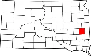 | |
| Towns | ||
| Village | ||
| CDPs | ||
| Other unincorporated communities | ||
| ||

| Authority control |
|---|