Clay County, Texas
Clay County is a county located in the U.S. state of Texas. As of the 2010 census, its population was 10,752.[1] The county seat is Henrietta.[2] The county was founded in 1857 and later organized in 1860.[3] It is named in honor of Henry Clay,[4] famous American statesman, Kentucky Senator and United States Secretary of State.
Clay County | |
|---|---|
 Clay County Courthouse in Henrietta | |
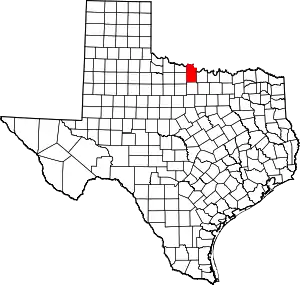 Location within the U.S. state of Texas | |
 Texas's location within the U.S. | |
| Coordinates: 33°47′N 98°13′W | |
| Country | |
| State | |
| Founded | 1860 |
| Named for | Henry Clay |
| Seat | Henrietta |
| Largest city | Henrietta |
| Area | |
| • Total | 1,117 sq mi (2,890 km2) |
| • Land | 1,089 sq mi (2,820 km2) |
| • Water | 28 sq mi (70 km2) 2.5%% |
| Population (2010) | |
| • Total | 10,752 |
| • Density | 9.9/sq mi (3.8/km2) |
| Time zone | UTC−6 (Central) |
| • Summer (DST) | UTC−5 (CDT) |
| Congressional district | 13th |
| Website | www |

Clay County is part of the Wichita Falls, Metropolitan Statistical Area in North Texas.
Several railroads once served Clay County, including the Wichita Falls Railway, one of the properties of Joseph A. Kemp and his brother-in-law Frank Kell, along with twenty-nine other stockholders. The Wichita Falls Railway linked Henrietta with Wichita Falls. Built in 1894–1895, it was sold in 1911 to the Missouri-Kansas-Texas Railroad, also known as the Katy. The original eighteen miles of track was abandoned in 1970.[5]
The Wichita Falls rancher, oilman, and philanthropist Joseph Sterling Bridwell owned a ranch in Clay County, among his multiple holdings.[6]
Clay County is represented in the Texas House of Representatives by the Republican James Frank, a businessman from Wichita Falls.
Geography
According to the U.S. Census Bureau, the county has a total area of 1,117 square miles (2,890 km2), of which 1,089 square miles (2,820 km2) is land and 28 square miles (73 km2) (2.5%) is water.[7]
Lake Arrowhead State Park, a 524-acre (212 ha) development on Lake Arrowhead in Clay County, encompasses 14,390-acre (5,820 ha) acres. The lakeshore extends 106 miles; the park offers bicycling, birding, boating, camping, canoeing, fishing, hiking, horseback riding, nature study, picnicking, swimming, and wildlife observation.[8]
Adjacent counties
- Jefferson County, Oklahoma (north)
- Montague County (east)
- Jack County (south)
- Wichita County (west)
- Archer County (west)
- Cotton County, Oklahoma (northwest)
Demographics
| Historical population | |||
|---|---|---|---|
| Census | Pop. | %± | |
| 1860 | 109 | — | |
| 1880 | 5,045 | — | |
| 1890 | 7,503 | 48.7% | |
| 1900 | 9,231 | 23.0% | |
| 1910 | 17,043 | 84.6% | |
| 1920 | 16,864 | −1.1% | |
| 1930 | 14,545 | −13.8% | |
| 1940 | 12,524 | −13.9% | |
| 1950 | 9,896 | −21.0% | |
| 1960 | 8,351 | −15.6% | |
| 1970 | 8,079 | −3.3% | |
| 1980 | 9,582 | 18.6% | |
| 1990 | 10,024 | 4.6% | |
| 2000 | 11,006 | 9.8% | |
| 2010 | 10,752 | −2.3% | |
| 2019 (est.) | 10,471 | [9] | −2.6% |
| U.S. Decennial Census[10] 1850–2010[11] 2010–2014[1] | |||
As of the census[12] of 2000, there were 11,006 people, 4,323 households, and 3,181 families residing in the county. The population density was 10 people per square mile (4/km2). There were 4,992 housing units at an average density of 4 per square mile (2/km2). The racial makeup of the county was 95.35% White, 0.42% Black or African American, 1.03% Native American, 0.10% Asian, 0.01% Pacific Islander, 1.68% from other races, and 1.42% from two or more races. 3.67% of the population were Hispanic or Latino of any race.
There were 4,323 households, out of which 30.70% had children under the age of 18 living with them, 63.20% were married couples living together, 7.30% had a female householder with no husband present, and 26.40% were non-families. 23.50% of all households were made up of individuals, and 11.80% had someone living alone who was 65 years of age or older. The average household size was 2.52 and the average family size was 2.98.
In the county, the population was spread out, with 24.90% under the age of 18, 6.80% from 18 to 24, 26.40% from 25 to 44, 25.90% from 45 to 64, and 16.10% who were 65 years of age or older. The median age was 40 years. For every 100 females, there were 94.00 males. For every 100 females age 18 and over, there were 93.10 males.
The median income for a household in the county was $35,738, and the median income for a family was $41,514. Males had a median income of $28,914 versus $20,975 for females. The per capita income for the county was $16,361. About 8.10% of families and 10.30% of the population were below the poverty line, including 11.70% of those under age 18 and 11.00% of those age 65 or over.
Transportation
Major highways
 U.S. Highway 82
 U.S. Highway 287
 State Highway 79
 State Highway 148
Politics
Prior to 1996, Clay County was strongly Democratic in presidential elections. The only Republican Party candidates who managed to win the county from 1912 to 1992 were Herbert Hoover thanks to anti-Catholic sentiment towards Al Smith as well as Richard Nixon & Ronald Reagan in their 49-state landslides of 1972 & 1984, respectively. Since 1996, the county has swung hard to the supporting Republican Party similar to almost all white-majority rural counties in the Solid South, with its presidential candidates winning by increasing margins in each passing election. As a testament to how strongly Republican the county has swung, Donald Trump defeated Hillary Clinton by a margin of over 75 percent in 2016, compared to an only 7.4 percent margin Bob Dole won the county by 20 years prior at the start of its Republican trend.
| Year | Republican | Democratic | Third parties |
|---|---|---|---|
| 2020 | 88.3% 5,069 | 10.7% 614 | 1.1% 61 |
| 2016 | 87.2% 4,377 | 10.7% 536 | 2.1% 105 |
| 2012 | 84.4% 4,266 | 14.6% 740 | 1.0% 51 |
| 2008 | 78.9% 4,213 | 20.3% 1,085 | 0.8% 41 |
| 2004 | 75.1% 3,971 | 24.6% 1,299 | 0.3% 18 |
| 2000 | 67.1% 3,112 | 31.5% 1,460 | 1.4% 65 |
| 1996 | 48.0% 1,997 | 40.6% 1,690 | 11.4% 473 |
| 1992 | 32.3% 1,586 | 39.1% 1,919 | 28.6% 1,405 |
| 1988 | 47.1% 2,043 | 52.7% 2,288 | 0.2% 9 |
| 1984 | 58.0% 2,569 | 41.7% 1,844 | 0.3% 13 |
| 1980 | 44.4% 1,824 | 54.3% 2,233 | 1.3% 52 |
| 1976 | 31.7% 1,200 | 67.9% 2,568 | 0.4% 15 |
| 1972 | 64.3% 1,893 | 34.7% 1,023 | 1.0% 29 |
| 1968 | 29.5% 936 | 49.6% 1,573 | 21.0% 665 |
| 1964 | 21.8% 659 | 78.1% 2,357 | 0.1% 4 |
| 1960 | 37.5% 1,019 | 62.3% 1,692 | 0.3% 7 |
| 1956 | 35.3% 990 | 64.6% 1,813 | 0.2% 5 |
| 1952 | 38.4% 1,272 | 61.6% 2,044 | |
| 1948 | 12.9% 332 | 82.5% 2,131 | 4.6% 120 |
| 1944 | 10.4% 311 | 77.4% 2,307 | 12.2% 362 |
| 1940 | 15.3% 427 | 84.5% 2,357 | 0.2% 6 |
| 1936 | 8.2% 196 | 91.1% 2,168 | 0.7% 16 |
| 1932 | 6.0% 151 | 93.7% 2,365 | 0.3% 7 |
| 1928 | 53.4% 1,327 | 46.6% 1,160 | |
| 1924 | 17.4% 318 | 76.5% 1,402 | 6.2% 113 |
| 1920 | 24.5% 446 | 72.7% 1,324 | 2.8% 51 |
| 1916 | 11.4% 177 | 84.9% 1,324 | 3.8% 59 |
| 1912 | 4.5% 54 | 83.4% 1,002 | 12.2% 146 |
See also
References
- "State & County QuickFacts". United States Census Bureau. Archived from the original on January 13, 2016. Retrieved December 9, 2013.
- "Find a County". National Association of Counties. Archived from the original on May 31, 2011. Retrieved June 7, 2011.
- "Texas: Individual County Chronologies". Texas Atlas of Historical County Boundaries. The Newberry Library. 2008. Retrieved May 21, 2015.
- Gannett, Henry (1905). The Origin of Certain Place Names in the United States. Govt. Print. Off. pp. 83.
- "Wichita Falls Railway". tshaonline.org. June 15, 2010. Retrieved April 20, 2013.
- "Jack O. Loftin, "Joseph Sterling Bridwell"". Texas State Historical Association online. June 12, 2010. Retrieved April 30, 2013.
- "2010 Census Gazetteer Files". United States Census Bureau. August 22, 2012. Retrieved April 20, 2015.
- "Lake Arrowhead State Park". wildtexas.com. Retrieved April 17, 2013.
- "Population and Housing Unit Estimates". United States Census Bureau. May 24, 2020. Retrieved May 27, 2020.
- "U.S. Decennial Census". United States Census Bureau. Retrieved April 20, 2015.
- "Texas Almanac: Population History of Counties from 1850–2010" (PDF). Texas Almanac. Retrieved April 20, 2015.
- "U.S. Census website". United States Census Bureau. Retrieved May 14, 2011.
- Leip, David. "Dave Leip's Atlas of U.S. Presidential Elections". uselectionatlas.org. Retrieved July 20, 2018.
External links
![]() Media related to Clay County, Texas at Wikimedia Commons
Media related to Clay County, Texas at Wikimedia Commons
- Clay County Official Website
- See historic photos of Clay County from the Clay County Historical Society, hosted by the Portal to Texas History
- Clay County from the Handbook of Texas Online
- Clay County 1890 Jail Museum-Heritage Center
Places adjacent to Clay County, Texas | ||||||||||
|---|---|---|---|---|---|---|---|---|---|---|
| ||||||||||
Municipalities and communities of Clay County, Texas, United States | ||
|---|---|---|
| Cities | Clay County map | |
| Town | ||
| Unincorporated communities | ||
| Footnotes | ‡This populated place also has portions in an adjacent county or counties | |
| ||

| Authority control |
|---|