Kendall County, Texas
Kendall County is a county located on the Edwards Plateau in the U.S. state of Texas. In 2010 census, its population was 33,410.[2] Its county seat is Boerne.[3] The county is named for George Wilkins Kendall, a journalist and Mexican–American War correspondent.
Kendall County | |
|---|---|
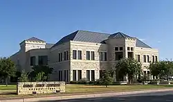 The Kendall County Courthouse in Boerne | |
 Seal | |
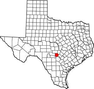 Location within the U.S. state of Texas | |
 Texas's location within the U.S. | |
| Coordinates: 29°57′N 98°42′W | |
| Country | |
| State | |
| Founded | 1862 |
| Named for | George Wilkins Kendall |
| Seat | Boerne |
| Largest city | Boerne |
| Area | |
| • Total | 663 sq mi (1,720 km2) |
| • Land | 662 sq mi (1,710 km2) |
| • Water | 0.6 sq mi (2 km2) 0.09%% |
| Population (2010) | |
| • Total | 33,410[1] |
| • Density | 50/sq mi (20/km2) |
| Time zone | UTC−6 (Central) |
| • Summer (DST) | UTC−5 (CDT) |
| Congressional district | 21st |
| Website | www |
Kendall County is part of the San Antonio–New Braunfels, TX metropolitan statistical area.
Progressive Farmer rated Kendall County fifth in its list of the "Best Places to Live in Rural America" in 2006.
Kendall, along with Hays and Comal Counties, was listed in 2017 of the nation's 10 fastest-growing large counties with a population of at least 10,000. From 2015 to 2016, Kendall County, the second-fastest-growing county in the nation, grew by 5.16%, gaining 2,088 people in a one-year period.[4][1]
History
Before 1850
- Early Native American inhabitants included Kiowa, Comanche, and Lipan Apache.[5]
- In the 1700s, Lipan Apaches discovered Cascade Caverns.[6]
- 1842
- April 20 – Adelsverein[7] organized in Germany to promote emigration to Texas.
- June 7 – Fisher-Miller Land Grant set aside 3,000,000 acres (1.2×10¹⁰ m2) to settle 600 families and single men of German, Dutch, Swiss, Danish, Swedish, and Norwegian ancestry in Texas.[8]
- 1844, June 26 – Henry Francis Fisher sold his interest in the land grant to Adelsverein.[5]
- 1845
- Prince Carl of Solms-Braunfels secured title to 1,265 acres (5.12 km2) of the Veramendi grant, including the Comal Springs and River, for the Adelsverein.
- February – Thousands of German immigrants were stranded at port of disembarkation Indianaola on Matagorda Bay. With no food or shelters, living in holes dug into the ground, an estimated 50% died from disease or starvation. The living began to walk to their destinations hundreds of miles away.[9][10]
- May – John O. Meusebach arrived in Galveston.[11]
- December 20 – Henry Francis Fisher and Burchard Miller sold their rights in the land grant to Adelsverein.
- 1847
- Meusebach–Comanche Treaty[12]
- Sisterdale was established.[13]
- 1849 Freethinkers Bettina colonists from Llano County settled Tusculum, named after Cicero’s home in ancient Rome. The initial community banned any churches from being erected. The town was later renamed Boerne, for German-Jewish political writer Ludwig Börne, who influenced Karl Marx.
1850–1899
- 1850s George W. Kendall introduced sheep ranching to the county.
- 1854
- John O. Meusebach received an appointment as commissioner from Governor Elisha M. Pease
- May 14–15, San Antonio – The Texas State Convention of Germans adopted a political, social, and religious platform, including: 1) Equal pay for equal work; 2) Direct election of the President of the United States; 3) Abolition of capital punishment; 4) "Slavery is an evil, the abolition of which is a requirement of democratic principles.."; 5) Free schools – including universities – supported by the state, without religious influence; and 6) Total separation of church and state.[14]
- Comfort is founded by German immigrant Freethinkers and abolitionists.[15]
- 1860 Boerne Village Band was formed by Karl Dienger.[16]
- 1861 Unionists from Kerr, Gillespie, and Kendall Counties participated in the formation of the Union League, a secret organization to support President Abraham Lincoln’s policies.[17]
- 1862
- Kendall County was established from Kerr and Blanco Counties, named for journalist George Wilkins Kendall. Boerne was made the county seat.
- The Union League formed companies to protect the frontier against Indians and their families against local Confederate forces. Conscientious objectors to the military draft were primarily among Tejanos and Germans .
- May 30 – Confederate authorities imposed martial law on Central Texas.
- August 10 – The Nueces massacre occurred in Kinney County. Jacob Kuechler served as a guide for 61 conscientious objectors attempting to flee to Mexico. Scottish-born Confederate irregular James Duff and his Duff’s Partisan Rangers pursued and overtook them at the Nueces River, 34 were killed, some executed after being taken prisoner. Jacob Kuechler survived the battle. The cruelty shocked the people of Gillespie County; 2,000 took to the hills to escape Duff's reign of terror.[18]
- Spring Creek Cemetery near Harper in Gillespie County has a singular grave with the names Sebird Henderson, Hiram Nelson, Gus Tegener, and Frank Scott. The inscription reads "Hanged and thrown in Spring Creek by Col. James Duff’s Confederate Regiment."[19]
- 1866 Samuel Boyd Patton was elected chief justice after his home became part of Kendall County which had been Blanco County.
- 1866, August 10 – Treue der Union Monument ("Loyalty to the Union") in Comfort dedicated to the German Texans slain at the Nueces massacre. It is one of only six such sites allowed to fly the United States flag at half-mast in perpetuity.[20][21]
- 1870 The original Kendall County limestone courthouse was built (Italianate architecture), with architects Philip Zoeller and J. F. Stendebach.[22]
- 1885
- Austrian-born Andreas Engel founded Bergheim.[23]
- The Sisterdale cotton gin began operations.[24]
- 1887 San Antonio and Aransas Pass Railway began a Boerne-to-San Antonio route.[25][26][27]
- 1897, May 27 – John O. Meusebach died at his farm at Loyal Valley in Mason County, and was buried in the Marschall Meusebach Cemetery at Cherry Spring.
1900–present
- 1900 Kendall County had 542 farms. Area under cultivation had risen from 153,921 acres (622.90 km2) in 1880 to 339,653 acres (1,374.53 km2). Stockraising was still the principal industry.
- 1905 Citizens of Boerne gathered to share agricultural information, recipes, and news of events. This later became the annual Kendall County Fair.[28]
- 1913 The Kendall County Fair Association was organized and was awarded a nonprofit corporate charter from the State of Texas.[28]
- 1914 Fredericksburg and Northern Railway connected Fredericksburg with the San Antonio and Aransas Pass Railway track just east of Comfort.
- 1918 A hygieostatic bat roost house was built in Comfort to attract bats to eradicate mosquitoes and reduce the spread of malaria. It was designed for former San Antonio Mayor Albert Steves Sr., by bat authority Dr. Charles A. R. Campbell.[29]
- 1930s
- The Great Depression brought an increase in tenant farming.
- Commercial development of Cascade Caverns began.
- World War II – American military bases in the San Antonio area provided jobs for Kendall County residents.
- 1983 The Guadalupe River State Park opened to the public.[30]
- 1988 The Federal Republic of Germany recognized the Boerne Village Band for its contribution to the German heritage in Texas and America.[31]
- 1990, Earth Day – Cibolo Nature Center opened to the public.[32]
- 1991 The Texas Legislature adopted a resolution recognizing the Boerne Village Band for "keeping alive German music as a part of our heritage."
- 1998 The current Kendall County limestone, steel, and concrete courthouse was built in Boerne, across the street from the original 1870 courthouse with architect Rehler Vaughn & Koone, Inc.
- 2005 Kendall County celebrated its 100th anniversary of the Kendall County Fair. The Kendall County Fair Association continues to produce one of the few remaining entirely privately funded county fairs in Texas.
- 2013 The Kendall County Fair Association, Inc. celebrated its 100th year of existence.
- 2015 Kendall County declared a state of emergency from May flooding.
Geography
According to the U.S. Census Bureau, the county has a total area of 663 square miles (1,720 km2), of which 662 square miles (1,710 km2) are land and 0.6 square miles (1.6 km2) (0.09%) is covered by water.[33]
Major highways
.svg.png.webp) Interstate 10
Interstate 10 U.S. Highway 87 (Old Spanish Trail)
 U.S. Highway 87 Business (Old Spanish Trail)
 State Highway 27 (Old Spanish Trail)
 State Highway 46
 Farm To Market Road 289 (Old Spanish Trail)
 Farm to Market Road 1621
 Farm to Market Road 3351
 Ranch to Market Road 473
 Ranch to Market Road 474
 Ranch to Market Road 1376
 Ranch to Market Road 3160 (formerly part of FM 3351)
Historic highways
 Old Spanish Trail (auto trail)
- Glacier to Gulf Highway
Adjacent counties
- Gillespie County (north)
- Blanco County (northeast)
- Comal County (southeast)
- Bexar County (south)
- Bandera County (southwest)
- Kerr County (west)
Waterways
- Guadalupe River
- Cibolo Creek
- Boerne Lake
- Browns Creek
- Block Creek
- Spring Creek
- Flat Rock Creek
- West Sister Creek
- East Sister Creek
- Sister Creek
- Wemer Creek
- Jacobs Creek
- Curry Creek
- First Coffee Hollow
- Dry Creek
- Sheps Creek
- Ralls Creek
- Ross Creek
- Black Creek
- Pleasant Valley Creek
- Polecat Spring Creek
- Joshua Creek
- Zinke Creek
- Holliday Creek
- Lake Oz
- Postroak Creek
- Deep Hollow Creek
- Menger Creek
- Kww Ranch Lake
- Masters Lake
- Smith Investment company lake number 1
- 711 Ranch Lake
- Goss Creek
Caves
- Cave Without a Name
- Spring Creek Cave
- Prassell Ranch Cave
- Three Whirlpool Cave
- Cascade Caverns
- Pfeiffer's Water Cave
- Alzafar Water Cave
- Reed Cave
Demographics
| Historical population | |||
|---|---|---|---|
| Census | Pop. | %± | |
| 1870 | 1,536 | — | |
| 1880 | 2,763 | 79.9% | |
| 1890 | 3,826 | 38.5% | |
| 1900 | 4,103 | 7.2% | |
| 1910 | 4,517 | 10.1% | |
| 1920 | 4,779 | 5.8% | |
| 1930 | 4,970 | 4.0% | |
| 1940 | 5,080 | 2.2% | |
| 1950 | 5,423 | 6.8% | |
| 1960 | 5,889 | 8.6% | |
| 1970 | 6,964 | 18.3% | |
| 1980 | 10,635 | 52.7% | |
| 1990 | 14,589 | 37.2% | |
| 2000 | 23,743 | 62.7% | |
| 2010 | 33,410 | 40.7% | |
| 2019 (est.) | 47,431 | [34] | 42.0% |
| U.S. Decennial Census[35] 1850–2010[36] 2010–2014[2] | |||
As of the census[37] of 2010, 33,410 people, 8,613 households, and 6,692 families resided in the county. The population density was 36 people per square mile (14/km2). The 9,609 housing units averaged 14 per square mile (6/km2). The racial makeup of the county was 92.86% White, 0.56% Native American, 0.35% African American, 0.23% Asian, 4.46% from other races, and 1.55% from two or more races. About 17.89% of the population was Hispanic or Latino of any race.
Of the 8,613 households, 36.30% had children under the age of 18 living with them, 67.20% were married couples living together, 7.90% had a female householder with no husband present, and 22.30% were not families. About 19.20% of all households were made up of individuals, and 8.40% had someone living alone who was 65 years of age or older. The average household size was 2.70 and the average family size was 3.09.
In the county, the population was distributed as 27.20% under the age of 18, 6.10% from 18 to 24, 26.40% from 25 to 44, 26.40% from 45 to 64, and 13.90% who were 65 years of age or older. The median age was 39 years. For every 100 females, there were 95.00 males. For every 100 females age 18 and over, there were 91.40 males.
The median income for a household in the county was $49,521, and for a family was $58,081. Males had a median income of $39,697 versus $28,807 for females. The per capita income for the county was $24,619. About 7.90% of families and 10.50% of the population were below the poverty line, including 13.60% of those under age 18 and 9.40% of those age 65 or over.
Communities
Cities
- Boerne (county seat)
- Fair Oaks Ranch (partly in Bexar and Comal Counties)
Census-designated place
Other unincorporated communities
- Alamo Springs
- Bergheim
- Kendalia
- Kreutzberg
- Lindendale
- Nelson City
- Oberly Crossing
- Pleasant Valley
- Sisterdale
- Waring
- Walnut Grove
Ghost towns
- Ammans Crossing
- Bankersmith
- Benton
- Block Creek (town)
- Currey's Creek
- Schiller
- Wasp Creek
- Welfare
- Windsor
Politics
Kendall County constitutes an anomaly in Texas politics because it is a historically Republican county in a state that was overwhelmingly Democratic at the presidential level until the 1950s and at other levels until the 1960s. This is largely due to the heavily German American heritage of the county and that the area Kendall County occupies was the center of Texas’ small Unionist movement during the Civil War, when most Texas Germans acquiesced to secession, but Fredericksburg and surrounds were still self-sufficient and sold surplus food to the army.[38] No Democratic presidential nominee has carried Kendall County since Franklin D. Roosevelt won 88% of Texas’ vote and carried all 254 counties in 1932, though his performance is particularly impressive seeing as how he won the county by almost 50 points despite the county's long-standing Republican favoritism. In 1936, when Roosevelt won over 87% of Texas’ vote, Alf Landon carried Kendall County with over 62% of the vote, while Kendall was the nation's southernmost county to vote for Landon. Since then, only Lyndon Johnson in 1964 and Jimmy Carter in 1976 have managed over 30% for the Democratic Party in Kendall County.
| Year | Republican | Democratic | Third parties |
|---|---|---|---|
| 2020 | 75.9% 20,083 | 22.8% 6,020 | 1.3% 313 |
| 2016 | 77.4% 15,700 | 18.0% 3,643 | 4.6% 940 |
| 2012 | 81.6% 14,508 | 17.1% 3,043 | 1.3% 232 |
| 2008 | 77.5% 12,971 | 21.5% 3,599 | 1.1% 176 |
| 2004 | 81.3% 11,434 | 18.0% 2,532 | 0.8% 106 |
| 2000 | 79.4% 8,788 | 17.2% 1,901 | 3.5% 384 |
| 1996 | 67.7% 5,940 | 23.8% 2,092 | 8.5% 749 |
| 1992 | 56.6% 4,162 | 18.7% 1,374 | 24.7% 1,818 |
| 1988 | 76.2% 4,875 | 22.6% 1,446 | 1.2% 77 |
| 1984 | 82.7% 4,568 | 17.0% 938 | 0.3% 16 |
| 1980 | 76.5% 3,890 | 21.1% 1,075 | 2.4% 121 |
| 1976 | 67.0% 2,543 | 31.4% 1,190 | 1.6% 60 |
| 1972 | 84.2% 2,681 | 15.2% 484 | 0.6% 18 |
| 1968 | 63.5% 1,569 | 21.8% 538 | 14.7% 364 |
| 1964 | 55.2% 1,200 | 44.6% 970 | 0.1% 3 |
| 1960 | 73.5% 1,544 | 26.1% 549 | 0.3% 7 |
| 1956 | 81.1% 1,519 | 18.2% 341 | 0.7% 13 |
| 1952 | 82.5% 1,786 | 17.1% 370 | 0.4% 8 |
| 1948 | 67.5% 1,207 | 28.6% 511 | 4.0% 71 |
| 1944 | 75.9% 1,337 | 17.5% 309 | 6.6% 116 |
| 1940 | 75.8% 1,321 | 24.1% 421 | 0.1% 2 |
| 1936 | 62.8% 693 | 36.7% 405 | 0.5% 6 |
| 1932 | 25.9% 416 | 73.7% 1,185 | 0.5% 8 |
| 1928 | 63.6% 663 | 36.2% 377 | 0.2% 2 |
| 1924 | 55.9% 689 | 11.0% 136 | 33.0% 407 |
| 1920 | 73.0% 846 | 12.3% 142 | 14.8% 171 |
| 1916 | 71.0% 590 | 27.9% 232 | 1.1% 9 |
| 1912 | 23.6% 119 | 39.6% 200 | 36.8% 186 |
The county is part of the 21st District in the United States House of Representatives, represented by Republican Chip Roy, the 25th district of the Texas State Senate, represented by Republican Donna Campbell, and the 73rd District of the Texas House of Representatives and is represented by Republican Kyle Biedermann. Biedermann's predecessors in the House seat are Republicans. They include Nathan Macias, a businessman from Bulverde, Carter Casteel, a former Comal County county judge and a lawyer in New Braunfels, and Doug Miller, a former mayor of New Braunfels.
Government offices
State parks
- Boerne-Hallie Maude Neff State Park (former)
- Guadalupe River State Park (part)
- Old Tunnel State Park
Fire departments
- Alamo Springs Volunteer Fire Department
- Berghiem Volunteer Fire Department
- Boerne Fire Department
- Comfort Fire Department
- kendalia Volunteer Fire Department
- Sisterdale Volunteer Fire Department
- Waring Voulunteer Fire Department
Post offices
- Village Post Office, Bergheim
- Boerne Carrier Annex
- Boerne Post Office
- Comfort Post Office
- Kendalia Post Office
- Waring Post Office
Former
- Welfare Post Office (1880–1976)
- Currey's Creek Post Office (1870–1894)
- Panther Creek Post Office (Jun 1879-Aug 1879)
- Ammans Post Office (Feb 1881-Oct 1881)
- Benton Post Office (1875–1880)
- Block Creek Post Office (1884–1895)
- Curry Post Office (1894–1895)
- Guadalupe Post Office (1875–1890)
- Hastings Post Office (1890–1903)
- Hodge's Mill Post Office (1867–1870)
- Joseway Post Office (Feb 1880-Mar 1880)
- Schiller Post Office (1890–1907)
- South Grape Creek Post Office (1875–1881)
- Waringford Post Office (1888–1891)
- Windsor Post Office (1880–1888)
- Bankersmith Post Office
- Brownsboro Post Office
Darmstadt Society of Forty
Count Castell[40] of the Adelsverein negotiated with the separate Darmstadt Society of Forty to colonize two hundred families on the Fisher–Miller Land Grant territory in Texas. In return, they were to receive $12,000 in money, livestock, equipment and provisions for a year. After the first year, the colonies were expected to support themselves.[41] The colonies attempted were Castell,[42] Leiningen, Bettina,[43] Schoenburg and Meerholz in Llano County; Darmstädler Farm in Comal County; and Tusculum in Kendall County.[44] Of these, only Castell survives. The colonies failed after the Adelsverein funding expired, and also due to conflict of structure and authorities. Some members moved to other Adelsverein settlements in Texas. Others moved elsewhere, or returned to Germany.
See also
References
- Press Release Number: CB17-44. Maricopa County Added Over 222 People Per Day in 2016, More Than Any Other County, U.S. Census Bureau, March 23, 2017.
- "State & County QuickFacts". United States Census Bureau. Archived from the original on October 18, 2011. Retrieved December 18, 2013.
- "Find a County". National Association of Counties. Archived from the original on 2011-05-31. Retrieved 2011-06-07.
- Zeke MacCormack, "Folks flocking to area counties: Kendall, Comal, and Hays are on the top 10 list", San Antonio Express-News, March 24, 2017, pp. 1, A11.
- Smyrl, Vivian Elizabeth. "Kendall County". Handbook of Texas Online. Texas State Historical Association. Retrieved 27 November 2010.
- "Cascade Caverns". Cascade Caverns. Retrieved 27 November 2010.
- Brister, Louis E. "Adelsverein". Handbook of Texas Online. Texas State Historical Association. Retrieved 27 November 2010.
- Ramos, Mary G. "German Settlements of Texas". Texas Almanac. Texas State Historical Association. Archived from the original on 7 February 2011. Retrieved 27 November 2010.
- "Indianola, Texas". Blueprints For Travel, LLC. Retrieved 27 November 2010.
- Block, W T. "The Story of our Texas' German Pilgrims". Blueprints For Travel, LLC. Retrieved 27 November 2010.
- Smith, Cornelia Marshall; Tetzlaff, Otto W. "Meusebach, John O". Handbook of Texas Online. Texas State Historical Association. Retrieved 27 November 2010.
- "Comanche Indian Treaty". William Nienke, Sam Morrow. Archived from the original on 18 July 2011. Retrieved 27 November 2010.
- Lich, Glen E. "Sisterdale, Texas". Handbpok of Texas Online. Texas State Historical Association. Retrieved 27 November 2010.
- Biesele, R. L. (April 1930). "The Texas State Convention of Germans in 1854". Southwestern Historical Quarterly. Denton, TX: Texas State Historical Association. 33 (4): 247–261.
- Lich, Glen E. "Comfort, Texas". Handbook of Texas Online. Texas State Historical Association. Retrieved 27 November 2010.
- Thonhoff, Robert H. "Boerne Village Band". Handbook of Texas Online. Texas State Historical Association. Retrieved 27 November 2010.
- Moneyhon, Charles H. "The Union League". Handbook of Texas Online. Texas State Historical Association. Retrieved 27 November 2010.
- Shook, Robert W. "Duff, James". Handbook of Texas Online. Texas State Historical Association. Retrieved 21 November 2010.
- "Spring Creek Cemetery". Texas Gen Web. Archived from the original on 2 December 2008. Retrieved 13 November 2010.
- "Treue der Union Monument". Blueprints For Travel, LLC. Retrieved 27 November 2010.
- "List of Dead-Treue Der Union Monument". Texas Gen Web. Archived from the original on 26 February 2012. Retrieved 27 November 2010.
- "Kendall County Courthouse". Texas Escapes. Texas Escapes – Blueprints For Travel, LLC. Retrieved 27 November 2010.
- "Bergheim". Texas Escapes. Texas Escapes – Blueprints For Travel, LLC. Retrieved 27 November 2010.
- "Sisterdale". Texas Escapes. Texas Escapes – Blueprints For Travel, LLC. Retrieved 27 November 2010.
- "Boerne History". Boerne Convention and Visitors Bureau. Archived from the original on 18 July 2011. Retrieved 27 November 2010.
- Boerne Convention and Visitors Bureau Archived 2009-06-25 at the Wayback Machine
- "San Antonio and Aransas Pass Railway". Archived from the original on 12 September 2006. Retrieved 27 November 2010.
- "Kendall County Fair Association, Inc". Archived from the original on 5 July 2012. Retrieved 12 June 2012.
- "Hygieostatic Bat Roost – Comfort, Kendall County, Texas". William Nienke, Sam Morrow. Archived from the original on 18 July 2011. Retrieved 27 November 2010.
- "Guadalupe River State Park". Texas Parks and Wildlife Department. Retrieved 27 November 2010.
- "History Boerne Village Band". Tx Gen Web. Archived from the original on 23 November 2008. Retrieved 27 November 2010.
- "Cibolo Nature Center". History. Cibolo Nature Center. Retrieved 27 November 2010.
- "2010 Census Gazetteer Files". United States Census Bureau. August 22, 2012. Retrieved May 2, 2015.
- "Population and Housing Unit Estimates". United States Census Bureau. May 24, 2020. Retrieved May 27, 2020.
- "U.S. Decennial Census". United States Census Bureau. Retrieved May 2, 2015.
- "Texas Almanac: Population History of Counties from 1850–2010" (PDF). Texas Almanac. Retrieved May 2, 2015.
- "U.S. Census website". United States Census Bureau. Retrieved 2011-05-14.
- Bünger, Walter L.; ‘Secession and the Texas German Community: Editor Lindheimer vs. Editor Flake’; The Southwestern Historical Quarterly, Vol. 82, No. 4 (Apr., 1979), pp. 379-402
- Leip, David. "Dave Leip's Atlas of U.S. Presidential Elections". uselectionatlas.org. Retrieved 2018-07-26.
- Brister, Louis E. "Count Carl of Castell-Castell". Handbook of Texas Online. Texas State Historical Association. Retrieved 16 January 2011.
- King (1967) p.122
- Heckert-Greene, James B. "Castell, Texas". Handbook of Texas Online. Texas State Historical Association. Retrieved 20 January 2011.
- Lich, Glen E. "Bettina, Texas". Handbook of Texas Online. Texas State Historical Association. Retrieved 20 January 2011.
- Lich, Glen E. "The Forty". Handbook of Texas Online. Texas State Historical Association. Retrieved 20 January 2011.
External links
| Wikimedia Commons has media related to Kendall County, Texas. |
- Official website
- Kendall County from the Handbook of Texas Online
- Best Places to Live in 2006 from the Progressive Farmer website
- Kendall County Fair Association, Inc.
- Boerne Kendall County Economic Development Corporation
Places adjacent to Kendall County, Texas | ||||||||||
|---|---|---|---|---|---|---|---|---|---|---|
| ||||||||||
Municipalities and communities of Kendall County, Texas, United States | ||
|---|---|---|
| Cities | Kendall County map | |
| CDP | ||
| Other unincorporated communities | ||
| Ghost towns | ||
| Footnotes | ‡This populated place also has portions in an adjacent county or counties | |
| ||

| Authority control |
|---|