Live Oak County, Texas
Live Oak County is a county located in the U.S. state of Texas. As of the 2010 census, its population was 11,531.[1] Its county seat is George West.[2] The county was named for the groves of live oak within its borders.[3]
Live Oak County | |
|---|---|
 The Live Oak County Courthouse in George West | |
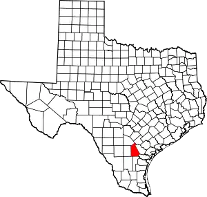 Location within the U.S. state of Texas | |
 Texas's location within the U.S. | |
| Coordinates: 28°21′N 98°08′W | |
| Country | |
| State | |
| Founded | 1856 |
| Named for | Groves of live oak |
| Seat | George West |
| Largest city | George West |
| Area | |
| • Total | 1,079 sq mi (2,790 km2) |
| • Land | 1,040 sq mi (2,700 km2) |
| • Water | 39 sq mi (100 km2) 3.6%% |
| Population (2010) | |
| • Total | 11,531 |
| • Density | 11/sq mi (4/km2) |
| Time zone | UTC−6 (Central) |
| • Summer (DST) | UTC−5 (CDT) |
| Congressional district | 15th |
| Website | www |
Geography
According to the U.S. Census Bureau, the county has a total area of 1,079 square miles (2,790 km2), of which 1,040 square miles (2,700 km2) is land and 39 square miles (100 km2) (3.6%) is water.[4] It is home to the Choke Canyon Reservoir.
Major highways
.svg.png.webp) Interstate 37
Interstate 37 U.S. Highway 59
.svg.png.webp) Interstate 69W is currently under construction and will follow the current route of U.S. 59 in most places.
Interstate 69W is currently under construction and will follow the current route of U.S. 59 in most places.
 U.S. Highway 281
.svg.png.webp) Interstate 69C is currently under construction and will follow the current route of U.S. 281 in most places south of George West.
Interstate 69C is currently under construction and will follow the current route of U.S. 281 in most places south of George West.
 SH 72
SH 72 FM 99
FM 99 FM 624
 FM 799
 FM 833
Adjacent counties
- Karnes County (northeast)
- Bee County (east)
- San Patricio County (southeast)
- Jim Wells County (south)
- Duval County (southwest)
- McMullen County (west)
- Atascosa County (northwest)
Demographics
| Historical population | |||
|---|---|---|---|
| Census | Pop. | %± | |
| 1860 | 593 | — | |
| 1870 | 852 | 43.7% | |
| 1880 | 1,994 | 134.0% | |
| 1890 | 2,055 | 3.1% | |
| 1900 | 2,268 | 10.4% | |
| 1910 | 3,442 | 51.8% | |
| 1920 | 4,171 | 21.2% | |
| 1930 | 8,956 | 114.7% | |
| 1940 | 9,799 | 9.4% | |
| 1950 | 9,054 | −7.6% | |
| 1960 | 7,846 | −13.3% | |
| 1970 | 6,697 | −14.6% | |
| 1980 | 9,606 | 43.4% | |
| 1990 | 9,556 | −0.5% | |
| 2000 | 12,309 | 28.8% | |
| 2010 | 11,531 | −6.3% | |
| 2019 (est.) | 12,207 | [5] | 5.9% |
| U.S. Decennial Census[6] 1850–2010[7] 2010–2014[1] | |||
As of the census[8] of 2000, there were 12,309 people, 4,230 households, and 3,070 families residing in the county. The population density was 12 people per square mile (5/km2). There were 6,196 housing units at an average density of 6 per square mile (2/km2). The racial makeup of the county was 87.28% White, 2.45% Black or African American, 0.41% Native American, 0.19% Asian, 0.02% Pacific Islander, 7.72% from other races, and 1.94% from two or more races. 38.05% of the population were Hispanic or Latino of any race.
There were 4,230 households, out of which 30.90% had children under the age of 18 living with them, 60.10% were married couples living together, 8.70% had a female householder with no husband present, and 27.40% were non-families. 23.90% of all households were made up of individuals, and 12.40% had someone living alone who was 65 years of age or older. The average household size was 2.53 and the average family size was 3.00.
In the county, the population was spread out, with 22.30% under the age of 18, 9.50% from 18 to 24, 27.10% from 25 to 44, 25.10% from 45 to 64, and 16.00% who were 65 years of age or older. The median age was 39 years. For every 100 females there were 122.20 males. For every 100 females age 18 and over, there were 129.80 males.
The median income for a household in the county was $32,057, and the median income for a family was $38,235. Males had a median income of $30,061 versus $19,665 for females. The per capita income for the county was $15,886. About 14.10% of families and 16.50% of the population were below the poverty line, including 22.20% of those under age 18 and 11.70% of those age 65 or over.
Government and infrastructure
The Federal Bureau of Prisons, Federal Correctional Institution, Three Rivers is located in unincorporated Live Oak County, near Three Rivers.[9][10]
Politics
Live Oak County mostly voted Democratic for the first half of the 20th century. The Republicans became more successful in the county following the election of Dwight D. Eisenhower in 1952. It last voted for the Democrats in 1976 when Jimmy Carter won the state of Texas and the presidency. It was won by Ronald Reagan in his landslide victory against Carter in 1980 and has voted for the Republicans ever since.
| Year | Republican | Democratic | Third parties |
|---|---|---|---|
| 2016 | 80.5% 3,464 | 17.3% 742 | 2.2% 96 |
| 2012 | 76.7% 3,154 | 22.3% 919 | 1.0% 40 |
| 2008 | 74.1% 3,095 | 25.1% 1,048 | 0.8% 33 |
| 2004 | 74.9% 3,147 | 24.7% 1,036 | 0.4% 18 |
| 2000 | 70.6% 2,828 | 27.8% 1,114 | 1.5% 62 |
| 1996 | 53.4% 1,929 | 38.0% 1,372 | 8.6% 311 |
| 1992 | 45.5% 1,805 | 33.9% 1,345 | 20.6% 815 |
| 1988 | 58.7% 2,277 | 40.5% 1,573 | 0.8% 30 |
| 1984 | 66.0% 2,481 | 33.5% 1,260 | 0.5% 18 |
| 1980 | 60.6% 2,193 | 38.1% 1,380 | 1.2% 45 |
| 1976 | 43.5% 1,287 | 55.9% 1,656 | 0.6% 18 |
| 1972 | 74.0% 1,745 | 25.9% 610 | 0.2% 4 |
| 1968 | 40.0% 938 | 39.3% 922 | 20.7% 484 |
| 1964 | 35.7% 795 | 63.9% 1,423 | 0.4% 8 |
| 1960 | 57.5% 1,048 | 42.3% 770 | 0.2% 4 |
| 1956 | 65.7% 1,077 | 31.8% 521 | 2.5% 41 |
| 1952 | 71.2% 1,443 | 28.3% 573 | 0.5% 10 |
| 1948 | 30.6% 479 | 60.3% 945 | 9.1% 143 |
| 1944 | 39.0% 548 | 45.7% 642 | 15.3% 215 |
| 1940 | 35.9% 499 | 63.9% 888 | 0.2% 3 |
| 1936 | 20.2% 231 | 76.3% 874 | 3.5% 40 |
| 1932 | 9.6% 114 | 89.8% 1,070 | 0.7% 8 |
| 1928 | 55.8% 484 | 44.2% 383 | |
| 1924 | 31.9% 323 | 58.9% 596 | 9.2% 93 |
| 1920 | 32.5% 161 | 47.2% 234 | 20.4% 101 |
| 1916 | 20.7% 119 | 69.2% 397 | 10.1% 58 |
| 1912 | 6.5% 26 | 77.2% 308 | 16.3% 65 |
Communities
Cities
- George West (county seat)
- Three Rivers
Village
- Pernitas Point (small part in Jim Wells County)
Unincorporated communities
Ghost town
See also
References
- "State & County QuickFacts". United States Census Bureau. Archived from the original on September 23, 2011. Retrieved December 19, 2013.
- "Find a County". National Association of Counties. Retrieved 2011-06-07.
- Gannett, Henry (1905). The Origin of Certain Place Names in the United States. U.S. Government Printing Office. p. 188.
- "2010 Census Gazetteer Files". United States Census Bureau. August 22, 2012. Retrieved May 3, 2015.
- "Population and Housing Unit Estimates". United States Census Bureau. May 24, 2020. Retrieved May 27, 2020.
- "U.S. Decennial Census". United States Census Bureau. Retrieved May 3, 2015.
- "Texas Almanac: Population History of Counties from 1850–2010" (PDF). Texas Almanac. Retrieved May 3, 2015.
- "U.S. Census website". United States Census Bureau. Retrieved 2011-05-14.
- "FCI Three Rivers Contact Information." Federal Bureau of Prisons. Retrieved on December 12, 2010. "US HIGHWAY 72 WEST THREE RIVERS, TX 78071"
- "Three Rivers city, Texas." U.S. Census Bureau. Retrieved on December 12, 2010.
- Leip, David. "Dave Leip's Atlas of U.S. Presidential Elections". uselectionatlas.org. Retrieved 2018-07-26.
External links
- Live Oak County government’s website
- Live Oak County from the Handbook of Texas Online
- "Live Oak County Profile" from the Texas Association of Counties
- Index of Landmarks
Places adjacent to Live Oak County, Texas | ||||||||||
|---|---|---|---|---|---|---|---|---|---|---|
| ||||||||||
Municipalities and communities of Live Oak County, Texas, United States | ||
|---|---|---|
| Cities | Live Oak County map | |
| Unincorporated communities | ||
| Ghost town | ||
| Footnotes | ‡This populated place also has portions in an adjacent county or counties | |
| ||

| Authority control |
|---|