Crosby County, Texas
Crosby County is a county located in the U.S. state of Texas. As of the 2010 census, its population was 6,059.[1] The county seat is Crosbyton.[2] The county was founded in 1876 and later organized in 1886.[3] Both the county and its seat are named for Stephen Crosby, a land commissioner in Texas.
Crosby County | |
|---|---|
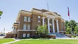 Crosby County Courthouse in Crosbyton | |
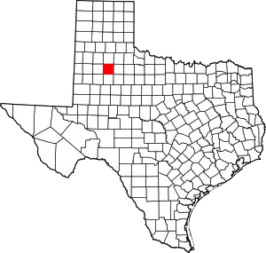 Location within the U.S. state of Texas | |
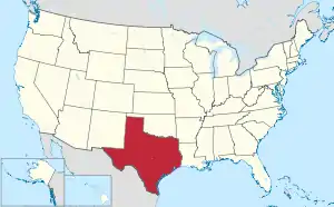 Texas's location within the U.S. | |
| Coordinates: 33°37′N 101°18′W | |
| Country | |
| State | |
| Founded | 1886 |
| Named for | Stephen Crosby |
| Seat | Crosbyton |
| Largest city | Crosbyton |
| Area | |
| • Total | 902 sq mi (2,340 km2) |
| • Land | 900 sq mi (2,000 km2) |
| • Water | 1.5 sq mi (4 km2) 0.2%% |
| Population (2010) | |
| • Total | 6,059 |
| • Density | 6.7/sq mi (2.6/km2) |
| Time zone | UTC−6 (Central) |
| • Summer (DST) | UTC−5 (CDT) |
| Congressional district | 19th |
| Website | www |
Crosby County, along with Lubbock and Lynn Counties, is part of the Lubbock Metropolitan Statistical Area (MSA). The Lubbock MSA and Levelland Micropolitan Statistical Area (µSA), encompassing only Hockley County, form the larger Lubbock–Levelland Combined Statistical Area.
Until the passage of a referendum to permit liquor sales, held on May 11, 2013, Crosby County had been one of 19 remaining prohibition or entirely dry counties within Texas.[4] That same day, voters in Denver City and Yoakum County also approved separate referenda to permit liquor sales. The number of prohibition counties in Texas has hence dropped to 17.[5] Part of the large Matador Ranch of West Texas extends into the county.[6] Republican Drew Springer, Jr., a businessman from Muenster in Cooke County, has since January 2013 represented Crosby County in the Texas House of Representatives.[7]
History
Around 11,000 BC, Paleo-Indians were the first inhabitants. Archeological artifacts indicate hunter-gatherers hunted the mammoth, mastodon, saber-toothed cat, and giant ground sloth. Later Native American inhabitants included the Comanche.[8] In 1871, Ranald S. Mackenzie fought Quanah Parker and other Comanches at the Battle of Blanco Canyon. The campaign established the Mackenzie Trail used by the first settlers in Crosby County in the late 1870s.[9]
The Texas Legislature formed Crosby County from Young and Bexar districts in 1876.[8] Bavarian Heinrich Schmidtt (Henry “Hank” Clay Smith) and his wife Elizabeth Boyle and their six children became the first permanent settlers in the area in 1878; Hank was active in the county's organization.[10][11][12]
Confederate veteran Paris Cox first visited the Caprock Escarpment of the Llano Estacado with a group of buffalo hunters in 1879.[13] Estacado was named the county seat in 1886.[14] By 1900, the beef industry was thriving, supporting 30,618 head.[8]
In 1908, the Bar-N-Bar Ranch began selling acreage to farmers.[8]
Crosbyton became the new county seat in 1910.[15] Some 45,400 acres (184 km2) in the county were planted in cotton, and 15,000 apple and peach trees were growing in the county in 1920.[8] By 1929, farmers owned 83,000 chickens and sold 395,000 dozen eggs that year.[8]
The first soil conservation district in the county was formed[8] in 1941. In 1955, oil was discovered in the county.[8]
Geography
According to the U.S. Census Bureau, the county has a total area of 902 square miles (2,340 km2), of which 900 square miles (2,300 km2) are land and 1.5 square miles (3.9 km2) (0.2%) are covered by water.[16]
Major highways
 U.S. Highway 62
 U.S. Highway 82/State Highway 114
 State Highway 207
Adjacent counties
- Floyd County (north)
- Dickens County (east)
- Garza County (south)
- Lubbock County (west)
Geographic features
Demographics
| Historical population | |||
|---|---|---|---|
| Census | Pop. | %± | |
| 1880 | 82 | — | |
| 1890 | 346 | 322.0% | |
| 1900 | 788 | 127.7% | |
| 1910 | 1,765 | 124.0% | |
| 1920 | 6,084 | 244.7% | |
| 1930 | 11,023 | 81.2% | |
| 1940 | 10,046 | −8.9% | |
| 1950 | 9,582 | −4.6% | |
| 1960 | 10,347 | 8.0% | |
| 1970 | 9,085 | −12.2% | |
| 1980 | 8,859 | −2.5% | |
| 1990 | 7,304 | −17.6% | |
| 2000 | 7,072 | −3.2% | |
| 2010 | 6,059 | −14.3% | |
| 2019 (est.) | 5,737 | [17] | −5.3% |
| U.S. Decennial Census[18] 1850–2010[19] 2010–2014[1] | |||
As of the census[20] of 2000, 7,072 people, 2,512 households, and 1,866 families resided in the county. The population density was eight people per square mile. The 3,202 housing units averaged four per square mile. The racial makeup of the county was 63.77% White, 3.89% Black or African American, 0.54% Native American, 0.03% Asian, 0.07% Pacific Islander, 29.89% from other races, and 1.81% from two or more races. About 48.93% of the population was Hispanic or Latino of any race.
Of the 2,512 households, 35.6% had children under the age of 18 living with them, 59.0% were married couples living together, 11.4% had a female householder with no husband present, and 25.7% were not families. About 23.8% of all households were made up of individuals, and 13.4% had someone living alone who was 65 years of age or older. The average household size was 2.78 and the average family size was 3.30.
In the county, the population was distributed as 30.7% under the age of 18, 8.5% from 18 to 24, 24.0% from 25 to 44, 21.1% from 45 to 64, and 15.6% who were 65 years of age or older. The median age was 34 years. For every 100 females, there were 91.1 males. For every 100 females age 18 and over, there were 87.2 males.
The median income for a household in the county was $25,769, and for a family was $29,891. Males had a median income of $23,775 versus $17,229 for females. The per capita income for the county was $14,445. About 22.6% of families and 28.1% of the population were below the poverty line, including 36.6% of those under age 18 and 22.7% of those age 65 or over.
Communities
Ghost towns
- Canyon Valley
- Estacado (partly in Lubbock County)
Gallery
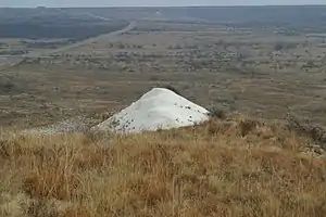
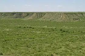
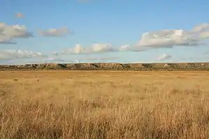 Caprock Escarpment south of Ralls
Politics
| Year | Republican | Democratic | Third parties |
|---|---|---|---|
| 2020 | 71.5% 1,396 | 27.0% 527 | 1.5% 30 |
| 2016 | 68.3% 1,181 | 27.1% 468 | 4.6% 79 |
| 2012 | 63.4% 1,132 | 35.8% 639 | 0.9% 16 |
| 2008 | 63.8% 1,221 | 35.7% 684 | 0.5% 9 |
| 2004 | 72.4% 1,647 | 27.3% 622 | 0.3% 6 |
| 2000 | 63.4% 1,270 | 35.2% 705 | 1.4% 27 |
| 1996 | 42.3% 968 | 49.1% 1,122 | 8.6% 197 |
| 1992 | 43.1% 1,006 | 43.3% 1,010 | 13.7% 319 |
| 1988 | 43.8% 1,121 | 56.0% 1,435 | 0.2% 6 |
| 1984 | 52.9% 1,376 | 46.6% 1,212 | 0.4% 11 |
| 1980 | 48.5% 1,361 | 50.2% 1,408 | 1.3% 37 |
| 1976 | 29.0% 897 | 70.4% 2,176 | 0.6% 19 |
| 1972 | 59.2% 1,503 | 40.2% 1,021 | 0.7% 17 |
| 1968 | 30.5% 865 | 55.4% 1,574 | 14.1% 401 |
| 1964 | 21.1% 611 | 78.8% 2,278 | 0.1% 3 |
| 1960 | 33.1% 889 | 66.5% 1,783 | 0.4% 11 |
| 1956 | 28.0% 704 | 71.8% 1,804 | 0.2% 6 |
| 1952 | 40.5% 1,053 | 59.6% 1,550 | |
| 1948 | 8.1% 168 | 83.7% 1,731 | 8.2% 170 |
| 1944 | 9.5% 201 | 79.5% 1,691 | 11.1% 235 |
| 1940 | 13.8% 276 | 85.9% 1,720 | 0.3% 6 |
| 1936 | 8.2% 153 | 91.6% 1,711 | 0.2% 3 |
| 1932 | 6.4% 108 | 93.6% 1,590 | |
| 1928 | 58.0% 1,004 | 42.0% 728 | |
| 1924 | 17.9% 278 | 79.9% 1,242 | 2.2% 34 |
| 1920 | 18.7% 146 | 73.2% 572 | 8.2% 64 |
| 1916 | 5.8% 31 | 85.6% 456 | 8.6% 46 |
| 1912 | 2.4% 7 | 83.7% 247 | 13.9% 41 |
See also
|
|
References
- "State & County QuickFacts". United States Census Bureau. Archived from the original on September 5, 2015. Retrieved December 9, 2013.
- "Find a County". National Association of Counties. Archived from the original on May 31, 2011. Retrieved June 7, 2011.
- "Texas: Individual County Chronologies". Texas Atlas of Historical County Boundaries. The Newberry Library. 2008. Retrieved May 21, 2015.
- "Archived copy". Archived from the original on May 16, 2014. Retrieved May 3, 2014.CS1 maint: archived copy as title (link)
- "Voters approve sales of alcohol in three elections". Lubbock Avalanche-Journal, May 12, 2013. Retrieved May 13, 2013.
- "Alyssa Dizon, "Cattle raisers honor Matador Ranch with rangeland management award"". Lubbock Avalanche-Journal, April 4, 2011. Retrieved April 29, 2011.
- "State Rep. Springer announces district tour July 30". Lubbock Avalanche-Journal, July 16, 2013. Retrieved July 18, 2013.
- Leffler, John. "Crosby County, Texas". Handbook of Texas Online. Texas State Historical Association. Retrieved December 16, 2010.
- Gwynne, S. C. (2010). Empire of the Summer Moon: Quanah Parker and the Rise and Fall of the Comanches, the Most Powerful Indian Tribe in American History. Scribner. pp. 10, 11. ISBN 978-1-4165-9105-4.
- Rodenberger, Lou Halsell; Butler, Laura Payne; Kolosoy, Jacqueline (2005). "Elizabeth Boyle (Aunt Hank) Smith". Writing on the Wind: An Anthology Of West Texas Women Writers. Texas Tech University Press. p. 174. ISBN 978-0-89672-548-5.
- "Smith, Henry Clay (1836–1912) – Crosbyton, Crosby County, Texas". Texas Historical Markers. William Nienke, Sam Morrow. Archived from the original on March 14, 2012. Retrieved December 16, 2010.
- Pearce, William M. "Henry Clay Smith". Handbook of Texas Online. Texas State Historical Association. Retrieved December 16, 2010.
- Lively, Jeanne F. "Paris Cox". Handbook of Texas Online. Texas State Historical Association. Retrieved December 16, 2010.
- "Estacado, Texas". Texas Escapes. Texas Escapes – Blueprints For Travel, LLC. Retrieved December 16, 2010.
- "Crosbyton, Texas". Texas Escapes. Texas Escapes – Blueprints For Travel, LLC. Retrieved December 16, 2010.
- "2010 Census Gazetteer Files". United States Census Bureau. August 22, 2012. Retrieved April 21, 2015.
- "Population and Housing Unit Estimates". United States Census Bureau. May 24, 2020. Retrieved May 27, 2020.
- "U.S. Decennial Census". United States Census Bureau. Retrieved April 21, 2015.
- "Texas Almanac: Population History of Counties from 1850–2010" (PDF). Texas Almanac. Retrieved April 21, 2015.
- "U.S. Census website". United States Census Bureau. Retrieved May 14, 2011.
- Leip, David. "Dave Leip's Atlas of U.S. Presidential Elections". uselectionatlas.org. Retrieved July 21, 2018.
