Wood County, Texas
Wood County is a county located in the U.S. state of Texas. As of the 2010 census, its population was 41,964.[2] Its county seat is Quitman.[3] The county was named for George T. Wood, governor of Texas from 1847 to 1849.[4]
Wood County | |
|---|---|
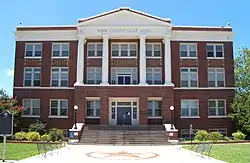 The Wood County Courthouse in Quitman | |
 Seal | |
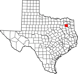 Location within the U.S. state of Texas | |
 Texas's location within the U.S. | |
| Coordinates: 32°47′N 95°23′W | |
| Country | |
| State | |
| Founded | 1850 |
| Named for | George Tyler Wood |
| Seat | Quitman |
| Largest city | Mineola |
| Area | |
| • Total | 695.719 sq mi (1,801.90 km2) |
| • Land | 645.234 sq mi (1,671.15 km2) |
| • Water | 50.484 sq mi (130.75 km2) 7.3% |
| Population (2010) | |
| • Total | 41,964 |
| • Estimate (2019) | 45,539[1] |
| • Density | 60/sq mi (23/km2) |
| Time zone | UTC−6 (Central) |
| • Summer (DST) | UTC−5 (CDT) |
| Congressional districts | 1st, 5th |
| Website | www |
History
The first documented European exploration of what is now Wood County took place in the late 18th century, when Pedro Vial,[4] was sent on expeditions by the Spanish governor of Texas.[5] After marching all the way to Santa Fe in 1787, he headed east to Natchitoches.[5] The following year, he passed through today's Wood County on his way back to San Antonio.[4] Some archeological evidence suggests that a French trading post stood along Mill Race Creek in the early 1700s near the site of the modern town of Hainsville.[6] The French may have build a military post called Fort Ledout near Black Oak in Wood County, but other than the archeological evidence, little is known about any possible French settlements.[6]
An important archeological discovery made by a hunting party in 1887, southeast of Hainsville and north of Bromley, suggests that Native Americans may have engaged in a battle either between different tribes or with the Spanish. Despite finding many relics, including a cross, tomahawk pieces, a Spanish coin, and several broken muskets, no written record of any such encounter has been found.[7] Some Spanish and Mexican land grants were issued in the area, but settlement was sparse until after the Texas Revolution. The first White settler was Martin Varner. He built his home near the southeast side of what is now Hainsville at least by 1824. The first organized settlement was at Webster in 1845.[4]
In 1850, after Texas was annexed to the United States, the Legislature authorized the forming of the county from Van Zandt County.[4] In 1849, residents of what was then Van Zandt County north of the Sabine River, petitioned the legislature for the county to be reorganized. Reasons included that the majority of the population lived north of the river, and that travel to Jordan's Saline, then the county seat, was difficult in winter. Wood County was created and Van Zandt was reorganized with territory from adjacent counties.[8]
Early industry
Early industry included a number of sawmills, gristmills, steam mills, and cotton gins. A jug factory operated north of the Big Sandy Creek in the 1850s. A second jug factory was built some years later near Holly Creek. Two brick kilns are known to have been located in the area of Winnsboro. Wigley Furniture Company began operating in Mineola in 1874. A cane and rawhide-bottom chair factory opened in 1886. Tie-cutting became a major industry in the county in the 1870s with the coming of the railroads.[9] Pine Mills, Perryville, Ogburn, Merrimac, Peach, and Fouke got their start as sawmill towns.[9]
Civil War era
Wood County had only 17 slaves by 1850, but that number ballooned 10 years later to 923, estimated at about 20% of the population.[4] Wood County voted for secession by a 70% majority.The two delegates to the Secession Convention, though, both opposed secession.[4]
The first soldiers raised for the Confederacy in Wood County were Company A, 10th Texas Cavalry Regiment.[9] A training ground called Camp Flournoy was established east of Quitman. Another company called the Wood County Rebels was formed on August 5, 1861. They then requested active duty as cavalry.[9]
Coming of the railroads
The Texas and Pacific Railroad came through the southern portion of the county in 1873 and formed a junction with the International and Great Northern Railroad at Sodom, which was later renamed Mineola, on a Longview-to-Dallas route. The railroads came to the northern portion of the county in 1876, when the East Line and Red River Railroad laid track from Jefferson to Greenville.[4] This segment later was absorbed by the Louisiana, Arkansas, and Texas Railroad.[9] The Texas Shortline Railroad also ran between Alba and Grand Saline in Van Zandt County.[9]
Discovery of coal
Coal was discovered in the Alba area in sometime before 1900. The operating mines were for lignite coal.[9]
Discovery of oil
Oil was discovered in Wood County in 1941, and the county produced 25 million barrels (4.0 million cubic metres) of oil per year by 1948.[4] Developed oilfields in Wood County include the Pine Mills Oilfield and the Alba Oilfield.
Geography
According to the U.S. Census Bureau, the county has a total area of 695.719 sq mi (1,801.903 km2), of which 645.234 sq mi (1,671.149 km2) are land and 50.484 sq mi (130.754 km2) (7.3%) are covered by water.[10]
Adjacent counties
- Hopkins County (north)
- Franklin County (northeast)
- Camp County (northeast)
- Upshur County (east)
- Smith County (south)
- Van Zandt County (southwest)
- Rains County (west)
National protected areas
Demographics
| Historical population | |||
|---|---|---|---|
| Census | Pop. | %± | |
| 1860 | 4,968 | — | |
| 1870 | 6,894 | 38.8% | |
| 1880 | 11,212 | 62.6% | |
| 1890 | 13,932 | 24.3% | |
| 1900 | 21,048 | 51.1% | |
| 1910 | 23,417 | 11.3% | |
| 1920 | 27,707 | 18.3% | |
| 1930 | 24,183 | −12.7% | |
| 1940 | 24,360 | 0.7% | |
| 1950 | 21,308 | −12.5% | |
| 1960 | 17,653 | −17.2% | |
| 1970 | 18,589 | 5.3% | |
| 1980 | 24,697 | 32.9% | |
| 1990 | 29,380 | 19.0% | |
| 2000 | 36,752 | 25.1% | |
| 2010 | 41,964 | 14.2% | |
| 2019 (est.) | 45,539 | [11] | 8.5% |
| U.S. Decennial Census[12] 1850–2010[13] 2010–2014[2] | |||
As of the census[14] of 2000, 36,752 people, 14,583 households, and 10,645 families were residing in the county. The population density was 56 inhabitants per square mile (22/km2). The 17,939 housing units averaged 28/sq mi (11/km2). The racial makeup of the county was 89.11% White, 6.12% African American, 0.55% Native American, 0.20% Asian, 2.93% from other races, and 1.09% from two or more races. About 5.72% of the population were Hispanics or Latinos of any race.
Of the 14,583 households, 26.70% had children under 18 living with them, 61.50% were married couples living together, 8.20% had a female householder with no husband present, and 27.00% were not families. About 24.10% of all households were made up of individuals, and 13.20% had someone living alone who was 65 or older. The average household size was 2.42, and the average family size was 2.85.
In the county, the age distribution was 21.80% under 18, 7.90% from 18 to 24, 22.90% from 25 to 44, 26.40% from 45 to 64, and 20.90% who were 65 or older. The median age was 43 years. For every 100 females, there were 97.10 males. For every 100 females age 18 and over, there were 95.10 males.
The median income for a household in the county was US$32,885, and for a family was US$38,219. Males had a median income of US$30,558 versus US$20,209 for females. The per capita income for the county was US$17,702. About 10.80% of families and 14.30% of the population were below the poverty line, including 20.50% of those under age 18 and 10.30% of those age 65 or over.
Transportation
Wood County includes the intersection of two major U.S. highways; U.S. 69 and 80 intersect in the city of Mineola's downtown area. Texas Highway 37 connects Mineola and Quitman off 69.
Major highways
 U.S. Highway 69
 U.S. Highway 80
 State Highway 11
 State Highway 37
 State Highway 154
 State Highway 182
Farm to market roads
Wood County includes all or part of these Texas Farm To Market roads:
|
|
Railroads
Wood County is currently served by Amtrak's Texas Eagle passenger railway line.[15] The railroad tracks which run through the southern portion of Wood County and through Mineola are currently owned and operated by Union Pacific.[16]
Airports
Wood County is served by three airports, located in Mineola, Quitman, and Winnsboro:
- Mineola Wisner Field is identified as 3F9.[17] This airport was established in 1917, and has been operated by the same family owners since 1926.[18]
- Wood County Airport (Mineola/Quitman Airport) is a public airport owned by Wood County.[19]
- Winnsboro Municipal Airport is located south of the city of Winnsboro and is a municipally-owned airport facility.[20]
Media
Wood County is in the Tyler-Longview media market. It is currently served by two local newspapers, and daily newspapers and television stations from other parts of the East Texas area.
Newspapers
Wood County has five newspapers published within its borders: Wood County Now, Wood County Monitor, Winnsboro News, Yantis Tymes, and The Community Chronicle. The Winnsboro News also serves Franklin County, as Winnsboro is split between the two counties.
Wood County Monitor
In August 2016, two of the county's longstanding newspaper operations, the Mineola Monitor and the Wood County Democrat, were merged by their owner, Bluebonnet Publishing.[21] Prior to that, the Mineola Monitor operated under its own masthead in Mineola, and the Wood County Democrat operated under its own masthead in Quitman. Staffing at the newspapers did not change, and the staffs of both newspapers were merged.[21]
Winnsboro News
Serving Winnsboro, the Winnsboro News is a weekly newspaper with no website. In August, 2003, the newspaper gained notoriety for publishing an editorial by publisher Tom Pendergast outing a gay couple living in the city.[22]
Wood County Now
In 2020, in the midst of the coronavirus pandemic, a free news source available by social media and online was established. Owner Amanda Duncan originally created the social-media accounts to keep residents informed of the pandemic and rising case numbers, and to help showcase small businesses that were financially struggling. Within eight months, the news outlet grew to be the largest social-media and online news source in Wood County.
Radio stations
Wood County is served by two local radio stations.
KWNS
KWNS is a Southern Gospel radio station located in Winnsboro.[23] It broadcasts at 104.7 FM.[23]
KMOO
KMOO is located in Mineola, broadcasting at 99.9 FM. The country music station is currently owned by Hightower Radio. The station was formerly operated by Sam Curry, its founder, who founded it in 1963.[24] Under Curry's tenure, the station was referred to by its ownership and on-air personalities as, "K M Double O," and on-air personalities were not allowed to call the station "KMOO," with the last three letters pronounced in a manner similar to a noise made by cattle. Curry sold the station in 1995 when he planned to embark on a race for Wood County judge as a Democrat, a race he ultimately lost.
Government
Wood County is represented in the Texas House of Representatives by the Republican Bryan Hughes, a lawyer in Mineola and a native of Wood County. The county is split between two different U.S. congressional districts, the First and the Fifth Congressional Districts. Thus, the county is represented by Congressman Louie Gohmert and Congressman Lance Gooden. The county is currently represented in the Texas Senate by Kevin Eltife.[25]
The current county judge is Lucy Hebron, elected in 2018.[26] As county judge, Hebron is both the county's chief administrator and judge of the constitutional county court, which handles misdemeanor cases.
Also noteworthy, former Sheriff James Arthur 'Jim' Brown and his Chief Deputy William 'Miles' Tucker were arrested in 2017 for abusing their public stations for their respective roles in pursuing a systemic personal vendetta against two area businessmen and their employees. Firstly, they brought fraudulent accusations, before progressing to false arrests, then more fraudulent retaliatory arrests in response to civil relief the businessmen obtained, before ultimately planning and unsuccessfully carrying out the murder of said businessmen via agent.[27]
Historic election results
In spite of an increasing number of voters in every U.S. presidential election since 1992, the percentage of registered Wood County voters turning out to vote in presidential elections has fallen about 10% between 1992 and 2012.
| Year | Republican | Democratic | Third parties |
|---|---|---|---|
| 2020 | 83.6% 19,049 | 15.4% 3,509 | 1.0% 221 |
| 2016 | 83.8% 15,700 | 14.0% 2,630 | 2.1% 397 |
| 2012 | 81.6% 14,351 | 17.4% 3,056 | 1.0% 174 |
| 2008 | 76.8% 13,658 | 22.6% 4,010 | 0.7% 116 |
| 2004 | 75.8% 12,831 | 23.8% 4,034 | 0.4% 64 |
| 2000 | 70.7% 9,810 | 28.0% 3,893 | 1.3% 181 |
| 1996 | 51.2% 6,228 | 38.7% 4,711 | 10.1% 1,222 |
| 1992 | 38.2% 4,708 | 33.2% 4,084 | 28.6% 3,526 |
| 1988 | 54.7% 6,216 | 40.1% 4,553 | 5.3% 597 |
| 1984 | 67.3% 7,144 | 32.5% 3,449 | 0.2% 19 |
| 1980 | 52.1% 4,515 | 46.5% 4,033 | 1.4% 123 |
| 1976 | 42.6% 3,076 | 56.8% 4,107 | 0.6% 43 |
| 1972 | 71.3% 4,746 | 27.7% 1,842 | 1.1% 70 |
| 1968 | 32.7% 2,046 | 35.0% 2,192 | 32.3% 2,021 |
| 1964 | 36.9% 2,068 | 62.9% 3,528 | 0.2% 10 |
| 1960 | 47.0% 2,400 | 51.5% 2,633 | 1.6% 79 |
| 1956 | 53.1% 2,508 | 46.6% 2,199 | 0.3% 15 |
| 1952 | 47.5% 2,748 | 52.4% 3,026 | 0.1% 6 |
| 1948 | 16.2% 629 | 66.7% 2,590 | 17.2% 666 |
| 1944 | 12.0% 485 | 75.4% 3,045 | 12.7% 511 |
| 1940 | 13.8% 585 | 86.1% 3,659 | 0.1% 5 |
| 1936 | 6.5% 192 | 93.3% 2,751 | 0.2% 7 |
| 1932 | 5.4% 189 | 94.1% 3,308 | 0.5% 19 |
| 1928 | 41.4% 1,161 | 58.6% 1,645 | |
| 1924 | 10.4% 342 | 85.6% 2,806 | 4.0% 132 |
| 1920 | 25.3% 798 | 52.0% 1,643 | 22.8% 719 |
| 1916 | 10.4% 248 | 71.8% 1,719 | 17.9% 428 |
| 1912 | 7.2% 146 | 71.2% 1,441 | 21.6% 438 |
1992 general election, presidential race
| ... | Bill Clinton/ | George Bush/ | Andre Marrou/ | Ross Perot/ | Howard Phillips/ | Quinn Brisben/ | James Bo Gritz/ | Lyndon H. LaRouche, Jr./ | James Wellington Wright/ | Lenora B. Fulani/ | John S. Hagelin/ | ... | ||
| Al Gore | Dan Quayle | Nancy Lord | James Stockdale | Albion W. Knight | Barbara Garson | C.W. 'Cy' Minett | James L. Bevel | Levi M. Cunningham | Maria Munoz | Mike Tompkins | Total | Total | ... | |
| County | DEM | REP | LIB | IND | W-I† | W-I | W-I | W-I | W-I | W-I | W-I | Votes | Voters | TurnOut |
| WOOD | 4,084 | 4,708 | 19 | 3,494 | 2 | 1 | 0 | 9 | 1 | 0 | 0 | 12,318 | 16,378 | 75.21%[29] |
1996 general election, presidential race
| ... | Bob Dole | Bill Clinton | Harry Browne | John Hagelin | Howard Phillips | Ross Perot | Ralph Nader | Mary Cal Hollis | ... | ||
| /Jack Kemp | /Al Gore | /Jo Jorgensen | /Mike Tompkins | /Herbert W. Titus | /James Campbell | /Winona LaDuke | /Eric Chester | Total | Total | ... | |
| County | REP | DEM | LIB | NLP‡ | UST৳ | IND₮ | W-I | W-I | Votes | Voters | TurnOut |
| WOOD | 6,228 | 4,711 | 22 | 4 | 8 | 1,184 | 0 | 4 | 12,161 | 18,548 | 65.57%[30] |
2000 general election, presidential race
| ... | George W. Bush | Al Gore | Harry Browne | Ralph Nader | Pat Buchanan | Howard Phillips | James "Jim" Wright | David McReynolds | ... | ||
| /Dick Cheney | /Joe Lieberman | /Art Olivier | /Winona LaDuke | /Ezola Foster | /J. Curtis Frazier | /Leonard L. Foster | /Mary Cal Hollis | Total | Total | ... | |
| County | REP | DEM | LIB₩ | GRN¥ | IND | W-I | W-I | W-I | Votes | Voters | TurnOut |
| WOOD | 9,810 | 3,893 | 35 | 128 | 18 | 0 | 0 | 0 | 13,884 | 20,984 | 66.16%[30] |
2004 general election, presidential race
| ... | George W. Bush/ | John F. Kerry/ | Michael Badnarik/ | Michael Anthony Peroutka/ | John Joseph Kennedy/ | Deborah Elaine Allen/ | Andrew J. Falk/ | Walt Brown/ | David Keith Cobb/ | Ralph Nader/ | ... | ||
| Dick Cheney | John Edwards | Richard V. Campagna | Chuck Baldwin | Daniel R. Rezac | Joseph H. Senegals | Marijohn Peterman | Mary Alice Herbert | Patricia LaMarche | Peter Miguel Camejo | Total | Total | ... | |
| County | REP | DEM | LIB | W-I | W-I | W-I | W-I | W-I | W-I | W-I | Votes | Voters | TurnOut |
| WOOD | 12,831 | 4,034 | 54 | 0 | 0 | 1 | 0 | 0 | 0 | 9 | 16,929 | 24,446 | 69.25%[30] |
2008 general election, presidential race
| ... | John McCain/ | Barack Obama/ | Bob Barr/ | Chuck Baldwin/ | Thaddaus Hill/ | Jonathan Allen/ | Alan Keyes/ | Ralph Nader/ | Cynthia McKinney/ | Brian Moore/ | ... | ||
| Sarah Palin | Joe Biden | Wayne A. Root | Darrell L. Castle | Gordon F. Bailey | Jeffrey D. Stath | Marvin Sprouse, Jr. | Matt Gonzalez | Rosa Clemente | Stewart A. Alexander | Total | Total | ... | |
| County | REP | DEM | LIB | W-I | W-I | W-I | W-I | W-I | W-I | W-I | Votes | Voters | TurnOut |
| WOOD | 13,658 | 4,010 | 92 | 13 | 0 | 0 | 2 | 9 | 0 | 0 | 17,784 | 27,030 | 65.79%[30] |
2012 general election, presidential race
| ... | Mitt Romney/Paul Ryan | Barack Obama/Joe Biden | Gary Johnson/Jim Gray | Jill Stein/Cheri Honkala | Avery Ayers/Alejandrina Cabrera | Stewart Alexander/Alex Mendoza | Thaddaus Hill/Gordon F. Bailey | Virgil Goode/Jim Clymer | Tom Hoefling/Jonathan D. Ellis | Andre N. Barnett/Kenneth R. Cross | Rocky Anderson/Louis J. Rodriguez | |||
| Total | Total | |||||||||||||
| County | REP | DEM | LIB | GRN | W-I | W-I | W-I | W-I | W-I | W-I | W-I | Votes | Voters | TurnOut |
| WOOD | 14,351 | 3,056 | 139 | 33 | 0 | 0 | 0 | 0 | 1 | 0 | 1 | 17,581 | 27,438 | 64.08%[30] |
| Footnotes For Electoral Tables | |||
|---|---|---|---|
| † W-I signifies a "write-in" candidate. | ‡ NLP Signifies "Natural Law Party." | ৳ UST Signifies "U.S. Taxpayer Party." | ₮ IND Signifies "Independent." |
| ₩ LIB signifies "Libertarian Party." | ¥ GRN Signifies "Green Party. | ||
Education
Early schools
There were a number of so-called "subscription schools" in Wood County after 1854, when free public schools in Texas were on the rise due to legislative action. In 1852, a log schoolhouse in the western part of the county near Chaney Crossing on Lake Fork was built. By 1854, school was being taught in Quitman. By 1859, Quitman had three schools that required tuition to be paid.[9]
On January 8, 1884, the Texas legislature required the county to be divided into free public school districts. The school districts established by the legislature were Quitman, Lone Star, Myrtle Springs, Forest Hill, Cartwright, Caney, Rock Hill, Forest Home, Winnsboro, Chalybeate Springs, Spring Hill, Smyrna, Cold Springs, Shady Grove, Center Point, Pleasant Grove, Floyd's Common Ridge, Mount Pisgah, Liberty, Sand Springs, Fletcher, Pleasant Divide, Friendship, Lone Pint, Salem, Webster, Persimmon Grove, Cottonwood, Macedonia, Concord, New Hope, Dyess, Mount Enterprise, and "Albia" (Alba). Free school districts for African Americans were established at Quitman, Cedar Tree, Robinson's Chapel, Muddy Creek, Mount Zion, Tranquil, Center, Hawkins, Shiloh and "District 48" which encompassed all of the district west of Lake Fork.[9]
School districts
Portions of the county are served by 11 separate independent school districts, serving students in pre-kindergarten through 12th grade: Alba-Golden ISD, Big Sandy ISD, Como-Pickton ISD, Harmony ISD, Hawkins ISD, Mineola ISD, Pittsburg ISD, Quitman ISD, Union Hill ISD, Winnsboro ISD, and Yantis ISD.
Colleges & universities
Jarvis Christian College is located in unincorporated Wood County, near Hawkins.
Culture
Wood County is home to a number of historic and natural preservation sites, Recorded Texas Historic Landmarks, special districts, and cities and businesses with special designations from various national and state bodies.
Historic sites
- Birthplace of Ima Hogg
- Callaway House
- Carlock Home
- Central Christian Church of Winnsboro
- Col. James A. Stinson Home
- Collins-Haines House
- Corbitt Home
- Dr. Pepper Bottling Plant
- Flora Lodge, No. 119
- George W. Haines Site
- Howle Site
- Old Settler's Reunion Grounds
- Jarvis Christian College
- Lankford-Stinson House
National Register listings
See National Register of Historic Places in Wood County, Texas
Landmark districts
Main Street cities[31]
- Mineola
- Winnsboro
Museums
Texas Business Treasure Award recipients (Texas Historical Commission Designation)
- Broadway Barber Shop (Mineola)
- Wisener Field (Mineola)
- First National Bank of Winnsboro
- R.H. McCrary Hardware (Winnsboro)[32]
Communities
Municipalities and incorporated towns
The following are municipalities and towns which are incorporated under the laws of the state of Texas, meaning they have elected governments and officially recognized municipal, town, or village governments.
Unincorporated settlements and towns
The following are towns in Wood County, Texas which are not incorporated but recognized as active settlements through community centers, churches, and similar geographic, historic, and physical landmarks.
|
|
Small communities, ghost towns, and former settlements
Wood County previously had a number of settlements. In 1884, there were 35 settlements in the county at which the Texas Legislature ordered schools to be established.[9]
|
|
Notable people
- Willie Brown, California politician
- Bryan Hughes, Texas state representative
- Bobby Ray Inman, U.S. Navy Admiral
- Ray Price, singer/songwriter; member of the Country Music Hall of Fame
- Harold Simmons, American billionaire businessman
- Sissy Spacek, Academy-Award-winning actress
- Kacey Musgraves, musician
- Mack Tuck, professional basketball player and coach
See also
References
- "Population and Housing Unit Estimate Tables". Retrieved June 15, 2020.
- "State & County QuickFacts". United States Census Bureau. Retrieved December 29, 2013.
- "Find a County". National Association of Counties. Retrieved June 7, 2011.
- Wood County from the Handbook of Texas Online (2010-06-15). Retrieved 2020-11-19.
- E., CHIPMAN, DONALD (June 15, 2010). "VIAL, PEDRO [PIERRE]". tshaonline.org. Retrieved October 30, 2016.
- "Wood County History". hlrgazette.com. Retrieved October 31, 2016.
- Woldert, Albert (1952). "Relics of Possible Indian Battle in Wood County, Texas". The Southwestern Historical Quarterly. 55 (4): 484–489 – via JSTOR.
- "History of Van Zandt County Texas". vanzandttx.org. Retrieved October 30, 2016.
- Wood County, 1850-1900. Quitman, Texas: Wood County Historical Society. 1976. pp. 7, 8, 19, 20, 32–33, 36.
- "2010 Census Gazetteer Files". United States Census Bureau. August 22, 2012. Retrieved May 12, 2015.
- "Population and Housing Unit Estimates". United States Census Bureau. May 24, 2020. Retrieved May 27, 2020.
- "U.S. Decennial Census". United States Census Bureau. Retrieved May 12, 2015.
- "Texas Almanac: Population History of Counties from 1850–2010" (PDF). Texas Almanac. Retrieved May 12, 2015.
- "U.S. Census website". United States Census Bureau. Retrieved May 14, 2011.
- "Amtrak's Texas Eagle | Mineola, TX". www.texaseagle.com. Retrieved November 4, 2016.
- "Texas 2016 Freight Railway Map" (PDF). ftp.dot.state.tx.us. Texas Department of Transportation. Retrieved November 3, 2016.
- "Texas Airport Directory" (PDF). ftp.dot.state.tx.us. Texas Department of Transportation. Retrieved November 3, 2016.
- "MINEOLA-WISENER FIELD AIRPORT". mineolawisener.com. Retrieved November 4, 2016.
- "AirportIQ 5010". gcr1.com. Retrieved November 4, 2016.
- "AirNav: F51 - Winnsboro Municipal Airport". www.airnav.com. Retrieved November 4, 2016.
- "Newspaper Merger". Wood County Monitor. Retrieved November 11, 2016.
- Grimes, Andrea (October 6, 2005). "Over the Edge". Dallas Observer. Retrieved November 11, 2016.
- "KWNS". Streema. Retrieved November 11, 2016.
- Jones, Lucille (1973). History of Mineola, Texas: "Gateway to the Pines". Quanah, Texas: Nortex Offset Publications, Inc. p. 125 – via University of North Texas Portal to Texas History.
- "Who Represents Me--Districts By County". www.fyi.legis.state.tx.us. Retrieved November 25, 2016.
- "Wood County Texas". www.mywoodcounty.com.
- "Staff". Wood County Monitor.
- Leip, David. "Dave Leip's Atlas of U.S. Presidential Elections". uselectionatlas.org. Retrieved April 9, 2018.
- "Texas Secretary of State Historic Election Results, 1992-current". elections.sos.state.tx.us/. Secretary of State of the State of Texas. Retrieved November 8, 2016.
- "HISTORICAL ELECTIONS - OFFICIAL RESULTS". elections.sos.state.tx.us. Retrieved November 8, 2016.
- "Texas Main Street Communities". www.google.com. Retrieved November 26, 2016.
- "Texas Treasure Businesses" (PDF). Texas Historical Commission. Texas Historical Commission. Retrieved November 26, 2016.
External links
- Official website
- Wood County from the Handbook of Texas Online
Places adjacent to Wood County, Texas | ||||||||||
|---|---|---|---|---|---|---|---|---|---|---|
| ||||||||||
| Wikimedia Commons has media related to Wood County, Texas. |
Municipalities and communities of Wood County, Texas, United States | ||
|---|---|---|
| Cities | Wood County map | |
| Towns | ||
| CDP | ||
| Other unincorporated communities | ||
| Footnotes | ‡This populated place also has portions in an adjacent county or counties | |
| ||

| Authority control |
|---|