Cottle County, Texas
Cottle County is a county in the U.S. state of Texas. As of the 2010 census, its population was 1,505.[1] Its county seat is Paducah.[2] The county was founded in 1876 and later organized in 1892.[3] It is named for George Washington Cottle,[4] who died defending the Alamo. Cottle County was formerly one of 46 prohibition, or entirely dry counties in the state of Texas. It now allows beer and wine sales.
Cottle County | |
|---|---|
 Cottle County Courthouse in Paducah | |
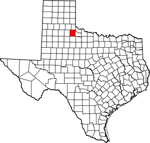 Location within the U.S. state of Texas | |
 Texas's location within the U.S. | |
| Coordinates: 34°05′N 100°16′W | |
| Country | |
| State | |
| Founded | 1892 |
| Named for | George Washington Cottle |
| Seat | Paducah |
| Largest town | Paducah |
| Area | |
| • Total | 902 sq mi (2,340 km2) |
| • Land | 901 sq mi (2,330 km2) |
| • Water | 1.1 sq mi (3 km2) 0.1%% |
| Population (2010) | |
| • Total | 1,505 |
| • Density | 1.7/sq mi (0.7/km2) |
| Time zone | UTC−6 (Central) |
| • Summer (DST) | UTC−5 (CDT) |
| Congressional district | 13th |
| Website | www |
The Matador Ranch, based in Motley, once reached into Cottle County.[5]
Geography
According to the U.S. Census Bureau, the county has a total area of 902 square miles (2,340 km2), of which 901 square miles (2,330 km2) are land and 1.1 square miles (2.8 km2) (0.1%) are covered by water.[6]
Major highways
 U.S. Highway 62
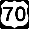 U.S. Highway 70
 U.S. Highway 83
Adjacent counties
- Childress County (north)
- Hardeman County (northeast)
- Foard County (east)
- King County (south)
- Motley County (west)
- Hall County (northwest)
Demographics
| Historical population | |||
|---|---|---|---|
| Census | Pop. | %± | |
| 1880 | 24 | — | |
| 1890 | 240 | 900.0% | |
| 1900 | 1,002 | 317.5% | |
| 1910 | 4,396 | 338.7% | |
| 1920 | 6,901 | 57.0% | |
| 1930 | 9,395 | 36.1% | |
| 1940 | 7,079 | −24.7% | |
| 1950 | 6,099 | −13.8% | |
| 1960 | 4,207 | −31.0% | |
| 1970 | 3,204 | −23.8% | |
| 1980 | 2,947 | −8.0% | |
| 1990 | 2,247 | −23.8% | |
| 2000 | 1,904 | −15.3% | |
| 2010 | 1,505 | −21.0% | |
| 2019 (est.) | 1,398 | [7] | −7.1% |
| U.S. Decennial Census[8] 1850–2010[9] 2010–2014[1] | |||
As of the census[10] of 2000, 1,904 people, 820 households, and 550 families resided in the county. The population density was 2 people per square mile (1/km2). The 1,088 housing units averaged 1 per square mile (0/km2). The racial makeup of the county was 81.46% White, 9.87% African American, 7.20% from other races, and 1.47% from two or more races. About 18.91% of the population was Hispanic or Latino of any race.
Of the 820 households, 28.00% had children under the age of 18 living with them, 53.90% were married couples living together, 10.60% had a female householder with no husband present, and 32.90% were not families. Around 32.00% of all households were made up of individuals, and 20.90% had someone living alone who was 65 years of age or older. The average household size was 2.28 and the average family size was 2.84.
In the county, the population was distributed as 23.90% under the age of 18, 5.70% from 18 to 24, 21.50% from 25 to 44, 23.30% from 45 to 64, and 25.60% who were 65 years of age or older. The median age was 44 years. For every 100 females, there were 87.20 males. For every 100 females age 18 and over, there were 81.90 males.
The median income for a household in the county was $25,446, and for a family was $33,036. Males had a median income of $24,375 versus $16,667 for females. The per capita income for the county was $16,212. About 13.70% of families and 18.40% of the population were below the poverty line, including 28.40% of those under age 18 and 16.00% of those age 65 or over.
Politics
Until 2000, Cottle County went consistently Democratic in presidential elections, except for the 1928 election, when sentiment against Al Smith’s devout Catholic faith and opposition to Prohibition allowed Herbert Hoover to carry the county with 52% of the vote. After John F. Kennedy, Lyndon Johnson, and Hubert Humphrey easily carried the county in 1960, 1964, and 1968, respectively,[11][12][13] Cottle County again voted for the Democratic candidate in the 1972 election, as it was the only county in Texas north of Maverick County (Eagle Pass) to have been won by George McGovern, albeit by a margin of only seven votes.[14] After Jimmy Carter carried it in 1976 and 1980,[15][16] Walter Mondale won a majority of the county's votes in 1984,[17] Michael Dukakis won the county in 1988[18] and Bill Clinton carried it in 1992 and 1996.[19][20]
Like the rest of the Bible Belt, Cottle has trended powerfully Republican[21] and in the last five elections, the Republican nominee has won more than two-thirds of the vote. In 2012, Mitt Romney received 555 votes to Barack Obama’s 180,[22] and in 2016, Hillary Clinton won fewer than 100 votes in the county, less than a tenth as many as Jimmy Carter 40 years before.
| Year | Republican | Democratic | Third parties |
|---|---|---|---|
| 2020 | 81.6% 540 | 17.1% 113 | 1.4% 9 |
| 2016 | 82.7% 506 | 15.0% 92 | 2.3% 14 |
| 2012 | 74.9% 555 | 24.3% 180 | 0.8% 6 |
| 2008 | 72.2% 509 | 26.5% 187 | 1.3% 9 |
| 2004 | 71.5% 549 | 27.9% 214 | 0.7% 5 |
| 2000 | 66.3% 502 | 31.8% 241 | 1.9% 14 |
| 1996 | 40.5% 331 | 49.4% 404 | 10.1% 83 |
| 1992 | 23.9% 245 | 52.9% 542 | 23.2% 238 |
| 1988 | 35.0% 379 | 63.7% 690 | 1.3% 14 |
| 1984 | 44.1% 507 | 54.2% 623 | 1.7% 20 |
| 1980 | 40.4% 511 | 57.8% 732 | 1.8% 23 |
| 1976 | 22.9% 311 | 76.9% 1,047 | 0.2% 3 |
| 1972 | 49.7% 564 | 50.3% 571 | |
| 1968 | 21.0% 268 | 58.2% 742 | 20.9% 266 |
| 1964 | 17.0% 230 | 82.9% 1,122 | 0.1% 1 |
| 1960 | 27.2% 370 | 72.5% 986 | 0.4% 5 |
| 1956 | 22.4% 329 | 77.5% 1,138 | 0.1% 2 |
| 1952 | 26.5% 494 | 73.5% 1,368 | |
| 1948 | 7.0% 102 | 90.7% 1,318 | 2.3% 33 |
| 1944 | 4.7% 130 | 91.9% 2,551 | 3.4% 95 |
| 1940 | 13.6% 237 | 86.4% 1,506 | |
| 1936 | 6.3% 86 | 93.1% 1,265 | 0.6% 8 |
| 1932 | 3.1% 38 | 96.9% 1,196 | |
| 1928 | 51.2% 473 | 48.8% 451 | |
| 1924 | 9.0% 59 | 88.2% 580 | 2.9% 19 |
| 1920 | 18.2% 121 | 71.1% 472 | 10.7% 71 |
| 1916 | 2.2% 12 | 85.1% 455 | 12.7% 68 |
| 1912 | 2.6% 8 | 91.4% 277 | 5.9% 18 |
Communities
Towns
- Paducah (county seat)
Unincorporated communities
- Cee Vee
- Chalk
- Hackberry
Ghost towns
See also
References
- "State & County QuickFacts". United States Census Bureau. Retrieved December 9, 2013.
- "Find a County". National Association of Counties. Archived from the original on 2011-05-31. Retrieved 2011-06-07.
- "Texas: Individual County Chronologies". Texas Atlas of Historical County Boundaries. The Newberry Library. 2008. Retrieved May 21, 2015.
- Gannett, Henry (1905). The Origin of Certain Place Names in the United States. Govt. Print. Off. pp. 93.
- "Matador Ranch," Historical marker, Texas Historical Commission, Motley County, Texas
- "2010 Census Gazetteer Files". United States Census Bureau. August 22, 2012. Retrieved April 21, 2015.
- "Population and Housing Unit Estimates". United States Census Bureau. May 24, 2020. Retrieved May 27, 2020.
- "U.S. Decennial Census". United States Census Bureau. Retrieved April 21, 2015.
- "Texas Almanac: Population History of Counties from 1850–2010" (PDF). Texas Almanac. Retrieved April 21, 2015.
- "U.S. Census website". United States Census Bureau. Retrieved 2011-05-14.
- http://uselectionatlas.org/RESULTS/datagraph.php?year=1960&fips=48&f=1&off=0&elect=0
- http://uselectionatlas.org/RESULTS/datagraph.php?year=1964&fips=48&f=1&off=0&elect=0
- http://uselectionatlas.org/RESULTS/datagraph.php?year=1968&fips=48&f=1&off=0&elect=0
- "David Leip Presidential Atlas". Retrieved 25 May 2017.
- http://uselectionatlas.org/RESULTS/datagraph.php?year=1976&fips=48&f=1&off=0&elect=0
- http://uselectionatlas.org/RESULTS/datagraph.php?year=1980&fips=48&f=1&off=0&elect=0
- http://uselectionatlas.org/RESULTS/datagraph.php?year=1984&fips=48&f=1&off=0&elect=0
- http://uselectionatlas.org/RESULTS/datagraph.php?year=1988&fips=48&f=1&off=0&elect=0
- http://uselectionatlas.org/RESULTS/datagraph.php?year=1992&fips=48&f=1&off=0&elect=0
- http://uselectionatlas.org/RESULTS/datagraph.php?year=1996&fips=48&f=1&off=0&elect=0
- Cohn, Nate; ‘Demographic Shift: Southern Whites’ Loyalty to G.O.P. Nearing That of Blacks to Democrats’, The New York Times, April 24, 2014
- http://uselectionatlas.org/RESULTS/datagraph.php?year=2012&fips=48&f=1&off=0&elect=0
- Leip, David. "Dave Leip's Atlas of U.S. Presidential Elections". uselectionatlas.org. Retrieved 2018-07-20.
External links
| Wikimedia Commons has media related to Cottle County, Texas. |
- Cottle County government's website
- Cottle County in Handbook of Texas Online at the University of Texas
- Cottle County Profile from the Texas Association of Counties
- Paducah ISD -- Home of the Dragons!
- Cottle, George Washington (1811-1836)
- The TXGenWeb Project: Cottle County
- Historical Marker -- Cottle County Courthouse
- Historical Marker -- Cottle County
- Historical Marker -- Cottle County
- Historical Marker -- The Grey and the Blue
Places adjacent to Cottle County, Texas | ||||||||||
|---|---|---|---|---|---|---|---|---|---|---|
| ||||||||||
Municipalities and communities of Cottle County, Texas, United States | ||
|---|---|---|
| Town | Cottle County map | |
| Unincorporated community | ||
| Ghost town | ||
| ||

| Authority control |
|---|