Anderson County, Texas
Anderson County is a county in the U.S. state of Texas. As of the 2010 United States Census, the population was 58,458.[1] Its county seat is Palestine.[2]
Anderson County | |
|---|---|
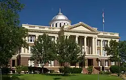 The Anderson County Courthouse in Palestine | |
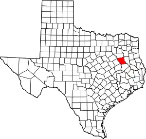 Location within the U.S. state of Texas | |
 Texas's location within the U.S. | |
| Coordinates: 31°49′N 95°39′W | |
| Country | |
| State | |
| Founded | March 24, 1846 |
| Named for | Kenneth L. Anderson |
| Seat | Palestine |
| Largest city | Palestine |
| Area | |
| • Total | 1,078 sq mi (2,790 km2) |
| • Land | 1,063 sq mi (2,750 km2) |
| • Water | 15 sq mi (40 km2) 1.4% |
| Population | |
| • Estimate (2018) | 58,057 |
| • Density | 54.3/sq mi (21.0/km2) |
| Time zone | UTC−6 (Central) |
| • Summer (DST) | UTC−5 (CDT) |
| Congressional district | 5th |
| Website | www |
Anderson County was organized in 1846, and was named for Kenneth L. Anderson, who had been the last Vice President of the Republic of Texas (died 1845).
Anderson County comprises the Palestine micropolitan statistical area.
The county is wholly located within area codes 430 and 903.[3][4]
History
Native Americans
Indians friendly to the settlers resided in East Texas[5] before the Kiowa, Kickapoo, Kichai, Apache, and Comanche intruded upon their territory.[6] These tribes hunted, farmed the land, and were adept traders. By 1772, they had settled on the Brazos at Waco and on the Trinity upstream from present Palestine. The Tawakoni[7] branch of Wichita Indians originated north of Texas, but migrated south into East Texas. From 1843 onward, the Tawakoni were part of treaties made by both the Republic of Texas and the United States.
On May 19, 1836, an alliance of Comanche, Kiowa, Caddo, and Wichita attacked Fort Parker, killing or kidnapping all but about 18 settlers, who managed to escape to Fort Houston, which had been erected in Anderson County in 1835 as protection against Indians.[8][9] Among the captured was Cynthia Ann Parker, who later became the mother of Quanah Parker, a Comanche chief.[10] Some residents of Anderson County are related to Cynthia Ann Parker.
In October 1838, Gen. Thomas Jefferson Rusk conducted a raid against hostile Indians at Kickapoo, near Frankston,[11] ending the engagements with the Indians in East Texas for that year.
Settlers
In 1826, empresario David G. Burnet received a grant from the Coahuila y Tejas legislature to settle 300 families in what is now Anderson County.[12] Most of the settlers came from the southern states and Missouri.
Baptist leader Daniel Parker[13] and eight other men organized the Pilgrim Predestinarian Regular Baptist Church in Lamotte, Illinois. This entire group migrated in 1833 to the new frontier of Texas. Among this group were Silas M. Parker, Moses Herrin, Elisha Anglin, Luther T. M. Plummer, David Faulkenberry, Joshua Hadley, and Samuel Frost. Fort Parker was the earliest actual settlement in the vicinity. After the fort was attacked, some of the survivors moved to Anderson County.
County established
The First Legislature of the State of Texas formed Anderson County from Houston County on March 24, 1846. The county was named for Kenneth Lewis Anderson. Palestine was named the county seat.[14]
Anderson County voted for secession from the Union.[15] When the Civil War began, former Palestine district judge Judge John H. Reagan[16] served in the cabinet of the Confederate government as postmaster general, being captured at the end of the war and spending 22 months in solitary confinement. During Reconstruction, District Nine Court Judge Reuben A. Reeves,[17] a resident of Palestine, was removed from office as "an obstruction to Reconstruction" in part because of his refusal to allow blacks to participate as jurors in the judicial process.
In 1875, the International – Great Northern Railroad[18] placed its machine and repair shops and general offices in Palestine, causing the community to double in size over the next 5 years. For a time, it was a rough railroad town, dominated by male workers.
White violence against blacks occurred in the county. In July 1910, at least 22 blacks were killed in white rioting near Slocum, a majority-black community, in what is called the Slocum Massacre. Racial and economic tensions were high and southern states had disenfranchised blacks and imposed Jim Crow in furtherance of white supremacy.[19] Anderson County tied for 13th place in a list of the 25 American counties with the highest number of lynchings between 1877 and 1950 (all were located in the South).[20]
Oral tradition in the African-American community says that as many as 200 blacks may have been killed in the massacre. An estimated 200 whites rioted and attacked blacks on the roads, in the fields, and in Slocum on July 29–30, 1910. Many black homes were burned, and black families fled for their lives, having to abandon their property and assets. This town is about 20 miles east of the county seat at Palestine.[21]
At the time, as was usual, events were described as a "race riot" by blacks; Texas newspapers mistakenly had contributed to problems by reporting rumors that 200 blacks were arming. Afterward, 11 men were arrested and seven were indicted, including James Spurger, said by many to be the instigator, but no prosecution resulted. The massacre had been preceded by racial tensions, rumors, and, for 6 months, at least one lynching per month of blacks in East Texas.[21] In January 2016, the state installed a highway historical marker in Slocum to recognize this unprovoked attack on the black community.[22]
In 1926, the Humble Oil and Refining Company, in partnership with the Rio Bravo Company, started an exploration drilling program along Boggy Creek, in what turned our to be the Boggy Creek salt dome. On 19 March 1927, the Elliott and Clark No. 1 encountered the Woodbine Formation at a depth of 3,838 feet (1,170 m) and produced 62 barrels of oil per hour, but showed salt water after producing only 15,000 barrels. On 10 November 1927, the Elliott and Clark No. 2, 150 feet to the west, was completed as a gas well. On 4 February 1928, the first oil-producing well in Anderson County, the Humble-Lizzie Smith No. 1, was completed, producing 80 BOPD. By May 1931, 80 wells had been drilled in the Boggy Creek Oil Field, 6 of which produced gas, 33 oil, and 41 were dry holes.[23][24][25]
The Fairway Oil Field was discovered in 1960, and straddles the border of Anderson and Henderson Counties. Oil is produced from the Lower Cretaceous James Limestone member of the Pearsall formation.[26]
The Gus Engeling Wildlife Management Area[27] was purchased by the state between 1950 and 1960, much of it formerly owned by Milze L. Derden. The area was renamed in 1952 for Gus A. Engeling, the first state biologist assigned to the area who was killed by a poacher on December 13, 1951.
Geography
.jpg.webp)
Anderson County is situated at the threshold of two ecoregions, the piney woods to the east, and the East Central Texas forests, also referred to as post oak savanna the west. The terrain of Anderson County consists of hills carved by drainages and gullies, with numerous lakes and ponds. The Trinity River flows southward along the west boundary line of the county; the Neches River flows southward along its east boundary line, and Brushy Creek flows southeastward through the central portion of the county.[28] The terrain slopes to the south and east, with its highest points along the midpoint of its northern boundary line at 551' (168m) ASL.[29] The county has a total area of 1,078 square miles (2,790 km2), of which 1,063 square miles (2,750 km2) are land and 15 square miles (39 km2) (1.4%) are covered by water.[30]
Major highways
 U.S. Highway 79
 U.S. Highway 84
 U.S. Highway 175
 U.S. Highway 287
 State Highway 19
 State Highway 155
 State Highway 294
Adjacent counties
- Henderson County (north)
- Cherokee County (east)
- Houston County (south)
- Leon County (southwest)
- Freestone County (west)
Protected areas
- Big Lake Bottom Wildlife Management Area (part)
- Gus Engeling Wildlife Management Area
- Neches River National Wildlife Refuge (part)
- Richland Creek Wildlife Management Area (part)
Lakes
- Big Twin Lake
- Cox Lake
- Crystal Lake
- Hudson Lake
- Lake Dogwood
- Lake Frankston
- Lost Prairie Lake
- Pineywoods Lake
- Spring Lake
- Williams Lake
Demographics
| Historical population | |||
|---|---|---|---|
| Census | Pop. | %± | |
| 1850 | 2,684 | — | |
| 1860 | 10,398 | 287.4% | |
| 1870 | 9,229 | −11.2% | |
| 1880 | 17,395 | 88.5% | |
| 1890 | 20,923 | 20.3% | |
| 1900 | 28,015 | 33.9% | |
| 1910 | 29,650 | 5.8% | |
| 1920 | 34,318 | 15.7% | |
| 1930 | 34,643 | 0.9% | |
| 1940 | 37,092 | 7.1% | |
| 1950 | 31,875 | −14.1% | |
| 1960 | 28,162 | −11.6% | |
| 1970 | 27,789 | −1.3% | |
| 1980 | 38,381 | 38.1% | |
| 1990 | 48,024 | 25.1% | |
| 2000 | 55,109 | 14.8% | |
| 2010 | 58,458 | 6.1% | |
| 2019 (est.) | 57,735 | [31] | −1.2% |
| US Decennial Census[32] 1850–2010[33] 2010-2014[1] | |||
As of the 2000 United States Census,[34] 55,109 people, 15,678 households, and 11,335 families were in the county. The population density was 52 people per square mile (20/km2). The 18,436 housing units averaged 17 per square mile (7/km2). The racial makeup of the county was 66.44% White, 23.48% African American, 0.64% Native American, 0.45% Asian, 0.03% Pacific Islander, 8.00% from other races, and 0.96% from two or more races. About 12.17% of the population was Hispanic or Latino of any race.
Of the 15,678 households, 34.10% had children under the age of 18 living with them, 55.50% were married couples living together, 13.20% had a female householder with no husband present, and 27.70% were not families. About 24.80% of all households were made up of individuals, and 11.80% had someone living alone who was 65 years of age or older. The average household size was 2.58, and the average family size was 3.07.
The county population contained 20.70% under the age of 18, 9.30% from 18 to 24, 37.70% from 25 to 44, 20.60% from 45 to 64, and 11.70% who were 65 years of age or older. The median age was 36 years. For every 100 females, there were 155.80 males. For every 100 females age 18 and over, there were 173.40 males.
The median income for a household in the county was $31,957, and for a family was $37,513. Males had a median income of $27,070 versus $21,577 for females. The per capita income for the county was $13,838. About 12.70% of families and 16.50% of the population were below the poverty line, including 21.60% of those under age 18 and 16.60% of those age 65 or over.
Government, courts, and politics
Government
Anderson County is governed by a commissioners' court. It consists of the county judge, who is elected at-large and presides over the full court, and four commissioners, who are elected from the county's four single-member precincts.[35][36]
County commissioners
| Office | Name | Party | |
|---|---|---|---|
| County judge | Robert D. Johnston | Republican | |
| Precinct 1 | Greg Chapin | Republican | |
| Precinct 2 | Rashad Mims | Democratic | |
| Precinct 3 | Kenneth Dickson | Republican | |
| Precinct 4 | Joey Hill | Republican | |
County officials
| Office | Name | Party | |
|---|---|---|---|
| County clerk | Mark Staples | Republican | |
| Criminal district attorney | Allyson Mitchell | Republican | |
| District clerk | Teresa Coker | Republican | |
| Sheriff | Greg Taylor | Republican | |
| Tax assessor-collector | Teri Garvey Hanks | Republican | |
| Treasurer | Tara Holliday | Republican | |
Constables
| Office | Name | Party | |
|---|---|---|---|
| Precinct 1 | David Franklin | ||
| Precinct 2 | Doug Lightfoot | Republican | |
| Precinct 3 | Kim Dickson | Republican | |
| Precinct 4 | James Muniz | Republican | |
State prisons
The Texas Department of Criminal Justice operates state prisons for men in the county. The prisons Beto, Coffield, Michael, and Powledge units and the Gurney Unit transfer facility are located in an unincorporated area 7 miles (11 km) west of Palestine.[37] The Beto Unit has the Correctional Institutions Division Region II maintenance headquarters.[38]
Justices of the peace
| Office | Name | Party | |
|---|---|---|---|
| Precinct 1 | Gary Thomas | Republican | |
| Precinct 2 | Carl Davis | Democratic | |
| Precinct 3 | James Todd | Democratic | |
| Precinct 4 | James Westley | Republican | |
District courts
| Office | Name | Party | |
|---|---|---|---|
| 3rd district court | Mark Calhoon | Republican | |
| 87th district court | Deborah Oakes Evans | Republican | |
| 349th district court | Pam Foster Fletcher | Republican | |
| 369th district court | Michael Davis | Republican | |
Politics
Anderson is a strongly Republican county, voting Republican in every election since 1980 (as of 2016). The county last voted Democratic in 1976, when Jimmy Carter won 57% of the county's votes. Hillary Clinton managed to win just 19.8% of the vote in the county, the least of any presidential candidate since at least 1960.
| Year | Republican | Democratic | Third parties |
|---|---|---|---|
| 2020 | 78.6% 15,110 | 20.6% 3,955 | 1.0% 162 |
| 2016 | 77.8% 13,201 | 19.8% 3,369 | 2.4% 407 |
| 2012 | 75.6% 12,262 | 23.5% 3,813 | 0.9% 137 |
| 2008 | 71.4% 11,884 | 27.8% 4,630 | 0.9% 141 |
| 2004 | 70.7% 11,525 | 28.7% 4,678 | 0.6% 98 |
| 2000 | 65.2% 9,835 | 33.4% 5,041 | 1.4% 204 |
| 1996 | 48.2% 6,458 | 42.5% 5,693 | 9.3% 1,249 |
| 1992 | 38.7% 5,598 | 36.8% 5,322 | 24.5% 3,546 |
| 1988 | 56.0% 7,858 | 43.6% 6,128 | 0.4% 59 |
| 1984 | 64.3% 8,634 | 35.4% 4,747 | 0.3% 42 |
| 1980 | 52.7% 5,970 | 45.6% 5,163 | 1.7% 197 |
| 1976 | 42.9% 4,172 | 56.6% 5,499 | 0.5% 44 |
| 1972 | 72.2% 5,826 | 27.7% 2,233 | 0.1% 6 |
| 1968 | 29.9% 2,828 | 36.4% 3,447 | 33.8% 3,196 |
| 1964 | 41.1% 3,362 | 58.8% 4,809 | 0.1% 10 |
| 1960 | 52.2% 3,642 | 47.2% 3,296 | 0.6% 44 |
| 1956 | 60.5% 4,181 | 39.2% 2,710 | 0.3% 23 |
| 1952 | 57.2% 4,637 | 42.7% 3,462 | 0.1% 10 |
| 1948 | 23.1% 1,199 | 62.4% 3,242 | 14.6% 757 |
| 1944 | 8.5% 467 | 79.3% 4,342 | 12.2% 665 |
| 1940 | 11.5% 688 | 88.4% 5,281 | 0.1% 7 |
| 1936 | 7.2% 289 | 92.8% 3,749 | 0.1% 2 |
| 1932 | 5.6% 259 | 94.1% 4,354 | 0.3% 14 |
| 1928 | 50.9% 1,814 | 49.1% 1,747 | |
| 1924 | 47.2% 562 | 31.4% 374 | 21.4% 255 |
| 1920 | 8.2% 323 | 60.0% 2,355 | 31.8% 1,248 |
| 1916 | 18.7% 501 | 74.1% 1,984 | 7.2% 192 |
| 1912 | 19.4% 444 | 75.8% 1,737 | 4.8% 110 |
Education
These school districts serve areas in Anderson County:
- Athens Independent School District (partial)
- Cayuga Independent School District
- Elkhart Independent School District (partial)
- Frankston Independent School District (partial)
- La Poynor Independent School District (partial)
- Neches Independent School District
- Palestine Independent School District
- Slocum Independent School District
- Westwood Independent School District
Media
Anderson County is part of the Dallas/Fort Worth DMA. Local TV media outlets include: KDFW-TV, KXAS-TV, WFAA-TV, KTVT-TV, KERA-TV, KTXA-TV, KDFI-TV, KDAF-TV, and KFWD-TV. Other nearby TV stations that provide coverage for Anderson County come from the Tyler/Longview/Jacksonville market and they include: KLTV, KTRE-TV, KYTX-TV, KFXK-TV, KCEB-TV, and KETK-TV.
Newspapers serving Anderson County include the Palestine Herald-Press in Palestine and the weekly Frankston Citizen in Frankston.
Communities
City
- Palestine (county seat)
Unincorporated areas
- Alderbranch
- Bethel
- Blackfoot
- Bois d'Arc
- Bradford
- Broom City
- Brushy Creek
- Cayuga
- Cedar Creek
- Concord Church[28]
- Cronin
- Crystal Lake
- Days Chapel
- Denson Springs
- Elmtown
- Elmwood
- Fosterville
- Greens Bluff
- Long Lake
- Massey Lake
- Montalba
- Mound City (partly in Houston County)
- Myrtle Springs
- Neches
- Pert
- Providence
- Redtown
- Salmon
- Sand Springs Church[28]
- Slocum
- Springfield
- Swanson Hill Church
- Tennessee Colony
- Todd City
- Tucker
- Wells Creek
- Yard
Ghost towns
- County Line
- Davenport
- Denmark
- Fitzgerald
- Houston
- Ioni
- Jarvis
- Kickapoo
- Magnolia
- Parker's Bluff
- Wild Cat Bluff
See also
- National Register of Historic Places listings in Anderson County, Texas
- Recorded Texas Historic Landmarks in Anderson County
- East Texas Oil Field
- Category:People from Anderson County, Texas
Further reading
- E.R. Bills wrote The 1910 Slocum Massacre: An Act of Genocide in East Texas (2014) about white mobs rioting and killing at least 22 blacks in Anderson County in July 1910, and driving off hundreds more.[21]
References
- "State & County QuickFacts". US Census Bureau. Archived from the original on July 6, 2011. Retrieved December 8, 2013.
- "Find a County". National Association of Counties. Archived from the original on May 31, 2011. Retrieved June 7, 2011.
- Texas Area Codes - Cities & Prefixes - Area Code 430, Public Utility Commission of Texas website, retrieved July 30, 2015.
- Texas Area Codes - Cities & Prefixes - Area Code 903, Public Utility Commission of Texas website, retrieved July 30, 2015.
- Moore, R. Edward. "East Texas Indian Lands". Texas Indians. Archived from the original on April 17, 2010. Retrieved May 2, 2010. R. E. Moore and Texarch Associates
- "The Passing of the Indian Era". Texas Beyond History. Retrieved May 2, 2010. Texas Beyond History
- Krieger, Margery H.: Tawakoni Indians from the Handbook of Texas Online. Retrieved May 2, 2010. Texas State Historical Association
- "Fort Houston, Texas". Texas Escapes - Blueprints For Travel, LLC. Retrieved May 2, 2010. Texas Escapes - Blueprints For Travel, LLC.
- Watts, Mrs. Harmon: Fort Houston from the Handbook of Texas Online. Retrieved May 2, 2010. Texas State Historical Association
- Hacker, Margaret Schmidt: Parker, Cynthia Ann from the Handbook of Texas Online. Retrieved May 2, 2010. Texas State Historical Association
- "Frankston, Texas". Texas Escapes - Blueprints For Travel, LLC. Retrieved May 2, 2010. Texas Escapes - Blueprints For Travel, LLC.
- "Empresario Contracts in the Colonization of Texas 1825-1834". Texas A & M University. Archived from the original on June 15, 2010. Retrieved May 2, 2010. Wallace L. McKeehan,
- Bob Bowman. "The Parker Family". Texas Escapes - Blueprints For Travel, LLC. Retrieved May 2, 2010. Texas Escapes - Blueprints For Travel, LLC.
- "Palestine, Texas". Texas Escapes - Blueprints For Travel, LLC. Retrieved May 2, 2010. Texas Escapes - Blueprints For Travel, LLC.
- Bradberry Jr, Forrest E. "Anderson County in the Civil War". Palestine Herald Press. Retrieved May 2, 2010.
- Procter, Ben H.: Reagan, John Henninger from the Handbook of Texas Online. Retrieved May 2, 2010. Texas State Historical Association
- Caraway, Georgia Kemp: Reeves, Reuben A. from the Handbook of Texas Online. Retrieved May 2, 2010. Texas State Historical Association
- Werner, George C.: International-Great Northern Railroad from the Handbook of Texas Online. Retrieved May 2, 2010. Texas State Historical Association
- Lynching in America, Third Edition: Supplement by County Archived October 23, 2017, at the Wayback Machine, p. 9, Equal Justice Initiative, Mobile AL (2017)
- Josh Marshall, "The History of Lynching and Racial Terror", Talking Points Memo, February 10, 2015; accessed May 15, 2018
- David Martin Davies, "Should Texas Remember Or Forget The Slocum Massacre?", Texas Public Radio, January 16, 2015; accessed May 15, 2018
- Tim Madigan (January 16, 2016). "Texas marks racial slaughter more than a century later". The Washington Post. Retrieved January 17, 2016.
- McLELLAN, H.J.; WENDLANDT, E.A.; MURCHISON, E.A. (1932). "BOGGY CREEK SALT DOME, ANDERSON AND CHEROKEE COUNTIES, TEXAS". GeoScience World. AAPG. pp. 584–600. Retrieved August 21, 2020.
- Eaton, R.W. (1950). "Boggy Creek Field, in University of Texas Publication No. 5116: Occurrence of Oil and Gas in Northeast Texas". AAPG Datapages. AAPG. pp. 29–34. Retrieved August 21, 2020.
- Caraway, Georgia Kemp: Anderson County from the Handbook of Texas Online. Retrieved May 2, 2010. Texas State Historical Association
- Terriere, Robert (1976). Braunstein, Jules (ed.). Geology of Fairway Field, East Texas, in North American Oil and Gas Fields. Tulsa: The American Association of Petroleum Geologists. pp. 157–176. ISBN 0891813004.
- "Gus Engeling Wildlife Management Area". Texas Parks and Wildlife Department. Archived from the original on April 3, 2010. Retrieved May 2, 2010.
- Anderson County TX Google Maps (accessed 12 February 2019)
- ""Find an Altitude" Google Maps (accessed 12 February 2019)". Archived from the original on May 21, 2019. Retrieved February 12, 2019.
- "2010 Census Gazetteer Files". US Census B. August 22, 2012. Retrieved April 18, 2015.
- "Population and Housing Unit Estimates". United States Census Bureau. May 24, 2020. Retrieved May 27, 2020.
- "US Decennial Census". US Census Bureau. Retrieved April 18, 2015.
- "Texas Almanac: Population History of Counties from 1850–2010" (PDF). Texas Almanac. Retrieved April 18, 2015.
- "U.S. Census website". US Census Bureau. Retrieved May 14, 2011.
- "www.co.anderson.tx.us/default.aspx?Anderson_County/Home". www.co.anderson.tx.us. Retrieved January 23, 2018.
- "Counties: Anderson - Texas State Directory Online". www.txdirectory.com. Retrieved January 23, 2018.
- Powledge Unit Archived July 25, 2010, at the Wayback Machine. Texas Department of Criminal Justice. Retrieved May 13, 2010.
- Beto Unit Archived July 25, 2010, at the Wayback Machine. Texas Department of Criminal Justice. Retrieved June 5, 2010.
- Leip, David. "Atlas of US Presidential Elections". uselectionatlas.org. Retrieved July 19, 2018.
External links
| Wikimedia Commons has media related to Anderson County, Texas. |
- Anderson County government
- Anderson County, Texas from the Handbook of Texas Online
- Anderson County from the Texas Almanac
- Anderson County from the TXGenWeb Project
- Anderson County Agrilife extension profile at Texas A&M University
- View historic Anderson County materials, hosted by the Portal to Texas History
Places adjacent to Anderson County, Texas | ||||||||||
|---|---|---|---|---|---|---|---|---|---|---|
| ||||||||||
Municipalities and communities of Anderson County, Texas, United States | ||
|---|---|---|
| City | Anderson County map | |
| Towns | ||
| Unincorporated communities |
| |
| Ghost towns |
| |
| Footnote | ‡This populated place also has portions in an adjacent county or counties | |
| ||

| Authority control |
|---|