Refugio County, Texas
Refugio County (/rɪˈfjʊəriː.oʊ/ ri-FYOOR-ee-oh)[1] is a county located in the U.S. state of Texas. As of the 2010 census, the population was 7,383.[2] Its county seat is Refugio.[3] The county was created as a municipality of Mexico in 1834 and organized as a county in 1837.[4][5]
Refugio County | |
|---|---|
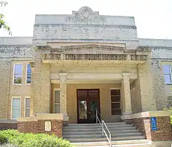 The Refugio County Courthouse in Refugio | |
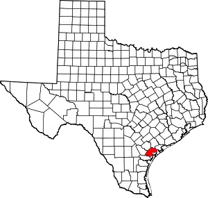 Location within the U.S. state of Texas | |
 Texas's location within the U.S. | |
| Coordinates: 28°19′N 97°10′W | |
| Country | |
| State | |
| Founded | 1837 |
| Named for | Refugio |
| Seat | Refugio |
| Largest town | Refugio |
| Area | |
| • Total | 818 sq mi (2,120 km2) |
| • Land | 770 sq mi (2,000 km2) |
| • Water | 48 sq mi (120 km2) 5.8%% |
| Population (2010) | |
| • Total | 7,383 |
| • Density | 9.6/sq mi (3.7/km2) |
| Time zone | UTC−6 (Central) |
| • Summer (DST) | UTC−5 (CDT) |
| Congressional district | 27th |
| Website | www |
Geography
According to the U.S. Census Bureau, the county has a total area of 818 square miles (2,120 km2), of which 770 square miles (2,000 km2) are land and 48 square miles (120 km2) (5.8%) are covered by water.[6]
Major highways
 U.S. Highway 77
.svg.png.webp) Interstate 69E is currently under construction and will follow the current route of U.S. 77 in most places.
Interstate 69E is currently under construction and will follow the current route of U.S. 77 in most places.

 U.S. Highway 77 Alternate/U.S. Highway 183
 State Highway 35
 State Highway 239
 Farm to Market Road 136
 Farm to Market Road 774
 Farm to Market Road 2441
 Farm to Market Road 2678
Adjacent counties
- Victoria County (north)
- Calhoun County (northeast)
- Aransas County (southeast)
- San Patricio County (south)
- Bee County (west)
- Goliad County (northwest)
National protected area
Demographics
| Historical population | |||
|---|---|---|---|
| Census | Pop. | %± | |
| 1850 | 288 | — | |
| 1860 | 1,600 | 455.6% | |
| 1870 | 2,324 | 45.3% | |
| 1880 | 1,585 | −31.8% | |
| 1890 | 1,239 | −21.8% | |
| 1900 | 1,641 | 32.4% | |
| 1910 | 2,814 | 71.5% | |
| 1920 | 4,050 | 43.9% | |
| 1930 | 7,691 | 89.9% | |
| 1940 | 10,383 | 35.0% | |
| 1950 | 10,113 | −2.6% | |
| 1960 | 10,975 | 8.5% | |
| 1970 | 9,494 | −13.5% | |
| 1980 | 9,289 | −2.2% | |
| 1990 | 7,976 | −14.1% | |
| 2000 | 7,828 | −1.9% | |
| 2010 | 7,383 | −5.7% | |
| 2019 (est.) | 6,948 | [7] | −5.9% |
| U.S. Decennial Census[8] 1850–2010[9] 2010–2014[2] | |||
As of the census[10] of 2000, 7,828 people, 2,985 households, and 2,176 families resided in the county. The population density was 10 people per square mile (4/km2). The 3,669 housing units averaged 5 per square mile (2/km2). The racial makeup of the county was 80.22% White, 6.77% African American, 0.56% Native American, 0.29% Asian, 10.47% from other races, and 1.67% from two or more races. Hispanics or Latinos of any race were about 48.6% of the population.

Of the 2,985 households, 31.60% had children under the age of 18 living with them, 55.10% were married couples living together, 12.80% had a female householder with no husband present, and 27.10% were not families. About 24.60% of all households were made up of individuals, and 11.50% had someone living alone who was 65 years of age or older. The average household size was 2.59 and the average family size was 3.07.
In the county, the population was distributed as 26.10% under the age of 18, 7.40% from 18 to 24, 25.90% from 25 to 44, 24.00% from 45 to 64, and 16.60% who were 65 years of age or older. The median age was 39 years. For every 100 females, there were 95.80 males. For every 100 females age 18 and over, there were 92.40 males.
The median income for a household in the county was $29,986, and for a family was $36,162. Males had a median income of $29,667 versus $16,565 for females. The per capita income for the county was $15,481. About 14.30% of families and 17.80% of the population were below the poverty line, including 24.20% of those under age 18 and 16.30% of those age 65 or over.
Geology
The Tom O'Connor oil field was discovered in 1934 with the Quintana No. 1-A well, the location of which was based on a gravity survey and a trend of other fields in the southwest and northeast between the Vicksburg Fault Zone and the Frio Fault Zone.[11] The field is a structural trap formed by an anticline on the downthrown side of the Vicksburg Fault Zone.[12] The faulting is due to "large-scale gravity slumping",[12] and these types of faults are referred to as growth faults, which are normal faults that occur simultaneously with sedimentation.[13] Most of the oil and half the gas is produced at depths between 4500 and 6000 feet, from 15 oil reservoirs and 4 gas reservoirs in the Oligocene Frio Formation sandstones deposited during Marine regression, notably the "5900 foot sand", the "5800 foot sand", the "5500 foot sand" and the "5200 foot sand".[14] Gas with some oil is found above these sandstones in the Oligocene Anahuac Formation, deposited in a Marine transgression, notably the "4400 foot Greta sand".[15] Dry gas is found in the Miocene-Pliocene Fleming sandstones deposited during marine regression, notably the "L-4 sand, which is overlain by 1400 feet of Pleistocene Lissie sandstones.[16]
Healthcare
Medical care is provided to the citizens of Refugio County through a county hospital, several rural health clinics, a wellness clinic and a specialty clinic. Refugio County Medical Center opened in 1940 and underwent expansions in 1962 and 2009. The hospital was run by religious orders until the 1970s, when Refugio County assumed operations. A hospital district was established in 1977.[17]
Politics
| Year | Republican | Democratic | Third parties |
|---|---|---|---|
| 2020[19][20] | 65.7% 2,210 | 32.9% 1,108 | 1.4% 48 |
| 2016 | 62.1% 1,830 | 35.1% 1,034 | 2.9% 84 |
| 2012 | 62.1% 1,663 | 37.3% 998 | 0.6% 16 |
| 2008 | 56.9% 1,855 | 42.4% 1,382 | 0.7% 24 |
| 2004 | 64.0% 2,212 | 35.7% 1,232 | 0.3% 11 |
| 2000 | 58.9% 1,721 | 40.1% 1,172 | 1.0% 28 |
| 1996 | 42.4% 1,376 | 50.3% 1,635 | 7.3% 238 |
| 1992 | 39.4% 1,469 | 41.0% 1,531 | 19.6% 732 |
| 1988 | 50.6% 1,883 | 49.2% 1,831 | 0.3% 10 |
| 1984 | 60.7% 2,421 | 39.1% 1,559 | 0.2% 8 |
| 1980 | 45.7% 1,944 | 52.3% 2,224 | 2.0% 83 |
| 1976 | 40.8% 1,537 | 58.9% 2,218 | 0.3% 10 |
| 1972 | 64.6% 1,937 | 35.3% 1,060 | 0.1% 3 |
| 1968 | 33.8% 1,114 | 51.5% 1,699 | 14.7% 486 |
| 1964 | 25.0% 772 | 75.0% 2,319 | |
| 1960 | 37.4% 1,062 | 62.5% 1,777 | 0.1% 3 |
| 1956 | 53.1% 1,355 | 46.6% 1,188 | 0.4% 9 |
| 1952 | 50.4% 1,427 | 49.5% 1,401 | 0.1% 4 |
| 1948 | 22.2% 489 | 74.4% 1,637 | 3.3% 73 |
| 1944 | 25.6% 376 | 67.5% 991 | 6.9% 101 |
| 1940 | 23.5% 458 | 76.2% 1,487 | 0.4% 7 |
| 1936 | 18.5% 242 | 81.1% 1,058 | 0.4% 5 |
| 1932 | 12.3% 172 | 86.2% 1,201 | 1.5% 21 |
| 1928 | 36.3% 383 | 63.7% 671 | |
| 1924 | 27.4% 256 | 62.6% 585 | 10.0% 93 |
| 1920 | 55.8% 360 | 35.2% 227 | 9.0% 58 |
| 1916 | 33.3% 232 | 58.6% 408 | 8.1% 56 |
| 1912 | 29.0% 115 | 51.5% 204 | 19.5% 77 |
See also
References
- https://www.texasmonthly.com/the-daily-post/texans-spanish-place-names/
- "State & County QuickFacts". United States Census Bureau. Retrieved December 23, 2013.
- "Find a County". National Association of Counties. Retrieved 2011-06-07.
- "Texas: Individual County Chronologies". Texas Atlas of Historical County Boundaries. The Newberry Library. 2008. Retrieved June 23, 2015.
- "Refugio County". Texas Almanac. Texas State Historical Association. Retrieved June 23, 2015.
- "2010 Census Gazetteer Files". United States Census Bureau. August 22, 2012. Retrieved May 9, 2015.
- "Population and Housing Unit Estimates". United States Census Bureau. May 24, 2020. Retrieved May 27, 2020.
- "U.S. Decennial Census". United States Census Bureau. Retrieved May 9, 2015.
- "Texas Almanac: Population History of Counties from 1850–2010" (PDF). Texas Almanac. Retrieved May 9, 2015.
- "U.S. Census website". United States Census Bureau. Retrieved 2011-05-14.
- Mills, H.G., 1970, Geology of Tom O'Connor Field, Refugio County, Texas, in Geology of Giant Petroleum Oil Fields, Halbouty, M.T., editor, Tulsa: American Association of Petroleum Geologists, pp. 292 and 299
- Mills, H.G., 1970, Geology of Tom O'Connor Field, Refugio County, Texas, in Geology of Giant Petroleum Oil Fields, Halbouty, M.T., editor, Tulsa: American Association of Petroleum Geologists, p. 292
- Bates, Robert (1984). Dictionary of Geological Terms. New York: Anchor Books. p. 571. ISBN 0385181019.
- Mills, H.G., 1970, Geology of Tom O'Connor Field, Refugio County, Texas, in Geology of Giant Petroleum Oil Fields, Halbouty, M.T., editor, Tulsa: American Association of Petroleum Geologists, pp. 292-293 and 295-296
- Mills, H.G., 1970, Geology of Tom O'Connor Field, Refugio County, Texas, in Geology of Giant Petroleum Oil Fields, Halbouty, M.T., editor, Tulsa: American Association of Petroleum Geologists, pp. 292 and 294 and 296
- Mills, H.G., 1970, Geology of Tom O'Connor Field, Refugio County, Texas, in Geology of Giant Petroleum Oil Fields, Halbouty, M.T., editor, Tulsa: American Association of Petroleum Geologists, pp. 295-296
- "About Us". Refugio County Memorial Hospital. Retrieved July 15, 2014.
- Leip, David. "Dave Leip's Atlas of U.S. Presidential Elections". uselectionatlas.org. Retrieved 2018-07-29.
- "Texas Presidential Election Results". The New York Times. Retrieved January 17, 2021.
- "Texas Election Results". Retrieved January 17, 2021.
External links
- Refugio County from the Handbook of Texas Online
- Refugio County government
- "Refugio County Profile" from the Texas Association of Counties
- Exxon wins, again, in oil field sabotage case
- At Tom O'Connor Ranch, Field Production High
Places adjacent to Refugio County, Texas | ||||||||||
|---|---|---|---|---|---|---|---|---|---|---|
| ||||||||||
Municipalities and communities of Refugio County, Texas, United States | ||
|---|---|---|
| City | Refugio County map | |
| Towns | ||
| CDP | ||
| Ghost towns | ||
| ||

| Authority control |
|---|