Llano County, Texas
Llano County /ˈlænoʊ/ is a county located on the Edwards Plateau in the U.S. state of Texas. As of the 2010 census, its population was 19,301.[1] Its county seat is Llano,[2] and the county is named for the Llano River.
Llano County | |
|---|---|
 | |
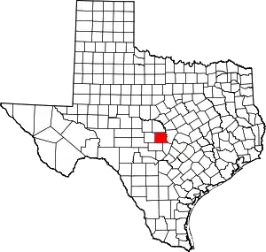 Location within the U.S. state of Texas | |
 Texas's location within the U.S. | |
| Coordinates: 30°43′N 98°41′W | |
| Country | |
| State | |
| Founded | 1856 |
| Named for | Llano River |
| Seat | Llano |
| Largest city | Llano |
| Area | |
| • Total | 966 sq mi (2,500 km2) |
| • Land | 934 sq mi (2,420 km2) |
| • Water | 32 sq mi (80 km2) 3.3%% |
| Population (2010) | |
| • Total | 19,301 |
| • Density | 21/sq mi (8/km2) |
| Time zone | UTC−6 (Central) |
| • Summer (DST) | UTC−5 (CDT) |
| Congressional district | 11th |
| Website | www |
During the American Civil War, the county was on the frontier, and Llano County's soldiers spent more time defending against Indian attacks then they did invading Yankees. In 1869, pioneer rancher John Wesley Snyder led a cattle drive from Llano County along the Chisholm Trail to Abilene, Kansas.[3]

In the 1870s, a pioneer community known as Baby Head existed in Llano County.[4] According to local legend, a small child was killed by Native Americans, and her remains were left on a hill called Baby Head Mountain.[5] Jodie May McKneely (died January 1, 1884) originated the Baby Head Cemetery. The pioneer town no longer exists, but the cemetery still remains and is still accepting the dead.[6]

History
- Peaceful Tonkawa tribe first inhabitants[7]
- 1842 April 20 - Adelsverein [8] Fisher-Miller Land Grant sets aside three million acres (12,000 km2) to settle 600 families and single men of German, Dutch, Swiss, Danish, Swedish, and Norwegian ancestry in Texas.[9]
- 1844, June 26 - Henry Francis Fisher sells interest in land grant to Adelsverein
- 1845 December 20 - Henry Francis Fisher and Burchard Miller sell their rights in the land grant to Adelsverein.
- 1847 Meusebach–Comanche Treaty[10] Bettina commune, last Adelsverein community in Texas, is established by a group of free thinking intellectuals, and named after German liberal Bettina Brentano von Arnim. The community fails within a year due to lack of any governing structure and conflict of authority.[11][12]
- 1852 Settlers at Tow and Bluffton on the Colorado River.[7]
- 1854 May 14–15, The Texas State Convention of Germans meet in San Antonio and adopt a political, social and religious platform, including: 1) Equal pay for equal work; 2) Direct election of the President of the United States; 3) Abolition of capital punishment; 4) “Slavery is an evil, the abolition of which is a requirement of democratic principles..”; 5) Free schools – including universities - supported by the state, without religious influence; and 6) Total separation of church and state.[13]
- 1860 Population 1,101 - 21 slaveholders, 54 slaves[7]
- 1862 One hundred Llano County volunteers join Major John George Walker Division of the Confederate States Army.
- 1864, April - A cavalry company is formed in Llano County under Captain Brazeal to defend the area from Indian attacks. It served under Brig. Gen. John David McAdoo until the war's end, when it disbanded in June 1865.
- 1873, August 4 - Packsaddle Mountain becomes the site of the region's last battle with the Indians. The county's farming economy begins to grow after threats of Indian attacks cease.[14]
- 1892, June 7 - Llano branch of Austin and Northwestern Railroad arrives[7]
- 1893 Completion of County Courthouse, designed by Austin architect A O Watson[15]
- 1895 Llano County Jail erected by the Pauly Jail Building and Manufacturing Company of St Louis, MO[16][17]
- 1900 Frank Teich establishes the Teich Monument Works[18]
- 1901 Llano Women's Literary Society organized - 16 charter members[7]
- 1901 The Victorian style Antlers Hotel, a railroad resort in Kingsland, opened for business.
Darmstadt Society of Forty
Count Castell[19] of the Adelsverein negotiated with the separate Darmstadt Society of Forty to colonize 200 families on the Fisher–Miller Land Grant in Texas. In return, they were to receive $12,000 in money, livestock, and equipment, and provisions for a year. After the first year, the colonies were expected to support themselves.[20] The colonies attempted were Castell,[21] Leiningen, Bettina,[22] Schoenburg and Meerholz in Llano County; Darmstädler Farm in Comal County; and Tusculum in Kendall County.[23] Of these, only Castell survives. The colonies failed after the Adelsverein funding expired, and also due to conflict of structure and authorities. Some members moved to other Adelsverein settlements in Texas. Others moved elsewhere, or returned to Germany.
Geography
According to the U.S. Census Bureau, the county has a total area of 966 square miles (2,500 km2), of which 934 square miles (2,420 km2) are land and 32 square miles (83 km2) (3.3%) are covered by water.[24]
Enchanted Rock, a designated state natural area and popular tourist destination, is located in southern Llano county.
Two significant rivers, the Llano and the Colorado, flow through Llano County. These rivers contribute to Lake Buchanan, Inks Lake, and Lake Lyndon B. Johnson, which are all located partially within the county.
Major highways
Adjacent counties
- San Saba County (north)
- Burnet County (east)
- Blanco County (southeast)
- Gillespie County (south)
- Mason County (west)
Demographics
| Historical population | |||
|---|---|---|---|
| Census | Pop. | %± | |
| 1860 | 1,101 | — | |
| 1870 | 1,379 | 25.2% | |
| 1880 | 4,962 | 259.8% | |
| 1890 | 6,772 | 36.5% | |
| 1900 | 7,301 | 7.8% | |
| 1910 | 6,520 | −10.7% | |
| 1920 | 5,360 | −17.8% | |
| 1930 | 5,538 | 3.3% | |
| 1940 | 5,996 | 8.3% | |
| 1950 | 5,377 | −10.3% | |
| 1960 | 5,240 | −2.5% | |
| 1970 | 6,979 | 33.2% | |
| 1980 | 10,144 | 45.4% | |
| 1990 | 11,631 | 14.7% | |
| 2000 | 17,044 | 46.5% | |
| 2010 | 19,301 | 13.2% | |
| 2019 (est.) | 21,795 | [25] | 12.9% |
| U.S. Decennial Census[26] 1850–2010[27] 2010–2014[1] | |||
As of the 2000 census,[28] 17,044 people, 7,879 households, and 5,365 families resided in the county. The population density was 18 people per square mile (7/km2). There were 11,829 housing units at an average density of 13 per square mile (5/km2). The racial makeup of the county was 96.27% White, 0.30% Black or African American, 0.42% Native American, 0.38% Asian, 0.03% Pacific Islander, 1.77% from other races, and 0.84% from two or more races. About 5.13% of the population were Hispanics or Latinos of any race.
Of the 7,879 households, 16.90% had children under the age of 18 living with them, 59.50% were married couples living together, 5.90% had a female householder with no husband present, and 31.90% were not families. About 28.30% of all households were made up of individuals, and 16.00% had someone living alone who was 65 years of age or older. The average household size was 2.13 and the average family size was 2.56.
In the county, the population was distributed as 15.90% under the age of 18, 4.50% from 18 to 24, 18.40% from 25 to 44, 30.50% from 45 to 64, and 30.70% who were 65 years of age or older. The median age was 53 years. For every 100 females, there were 94.40 males. For every 100 females age 18 and over, there were 91.70 males.
The median income for a household in the county was $34,830, and for a family was $40,597. Males had a median income of $30,839 versus $21,126 for females. The per capita income for the county was $23,547. About 7.20% of families and 10.30% of the population were below the poverty line, including 17.20% of those under age 18 and 6.00% of those age 65 or over.
Communities
Cities
- Horseshoe Bay (partly in Burnet County)
- Llano (county seat)
- Sunrise Beach Village
Census-designated places
Other unincorporated communities
Notable people
- Emil Kriewitz, who lived with the Penateka Comanche, served as guide for Fisher–Miller Land Grant settlers, 1870 Llano County justice of the peace, 1871 Llano County election judge, and postmaster of Castell from 1876 to 1883. He was buried in Llano County Cemetery.[29][30]
Politics
| Year | Republican | Democratic | Third parties |
|---|---|---|---|
| 2020 | 79.6% 10,079 | 19.5% 2,465 | 0.9% 116 |
| 2016 | 79.4% 8,299 | 17.5% 1,825 | 3.1% 323 |
| 2012 | 79.6% 7,610 | 19.1% 1,822 | 1.3% 126 |
| 2008 | 75.6% 7,281 | 23.4% 2,250 | 1.0% 98 |
| 2004 | 75.7% 7,241 | 23.6% 2,257 | 0.7% 65 |
| 2000 | 73.0% 6,295 | 24.8% 2,143 | 2.2% 189 |
| 1996 | 55.5% 4,290 | 34.0% 2,633 | 10.5% 814 |
| 1992 | 42.0% 3,056 | 33.1% 2,409 | 25.0% 1,818 |
| 1988 | 57.2% 3,550 | 42.4% 2,629 | 0.4% 23 |
| 1984 | 67.9% 4,042 | 31.8% 1,894 | 0.3% 18 |
| 1980 | 56.2% 2,866 | 41.8% 2,130 | 2.0% 101 |
| 1976 | 45.0% 1,947 | 54.6% 2,361 | 0.4% 16 |
| 1972 | 73.5% 2,164 | 26.0% 766 | 0.4% 13 |
| 1968 | 38.2% 1,079 | 45.4% 1,282 | 16.4% 464 |
| 1964 | 27.5% 655 | 72.4% 1,727 | 0.1% 2 |
| 1960 | 38.3% 704 | 61.5% 1,131 | 0.3% 5 |
| 1956 | 39.3% 672 | 60.5% 1,034 | 0.2% 3 |
| 1952 | 43.2% 840 | 56.7% 1,102 | 0.1% 2 |
| 1948 | 15.1% 253 | 82.4% 1,384 | 2.6% 43 |
| 1944 | 12.9% 198 | 78.0% 1,199 | 9.2% 141 |
| 1940 | 13.8% 238 | 85.9% 1,484 | 0.3% 5 |
| 1936 | 7.6% 107 | 92.4% 1,302 | |
| 1932 | 8.1% 108 | 91.9% 1,229 | |
| 1928 | 46.1% 439 | 53.9% 514 | |
| 1924 | 8.2% 88 | 86.2% 928 | 5.7% 61 |
| 1920 | 16.9% 184 | 60.9% 665 | 22.3% 243 |
| 1916 | 8.9% 72 | 88.1% 716 | 3.1% 25 |
| 1912 | 5.3% 29 | 79.3% 432 | 15.4% 84 |
See also
References
- "State & County QuickFacts". United States Census Bureau. Archived from the original on August 13, 2011. Retrieved December 19, 2013.
- "Find a County". National Association of Counties. Retrieved 2011-06-07.
- Anderson, H. Allan. "John Wesley Snyder". The Handbook of Texas. Retrieved April 27, 2011.
- Heckert-Greene, James B. "Baby Head". Handbook of Texas Online. Texas State Historical Association. Retrieved 27 November 2010.
- "Baby Head History". Texas Escapes. Texas Escapes - Blueprints For Travel, LLC. Retrieved 27 November 2010.
- "Baby Head Cemetery - Llano, Llano County, Texas". Texas Historical Markers. William Nienke, Sam Morrow. Archived from the original on 14 March 2012. Retrieved 11 December 2010.
- Speck, Ernest B. "Llano County, Texas". Handbook of Texas Online. Texas State Historical Association. Retrieved 27 November 2010.
- Brister, Louis E. "Adelsverein". Handbook of Texas Online. Texas State Historical Association. Retrieved 27 November 2010.
- Ramos, Mary G. "The German Settlements in Central Texas". Texas Almanac. Texas State Historical Association. Archived from the original on 7 February 2011. Retrieved 27 November 2010.
- "Comanche Indian Treaty". William Nienke, Sam Morrow. Archived from the original on 18 July 2011. Retrieved 27 November 2010.
- German American annals. University of Michigan Library. 2010. p. 31.
- Heckert-Green, James B. "Castell, Texas". Handbook of Texas Online. Texas State Historical Association. Retrieved 27 November 2010.
- Biesele, R. L. (April 1930). "The Texas State Convention of Germans in 1854". Southwestern Historical Quarterly. Denton, TX: Texas State Historical Association. 33 (4): 247–261.
- Hazelwood, Claudia. "Packsaddle Mountain Fight". Handbook of Texas Online. Texas State Historical Association. Retrieved 27 November 2010.
- "Llano County Courthouse". Texas Escapes. Texas Escapes - Blueprints For Travel, LLC. Retrieved 27 November 2010.
- "Llano County Jail". Texas Escapes. Texas Escapes - Blueprints For Travel, LLC. Retrieved 27 November 2010.
- "Redtop Jail". Friends of the Llano Redtop Jail. Archived from the original on 20 October 2010. Retrieved 27 November 2010.
- "Frank Teich". Handbook of Texas Online. Texas State Historical Association. Retrieved 27 November 2010.
- Brister, Louis E. "Count Carl of Castell-Castell". Handbook of Texas Online. Texas State Historical Association. Retrieved 16 January 2011.
- King (1967) p.122
- Heckert-Greene, James B. "Castell, Texas". Handbook of Texas Online. Texas State Historical Association. Retrieved 20 January 2011.
- Lich, Glen E. "Bettina, Texas". Handbook of Texas Online. Texas State Historical Association. Retrieved 20 January 2011.
- Lich, Glen E. "The Forty". Handbook of Texas Online. Texas State Historical Association. Retrieved 20 January 2011.
- "2010 Census Gazetteer Files". United States Census Bureau. August 22, 2012. Retrieved May 3, 2015.
- "Population and Housing Unit Estimates". United States Census Bureau. May 24, 2020. Retrieved May 27, 2020.
- "U.S. Decennial Census". United States Census Bureau. Retrieved May 3, 2015.
- "Texas Almanac: Population History of Counties from 1850–2010" (PDF). Texas Almanac. Retrieved May 3, 2015.
- "U.S. Census website". United States Census Bureau. Retrieved 2011-05-14.
- Emil Kriewitz at Find a Grave
- Hadeler, Glenn. "Emil von Kriewitz de Czepry". Handbook of Texas Online. Texas State Historical Association. Retrieved 17 February 2011.
- Leip, David. "Dave Leip's Atlas of U.S. Presidential Elections". uselectionatlas.org. Retrieved 2018-07-26.
Further reading
- Reinhardt, Louis (1900). "The Communistic Colony of Bettina". The Quarterly of the Texas State Historical Association. Denton, TX: Texas State Historical Association. 3: 33–40.
External links
- Llano County government’s website
- Llano County from the Handbook of Texas Online
Places adjacent to Llano County, Texas | ||||||||||
|---|---|---|---|---|---|---|---|---|---|---|
| ||||||||||
National landmarks and sites in Llano County, Texas, United States | ||
|---|---|---|
| National Natural Landmark | 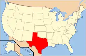 | |
| National Historic District |
| |
| National Historic Places | ||
Municipalities and communities of Llano County, Texas, United States | ||
|---|---|---|
| Cities | Llano County map | |
| CDPs | ||
| Other unincorporated communities | ||
| Ghost towns | ||
| Footnotes | ‡This populated place also has portions in an adjacent county or counties | |
| ||
