Jack County, Texas
Jack County is a county located in the north central part of the U.S. state of Texas. As of the 2010 census, its population was 9,044.[1] Its county seat is Jacksboro.[2] The county was created in 1856 and organized the next year.[3] It is named for Patrick Churchill Jack and his brother William Houston Jack, both soldiers of the Texas Revolution.[4][5][6] Since January 2013, Republican Drew Springer, Jr., a businessman from Muenster in Cooke County, has represented Jack County in the Texas House of Representatives.[7]
Jack County | |
|---|---|
 The Jack County Courthouse in Jacksboro | |
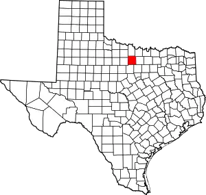 Location within the U.S. state of Texas | |
 Texas's location within the U.S. | |
| Coordinates: 33°14′N 98°11′W | |
| Country | |
| State | |
| Founded | 1857 |
| Seat | Jacksboro |
| Largest city | Jacksboro |
| Area | |
| • Total | 920 sq mi (2,400 km2) |
| • Land | 911 sq mi (2,360 km2) |
| • Water | 9.5 sq mi (25 km2) 1.0%% |
| Population (2010) | |
| • Total | 9,044 |
| • Density | 9.9/sq mi (3.8/km2) |
| Time zone | UTC−6 (Central) |
| • Summer (DST) | UTC−5 (CDT) |
| Congressional district | 13th |
| Website | www |
Geography
According to the U.S. Census Bureau, the county has a total area of 920 square miles (2,400 km2), of which 911 square miles (2,360 km2) is land and 9.5 square miles (25 km2) (1.0%) is water.[8]
Major highways
 U.S. Highway 281
 U.S. Highway 380
 State Highway 59
 State Highway 114
 State Highway 148
 State Highway 199
Adjacent counties
- Clay County (north)
- Montague County (northeast)
- Wise County (east)
- Parker County (southeast)
- Palo Pinto County (south)
- Young County (west)
- Archer County (northwest)
Demographics
| Historical population | |||
|---|---|---|---|
| Census | Pop. | %± | |
| 1860 | 1,000 | — | |
| 1870 | 694 | −30.6% | |
| 1880 | 6,626 | 854.8% | |
| 1890 | 9,740 | 47.0% | |
| 1900 | 10,224 | 5.0% | |
| 1910 | 11,817 | 15.6% | |
| 1920 | 9,863 | −16.5% | |
| 1930 | 9,046 | −8.3% | |
| 1940 | 10,206 | 12.8% | |
| 1950 | 7,755 | −24.0% | |
| 1960 | 7,418 | −4.3% | |
| 1970 | 6,711 | −9.5% | |
| 1980 | 7,408 | 10.4% | |
| 1990 | 6,981 | −5.8% | |
| 2000 | 8,763 | 25.5% | |
| 2010 | 9,044 | 3.2% | |
| 2019 (est.) | 8,935 | [9] | −1.2% |
| U.S. Decennial Census[10] 1850–2010[11] 2010–2014[1] | |||
As of the 2000 census,[12] there were 8,763 people, 3,047 households, and 2,227 families residing in Jack County. The population density was 10 people per square mile (4/km2). There were 3,668 housing units at an average density of 4 per square mile (2/km2). The racial makeup of the county was 88.68% White, 5.55% Black or African American, 0.67% Native American, 0.27% Asian, 0.02% Pacific Islander, 3.83% from other races, and 0.97% from two or more races. 7.89% of the population were Hispanic or Latino of any race.
There were 3,047 households, out of which 32.70% had children under the age of 18 living with them, 60.30% were married couples living together, 9.20% had a female householder with no husband present, and 26.90% were non-families. 24.50% of all households were made up of individuals, and 12.80% had someone living alone who was 65 years of age or older. The average household size was 2.52 and the average family size was 2.99. As of the 2010 census, there were about 4.1 same-sex couples per 1,000 households in the county.[13]
In the county, the population was spread out, with 23.40% under the age of 18, 10.00% from 18 to 24, 29.80% from 25 to 44, 21.60% from 45 to 64, and 15.20% who were 65 years of age or older. The median age was 37 years. For every 100 females there were 120.40 males. For every 100 females age 18 and over, there were 126.20 males.
The median income for a household in the county was $32,500, and the median income for a family was $37,323. Males had a median income of $28,838 versus $20,216 for females. The per capita income for the county was $15,210. About 10.10% of families and 12.90% of the population were below the poverty line, including 13.90% of those under age 18 and 13.70% of those age 65 or over.
Economy
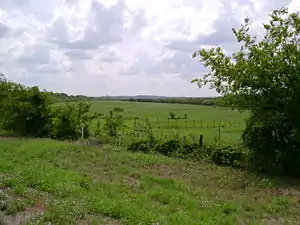
The county is dominated by agriculture and ranching, which has kept population density low. The extensive mechanization of agriculture has resulted in large farms and few workers.
A $200 million 110 MW Keechi Wind Farm project with Enbridge, financed via a 20-year agreement with Microsoft, was announced.[14][15][16]
Communities
Census-designated place
Notable residents
- Frank Shelby Groner (1877-1943). County attorney, and later President of College of Marshall
- Edith Wilmans, first woman elected to the Texas State Legislature, lived near Vineyard, in Jack County, for some years after leaving office; she raised goats and cattle on her farm, and was a practicing lawyer.[17]
Politics
Prior to 1952, Jack County was solidly Democratic in presidential elections similar to almost all of Texas & Solid South. From 1952 to 1996, the county was a swing county, though became somewhat of a bellwether earlier, voting for the national winner in all presidential elections from 1928 to 2004 except for 1960, 1968, & 1996. From 2000 on, the county has become a Republican Party stronghold similar to almost all white-majority rural counties in the Solid South, with its presidential candidates winning by increasing margins in each passing election. As a testament to how strongly Republican the county has swung, Donald Trump defeated Hillary Clinton by a margin of 79.4 percent in 2016, compared to an only 6.7 percent margin Bob Dole won the county by 20 years prior at the start of its Republican trend.
| Year | Republican | Democratic | Third parties |
|---|---|---|---|
| 2016 | 88.8% 2,973 | 9.4% 314 | 1.9% 63 |
| 2012 | 88.7% 2,580 | 10.4% 303 | 0.9% 25 |
| 2008 | 83.6% 2,528 | 15.6% 470 | 0.8% 25 |
| 2004 | 79.0% 2,470 | 20.6% 643 | 0.4% 13 |
| 2000 | 70.9% 2,107 | 27.6% 822 | 1.5% 45 |
| 1996 | 46.7% 1,162 | 41.0% 1,019 | 12.3% 306 |
| 1992 | 31.1% 1,041 | 37.5% 1,254 | 31.4% 1,052 |
| 1988 | 50.2% 1,542 | 49.5% 1,521 | 0.4% 11 |
| 1984 | 65.7% 1,825 | 34.0% 945 | 0.3% 9 |
| 1980 | 51.5% 1,482 | 46.9% 1,349 | 1.6% 46 |
| 1976 | 36.5% 1,049 | 63.2% 1,814 | 0.3% 8 |
| 1972 | 68.6% 1,719 | 30.9% 775 | 0.5% 13 |
| 1968 | 37.0% 966 | 43.4% 1,133 | 19.6% 512 |
| 1964 | 34.7% 847 | 65.2% 1,594 | 0.1% 3 |
| 1960 | 55.2% 1,342 | 44.4% 1,079 | 0.5% 11 |
| 1956 | 56.5% 1,327 | 42.5% 997 | 1.0% 23 |
| 1952 | 55.4% 1,406 | 44.5% 1,130 | 0.1% 3 |
| 1948 | 14.6% 265 | 78.5% 1,426 | 6.9% 126 |
| 1944 | 11.1% 217 | 75.6% 1,484 | 13.4% 263 |
| 1940 | 13.0% 305 | 87.0% 2,046 | 0.0% 1 |
| 1936 | 14.0% 183 | 85.2% 1,113 | 0.8% 10 |
| 1932 | 11.6% 189 | 87.5% 1,429 | 1.0% 16 |
| 1928 | 70.2% 1,068 | 29.6% 450 | 0.2% 3 |
| 1924 | 19.7% 290 | 78.5% 1,154 | 1.8% 26 |
| 1920 | 28.7% 253 | 64.3% 566 | 7.0% 62 |
| 1916 | 11.0% 121 | 78.2% 862 | 10.8% 119 |
| 1912 | 7.4% 85 | 65.3% 755 | 27.4% 317 |
See also
References
- "State & County QuickFacts". United States Census Bureau. Archived from the original on October 18, 2011. Retrieved December 18, 2013.
- "Find a County". National Association of Counties. Archived from the original on 2011-05-31. Retrieved 2011-06-07.
- "Texas: Individual County Chronologies". Texas Atlas of Historical County Boundaries. The Newberry Library. 2008. Retrieved May 24, 2015.
- "Jack, Patrick Churchill". The Handbook of Texas Online. The Texas State Historical Association. Retrieved 2009-05-27.
- "Jack, William Houston". The Handbook of Texas Online. The Texas State Historical Association. Retrieved 2009-05-27.
- Gannett, Henry (1905). The Origin of Certain Place Names in the United States. Govt. Print. Off. pp. 167.
- "State Rep. Springer announces district tour July 30". Lubbock Avalanche-Journal, July 16, 2013. Retrieved July 18, 2013.
- "2010 Census Gazetteer Files". United States Census Bureau. August 22, 2012. Retrieved May 2, 2015.
- "Population and Housing Unit Estimates". United States Census Bureau. May 24, 2020. Retrieved May 27, 2020.
- "U.S. Decennial Census". United States Census Bureau. Retrieved May 2, 2015.
- "Texas Almanac: Population History of Counties from 1850–2010" (PDF). Texas Almanac. Retrieved May 2, 2015.
- "U.S. Census website". United States Census Bureau. Retrieved 2011-05-14.
- Where Same-Sex Couples Live, June 26, 2015, retrieved July 6, 2015
- Smith, Patrick (6 January 2014). "Enbridge funds $200 million RES Texas wind project". Windpower Monthly. Retrieved 4 September 2014. See also Enbridge
- Ingle, John. "Casper, Wyoming-based company begins hauling wind generator pieces to Jack County," Times Record News, September 3, 2014. Accessed: September 4, 2014.
- "Portfolio - RES - Global Renewable Energy Company". www.res-americas.com. Retrieved 12 April 2018.
- Nancy Baker Jones; Ruthe Winegarten (22 July 2010). Capitol Women: Texas Female Legislators, 1923–1999. University of Texas Press. pp. 80–. ISBN 978-0-292-78853-4.
- Leip, David. "Dave Leip's Atlas of U.S. Presidential Elections". uselectionatlas.org. Retrieved 12 April 2018.
External links
- Jack County Web Site
- Jack County from the Handbook of Texas Online
Places adjacent to Jack County, Texas | ||||||||||
|---|---|---|---|---|---|---|---|---|---|---|
| ||||||||||
Municipalities and communities of Jack County, Texas, United States | ||
|---|---|---|
| Cities | Jack County map | |
| CDP | ||
| Other unincorporated communities | ||
| ||

| Authority control |
|---|