Verkhoyansk Range
The Verkhoyansk Range (Russian: Верхоянский хребет, Verkhojanskiy Khrebet; Yakut: Үөһээ Дьааҥы сис хайата, Üöhee Caañı sis xayata) is a mountain range in the Sakha Republic, Russia. It is part of the East Siberian Mountains.
| Verkhoyansk Range | |
|---|---|
| Верхоянский хребет Үөһээ Дьааҥы сис хайата | |
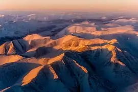 Aerial view of the Verkhoyansk Mountains | |
| Highest point | |
| Peak | Orulgan high point |
| Elevation | 2,409 m (7,904 ft) |
| Coordinates | 67°N 129°E |
| Dimensions | |
| Length | 1,100 km (680 mi) |
| Geography | |
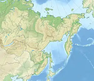 Verkhoyansk Range Location in the Far Eastern Federal District, Russia | |
| Country | Russia |
| State | Sakha Republic |
| Parent range | East Siberian System |
| Geology | |
| Orogeny | Alpine orogeny |
| Age of rock | Cretaceous |
| Type of rock | Metamorphic rocks |
The range lies just west of the boundary of the Eurasian and the North American tectonic plates.[1] The mountains were formed by folding, and represent an anticline.[2]
The Verkhoyansk Range was covered by glaciers during the Last Glacial Period and the mountains in the northern section, such as the Orulgan Range, display a typical Alpine relief.
There are coal, silver, lead, tin and zinc deposits in the mountains.
Geography
Rising from the shores of the Buor-Khaya Gulf in the north, it runs southwards spanning roughly 1000 km (600 mi.) across Yakutia, east of the Central Yakutian Lowland, and west of the Chersky Range, reaching the Lena Plateau to the south and the Yudoma-Maya Highlands to the southeast. It forms a vast arc between the Lena and Aldan rivers to the west and the Yana River to the east. Its highest point is an unnamed 2,409 metres (7,904 ft) high peak in the middle section of the range.
The Verkhoyansk Range has a higher southeastern prolongation, the Suntar-Khayata Range, that is occasionally considered as a separate range system. Thus the highest point of the range in a restricted geographical sense is an unnamed peak in the Orulgan Range.[3] The Skalisty Range (Rocky Range), highest point 2,017 metres (6,617 ft), and the Sette-Daban, highest point 2,012 metres (6,601 ft), are located at the SE end and were also considered separate ranges in classical geographic works. The two ranges were surveyed in 1934 by geologist Yuri Bilibin (1901—1952) together with mining engineer Evgeny Bobin (1897—1941) in the course of an expedition sent by the government of the Soviet Union. After conducting the first topographic survey of the area Bilibin established that the Skalisty and Sette-Daban mountain chains belong to the Verkhoyansk Mountain System. Bilibin and Bobin also explored for the first time the Yudoma-Maya Highlands, directly adjacent to Sette-Daban.[4]
Subranges
Besides the Orulgan, the system of the range comprises a number of subranges, including the following:[5]
- Northern section —north of the Arctic Circle
- Kharaulakh Range, highest point 1,429 metres (4,688 ft)
- Tuora Sis, highest point 990 metres (3,250 ft)
- Dzhardzhan Range
- Sietinden Range
- Kular Range, highest point 1,289 metres (4,229 ft)
- Byrandia Range
- Kuyellyakh Range (Кюельляхский хребет)
- Southern section —south of the Arctic Circle (northeast)
- Tagindzhin Range, highest point 2,084 metres (6,837 ft)
- Kuchurgin Range, highest point 1,056 metres (3,465 ft)
- Bygyn Range, highest point 1,152 metres (3,780 ft)
- Muosuchan Range, highest point 1,243 metres (4,078 ft)
- Southern section (southeast)
- Sorkin Range, highest point 1,250 metres (4,100 ft)
- Muni Range, highest point 1,862 metres (6,109 ft)[6]
- Kelter Range, highest point 2,002 metres (6,568 ft)
- Sordogin Range, highest point 1,352 metres (4,436 ft), prolongation of the Muni Range
- Southern section (close to the Lena)
- Ust-Vilyuy Range, highest point 998 metres (3,274 ft)[7]
- Chochum Range, highest point 1,363 metres (4,472 ft)
- Far southern section
- Khunkhadin Range, highest point 1,802 metres (5,912 ft)
- Ulakhan Bom, highest point 1,600 metres (5,200 ft),[8] parallel to the Sette-Daban
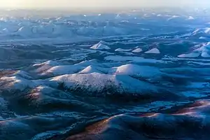
 Verkhoyansk Range. Area of rugged ridges. |
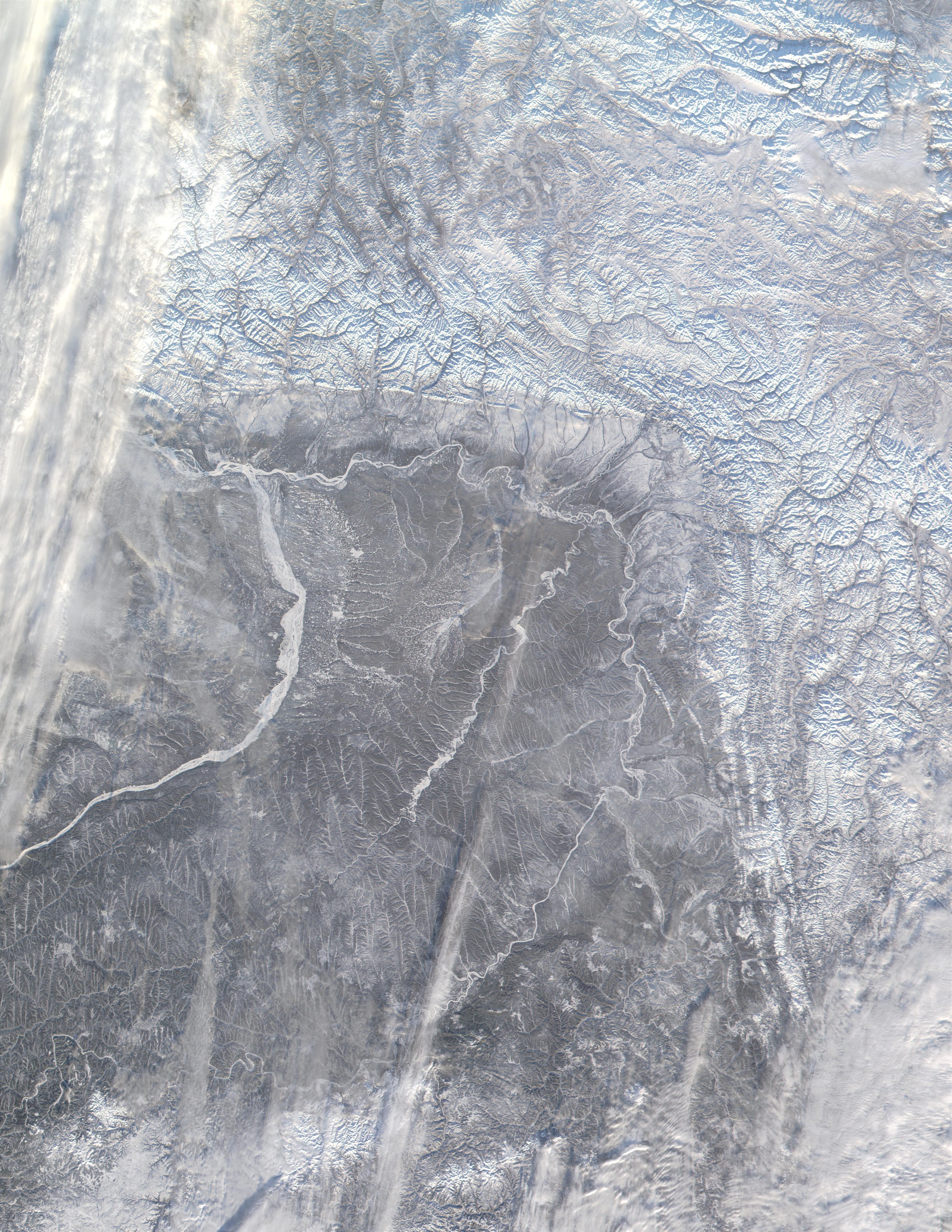
 Landscape of the Verkhoyansk Range with smooth mountains and intermontane basins. |
Climate and flora
The world's lowest temperatures for inhabited places have been recorded in this region, and there is quite deep snow cover for most of the year.
The mountain range is home to an alpine tundra, supporting various species of mosses and lichens.[2] Some sparsely-wooded forests of mainly larch and dwarf Siberian pine are found on smooth slopes.[3]
See also
References
- News Archive - The Earth Institute at Columbia University
- "Verkhoyansk Mountains". Encyclopædia Britannica. Encyclopædia Britannica, Inc. Retrieved 11 April 2017.
- Verkhoyansk Range // Great Soviet Encyclopedia: [in 30 vols.] / Ch. ed. A.M. Prokhorov. - 3rd ed. - M. Soviet Encyclopedia, 1969-1978.
- Essays on the History of Geographical Discoveries (in Russian)
- Oleg Leonidovič Kryžanovskij, A Checklist of the Ground-beetles of Russia and Adjacent Lands. p. 16
- Predominant heights of the Verkhoyansk Range
- Хребет Усть-Вилюйский - Wikimapia
- Snow Cover and Glaciers
External links
 Media related to Verkhoyansk Range at Wikimedia Commons
- NASA picture
- Chapter 5 Precambrian of the Cover - ScienceDirect
| Authority control |
|---|