New Richland, Minnesota
New Richland is a city in Waseca County, Minnesota, United States. The city was founded in 1877. The population was 1,203 at the 2010 census.[6]
New Richland | |
|---|---|
| Motto(s): "History is ours, Future is yours." | |
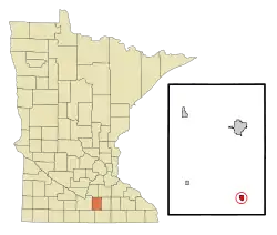 Location of New Richland, Minnesota | |
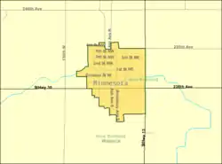 Detailed map of New Richland, Minnesota | |
| Coordinates: 43°53′40″N 93°29′40″W | |
| Country | |
| State | |
| County | Waseca |
| Government | |
| • Type | Mayor - Council |
| • Mayor | Michael Shurson |
| Area | |
| • Total | 0.59 sq mi (1.53 km2) |
| • Land | 0.59 sq mi (1.53 km2) |
| • Water | 0.00 sq mi (0.00 km2) |
| Elevation | 1,181 ft (360 m) |
| Population | |
| • Total | 1,203 |
| • Estimate (2019)[3] | 1,182 |
| • Density | 2,000.00/sq mi (772.21/km2) |
| Time zone | UTC-6 (Central (CST)) |
| • Summer (DST) | UTC-5 (CDT) |
| ZIP code | 56072 |
| Area code(s) | 507 |
| FIPS code | 27-45862[4] |
| GNIS feature ID | 0648518[5] |
| Website | City website |
History
New Richland was platted in 1877, taking its name from New Richland Township, which was named after Richland County, Wisconsin.[7] The city contains one property listed on the National Register of Historic Places, the 1902 New Richland Odd Fellows Hall.[8]
Geography
According to the United States Census Bureau, the city has a total area of 0.61 square miles (1.58 km2), all of it land.[9] Minnesota Highways 13 and 30 are two of the main routes in the city.
Demographics
| Historical population | |||
|---|---|---|---|
| Census | Pop. | %± | |
| 1880 | 304 | — | |
| 1890 | 423 | 39.1% | |
| 1900 | 750 | 77.3% | |
| 1910 | 685 | −8.7% | |
| 1920 | 754 | 10.1% | |
| 1930 | 777 | 3.1% | |
| 1940 | 863 | 11.1% | |
| 1950 | 908 | 5.2% | |
| 1960 | 1,046 | 15.2% | |
| 1970 | 1,113 | 6.4% | |
| 1980 | 1,263 | 13.5% | |
| 1990 | 1,237 | −2.1% | |
| 2000 | 1,197 | −3.2% | |
| 2010 | 1,203 | 0.5% | |
| 2019 (est.) | 1,182 | [3] | −1.7% |
| U.S. Decennial Census | |||
2010 census
As of the census[2] of 2010, there were 1,203 people, 487 households, and 297 families living in the city. The population density was 1,972.1 inhabitants per square mile (761.4/km2). There were 531 housing units at an average density of 870.5 per square mile (336.1/km2). The racial makeup of the city was 97.1% White, 1.0% African American, 0.1% Native American, 0.2% Asian, 1.1% from other races, and 0.5% from two or more races. Hispanic or Latino of any race were 3.4% of the population.
There were 487 households, of which 29.0% had children under the age of 18 living with them, 46.8% were married couples living together, 9.2% had a female householder with no husband present, 4.9% had a male householder with no wife present, and 39.0% were non-families. 33.3% of all households were made up of individuals, and 17.9% had someone living alone who was 65 years of age or older. The average household size was 2.35 and the average family size was 3.01.
The median age in the city was 40.9 years. 24.3% of residents were under the age of 18; 7% were between the ages of 18 and 24; 22.8% were from 25 to 44; 24.2% were from 45 to 64; and 21.8% were 65 years of age or older. The gender makeup of the city was 49.0% male and 51.0% female.
2000 census
As of the census[4] of 2000, there were 1,197 people, 483 households, and 308 families living in the city. The population density was 2,002.8 people per square mile (770.3/km2). There were 503 housing units at an average density of 841.6 per square mile (323.7/km2). The racial makeup of the city was 99.08% White, 0.08% Asian, 0.33% from other races, and 0.50% from two or more races. Hispanic or Latino of any race were 1.17% of the population.
There were 483 households, out of which 28.8% had children under the age of 18 living with them, 50.9% were married couples living together, 9.1% had a female householder with no husband present, and 36.2% were non-families. 33.1% of all households were made up of individuals, and 20.5% had someone living alone who was 65 years of age or older. The average household size was 2.34 and the average family size was 3.01.
In the city, the population was spread out, with 24.6% under the age of 18, 5.8% from 18 to 24, 25.0% from 25 to 44, 18.8% from 45 to 64, and 25.7% who were 65 years of age or older. The median age was 42 years. For every 100 females, there were 86.2 males. For every 100 females age 18 and over, there were 79.0 males.
The median income for a household in the city was $36,406, and the median income for a family was $46,339. Males had a median income of $31,081 versus $22,500 for females. The per capita income for the city was $18,106. About 2.3% of families and 4.7% of the population were below the poverty line, including 5.2% of those under age 18 and 6.4% of those age 65 or over.
Notable people
- Gerald Gustafson, Air Force Cross awardee
See also
References
- "2019 U.S. Gazetteer Files". United States Census Bureau. Retrieved July 26, 2020.
- "U.S. Census website". United States Census Bureau. Retrieved 2012-11-13.
- "Population and Housing Unit Estimates". United States Census Bureau. May 24, 2020. Retrieved May 27, 2020.
- "U.S. Census website". United States Census Bureau. Retrieved 2008-01-31.
- "US Board on Geographic Names". United States Geological Survey. 2007-10-25. Retrieved 2008-01-31.
- "2010 Census Redistricting Data (Public Law 94-171) Summary File". American FactFinder. United States Census Bureau. Retrieved 27 April 2011.
- Upham, Warren (1920). Minnesota Geographic Names: Their Origin and Historic Significance. Minnesota Historical Society. p. 565.
- "Minnesota National Register Properties Database". Minnesota Historical Society. 2009. Retrieved 2018-01-01.
- "US Gazetteer files 2010". United States Census Bureau. Archived from the original on 2012-01-25. Retrieved 2012-11-13.
External links
| Wikimedia Commons has media related to New Richland, Minnesota. |
- Official website
- New Richland Star
- NRHEG Schools
- Seven Towns Where Land Is Free; CNBC.com; November 17, 2010
Municipalities and communities of Waseca County, Minnesota, United States | ||
|---|---|---|
| Cities |  Map of Minnesota highlighting Waseca County | |
| Townships | ||
| Unincorporated communities | ||
| Footnotes | ‡This populated place also has portions in an adjacent county or counties | |
| ||
