Yellow Medicine County, Minnesota
Yellow Medicine County is a county in the State of Minnesota. Its eastern border is formed by the Minnesota River. As of the 2010 United States Census, the population was 10,438.[2] Its county seat is Granite Falls.[3]
Yellow Medicine County | |
|---|---|
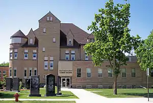 Yellow Medicine County Courthouse in Granite Falls in 2007 | |
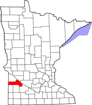 Location within the U.S. state of Minnesota | |
 Minnesota's location within the U.S. | |
| Coordinates: 44°43′N 95°52′W | |
| Country | |
| State | |
| Founded | March 6, 1871 |
| Named for | Yellow Medicine River[1] |
| Seat | Granite Falls |
| Largest city | Granite Falls |
| Area | |
| • Total | 763 sq mi (1,980 km2) |
| • Land | 759 sq mi (1,970 km2) |
| • Water | 4.1 sq mi (11 km2) 0.5%% |
| Population (2010) | |
| • Total | 10,438 |
| • Estimate (2019) | 9,709 |
| • Density | 13.0/sq mi (5.0/km2) |
| Time zone | UTC−6 (Central) |
| • Summer (DST) | UTC−5 (CDT) |
| Congressional district | 7th |
| Website | www |
The Upper Sioux Indian Reservation, related to the historical Yellow Medicine Agency that was located here, is entirely within the county. It was established under the Treaty of Traverse des Sioux in 1851, by which the Dakota ceded much territory in the region to the United States.
History
The county was established by the Minnesota legislature on March 6, 1871, with Granite Falls as the county seat. Its name comes from Yellow Medicine River, which runs through the eastern part of the county to the Minnesota. The river's name derives from a plant whose yellow root the native Dakota people used for medicinal purposes.[4]
It was proposed in 1878 to create a new county, taken from the western portions of Yellow Medicine, Lincoln, and Lac qui Parle counties. The state legislature approved the petition (subject to local voter approval), and Governor Pillsbury signed the act on February 27, 1879. However, the 1879 ballot proposal failed to garner a combined majority of voters in the three counties, and the proposed Canby County[5] did not come into being.[6]
Geography
Yellow Medicine County lies on the west side of Minnesota. Its west border abuts the east border of the state of South Dakota. The Minnesota River flows east-southeasterly along the county's northeast side on its way to discharge into the Mississippi River. The Yellow Medicine River flows northeastward through the eastern part of the county, discharging into the Minnesota near the midpoint of the county's eastern border. The Stony Run Creek flows eastward through the upper east part of the county; the Florida Creek flows northeastward through the west end of the county, and the Lac qui Parle River also flows northeastward through the west central part of the county. The county terrain consists of rolling hills, carved by drainages. The area is devoted to agriculture.[7] The terrain slopes to the east and slightly to the north; its highest point is on the west border, near its SW corner, at 1,732' (528m) ASL.[8] The county has a total area of 763 square miles (1,980 km2), of which 759 square miles (1,970 km2) is land and 4.1 square miles (11 km2) (0.5%) is water.[9]
Lakes[7]
- Burton Lake
- Culver Lake (part)
- Curtis Lake
- Highbank Lake
- Kvistid Lake
- Lake Louie
- Lone Tree Lake
- Miedd Lake
- Miller Lake
- Mud Lake
- Spellman Lake
- Timm Lake
- Tyson Lake
- Wood Lake
Rivers and drainages[7]
- Florida Creek
- Lac qui Parle River
- Minnesota River
- Spring Creek
- Stony Run Creek
- Yellow Medicine River
Major highways
 U.S. Highway 59
 U.S. Highway 75
.svg.png.webp) U.S. Highway 212
U.S. Highway 212 Minnesota State Highway 23
 Minnesota State Highway 67
 Minnesota State Highway 68
 Minnesota State Highway 274
Adjacent counties
- Lac qui Parle County - north
- Chippewa County - northeast
- Renville County - east
- Redwood County - southeast
- Lyon County - south
- Lincoln County - southwest
- Deuel County, South Dakota - west
Protected areas[7]
- Bigrock State Wildlife Management Area
- Christopherson State Wildlife Management Area
- Clawson State Wildlife Management Area
- Flinks State Wildlife Management Area
- Miller-Richter State Wildlife Management Area
- Mound Springs Prairie Scientific and Natural Area
- Omro State Wildlife Management Area
- Oshkosh State Wildlife Management Area
- Penthole State Wildlife Management Area
- Posen State Wildlife Management Area
- Saint Leo State Wildlife Management Area
- Sioux Nation State Wildlife Management Area
- Stokke State Wildlife Management Area
- Stony Run State Wildlife Management Area
- Swedes Forest Scientific and Natural Area (part)
- Upper Sioux Agency State Park
Demographics
| Historical population | |||
|---|---|---|---|
| Census | Pop. | %± | |
| 1880 | 5,884 | — | |
| 1890 | 9,854 | 67.5% | |
| 1900 | 14,602 | 48.2% | |
| 1910 | 15,406 | 5.5% | |
| 1920 | 16,550 | 7.4% | |
| 1930 | 16,625 | 0.5% | |
| 1940 | 16,917 | 1.8% | |
| 1950 | 16,279 | −3.8% | |
| 1960 | 15,523 | −4.6% | |
| 1970 | 14,418 | −7.1% | |
| 1980 | 13,653 | −5.3% | |
| 1990 | 11,684 | −14.4% | |
| 2000 | 11,080 | −5.2% | |
| 2010 | 10,438 | −5.8% | |
| 2019 (est.) | 9,709 | [11] | −7.0% |
| US Decennial Census[12] 1790-1960[13] 1900-1990[14] 1990-2000[15] 2010-2019[2] | |||
2000 census
As of the 2000 United States Census, there were 11,080 people, 4,439 households, and 2,974 families in the county. The population density was 14.6/sqmi (5.64/km2). There were 4,873 housing units at an average density of 6.42/sqmi (2.48/km2). The racial makeup of the county was 96.09% White, 0.11% Black or African American, 2.04% Native American, 0.17% Asian, 0.01% Pacific Islander, 0.92% from other races, and 0.66% from two or more races. 1.76% of the population were Hispanic or Latino of any race. 36.5% were of Norwegian and 34.6% German ancestry.
There were 4,439 households, out of which 30.30% had children under the age of 18 living with them, 58.60% were married couples living together, 5.70% had a female householder with no husband present, and 33.00% were non-families. 29.30% of all households were made up of individuals, and 15.20% had someone living alone who was 65 years of age or older. The average household size was 2.42 and the average family size was 3.01.
The county population contained 25.80% under the age of 18, 7.40% from 18 to 24, 24.20% from 25 to 44, 22.20% from 45 to 64, and 20.50% who were 65 years of age or older. The median age was 40 years. For every 100 females there were 98.20 males. For every 100 females age 18 and over, there were 94.90 males.
The median income for a household in the county was $34,393, and the median income for a family was $42,002. Males had a median income of $27,770 versus $20,870 for females. The per capita income for the county was $17,120. About 7.10% of families and 10.40% of the population were below the poverty line, including 10.40% of those under age 18 and 10.60% of those age 65 or over.
Communities
Cities
- Canby
- Clarkfield
- Echo
- Granite Falls (county seat; partly in Chippewa County
- Hanley Falls
- Hazel Run
- Porter
- St. Leo
- Wood Lake
Unincorporated communities
- Burr (original name Stanley)
- Lorne
- Normania
- Spring Creek
Townships
- Burton Township
- Echo Township
- Florida Township
- Fortier Township
- Friendship Township
- Hammer Township
- Hazel Run Township
- Lisbon Township
- Minnesota Falls Township
- Norman Township
- Normania Township
- Omro Township
- Oshkosh Township
- Posen Township
- Sandnes Township
- Sioux Agency Township
- Stony Run Township
- Swede Prairie Township
- Tyro Township
- Wergeland Township
- Wood Lake Township
Government and Politics
Yellow Medicine County has recently been a swing county in national elections. Since 1980, the county has selected the Republican Party candidate in 56% of national elections (as of 2016). The county gave a majority to Barack Obama in 2008, but has trended more Republican in recent cycles.
| Year | Republican | Democratic | Third parties |
|---|---|---|---|
| 2016 | 64.1% 3,382 | 28.9% 1,524 | 7.0% 370 |
| 2012 | 51.8% 2,806 | 45.5% 2,465 | 2.6% 143 |
| 2008 | 46.3% 2,579 | 50.6% 2,816 | 3.1% 174 |
| 2004 | 50.0% 2,878 | 48.6% 2,799 | 1.4% 81 |
| 2000 | 47.1% 2,598 | 45.8% 2,528 | 7.1% 389 |
| 1996 | 35.7% 2,006 | 48.7% 2,741 | 15.6% 877 |
| 1992 | 30.8% 1,909 | 41.9% 2,593 | 27.3% 1,691 |
| 1988 | 46.6% 2,925 | 52.3% 3,282 | 1.1% 71 |
| 1984 | 55.2% 3,819 | 43.6% 3,018 | 1.1% 79 |
| 1980 | 54.0% 4,004 | 38.2% 2,833 | 7.9% 584 |
| 1976 | 39.5% 2,946 | 58.1% 4,337 | 2.4% 179 |
| 1972 | 50.3% 3,683 | 47.3% 3,462 | 2.4% 174 |
| 1968 | 43.3% 3,060 | 50.8% 3,587 | 5.9% 413 |
| 1964 | 36.9% 2,751 | 63.1% 4,707 | 0.1% 6 |
| 1960 | 50.8% 3,800 | 48.8% 3,649 | 0.4% 26 |
| 1956 | 51.2% 3,594 | 48.7% 3,416 | 0.1% 8 |
| 1952 | 57.7% 4,322 | 42.0% 3,143 | 0.3% 21 |
| 1948 | 38.4% 2,693 | 59.4% 4,164 | 2.2% 155 |
| 1944 | 50.7% 3,337 | 48.8% 3,214 | 0.5% 34 |
| 1940 | 50.9% 3,964 | 48.6% 3,786 | 0.5% 39 |
| 1936 | 30.4% 2,029 | 58.7% 3,921 | 10.9% 729 |
| 1932 | 27.0% 1,739 | 71.1% 4,580 | 1.9% 119 |
| 1928 | 53.0% 3,302 | 45.9% 2,861 | 1.2% 72 |
| 1924 | 38.7% 2,278 | 2.6% 151 | 58.7% 3,458 |
| 1920 | 72.5% 4,225 | 14.0% 814 | 13.6% 790 |
| 1916 | 50.1% 1,501 | 41.3% 1,238 | 8.6% 258 |
| 1912 | 14.2% 352 | 29.8% 737 | 56.0% 1,383 |
| 1908 | 65.1% 1,745 | 29.3% 786 | 5.6% 151 |
| 1904 | 83.4% 1,947 | 11.1% 258 | 5.5% 129 |
| 1900 | 66.0% 1,743 | 28.9% 763 | 5.2% 137 |
| 1896 | 58.9% 1,578 | 37.9% 1,015 | 3.2% 85 |
| 1892 | 49.1% 911 | 19.6% 364 | 31.3% 580 |
| Position | Name | District | |
|---|---|---|---|
| Commissioner | Greg Renneke | District 1 | |
| Commissioner | John Berends | District 2 | |
| Commissioner | Gary Johnson | District 3 | |
| Commissioner | Ron Antony | District 4 | |
| Commissioner | Glen Kack | District 5 | |
| Position | Name | Affiliation | District | |
|---|---|---|---|---|
| Senate | Gary Dahms[18] | Republican | District 16 | |
| House of Representatives | Chris Swedzinski[19] | Republican | District 16A | |
| Position | Name | Affiliation | District | |
|---|---|---|---|---|
| House of Representatives | Collin Peterson[20] | Democrat | 7th | |
| Senate | Amy Klobuchar[21] | Democrat | N/A | |
| Senate | Tina Smith[22] | Democrat | N/A | |
See also
- National Register of Historic Places listings in Yellow Medicine County, Minnesota
References
- Upham, Warren (1920). Minnesota Geographic Names: Their Origin and Historic Significance. Minnesota Historical Society. p. 593.
- "State & County QuickFacts". United States Census Bureau. Retrieved September 1, 2013.
- "Find a County". National Association of Counties. Retrieved June 7, 2011.
- History of Yellow Medicine County Archived August 14, 2006, at the Wayback Machine, Yellow Medicine County website, accessed May 25, 2010
- Gramarly.com
- Upham, Warren. Minnesota Geographic Names, p. 593 (1920). Accessed March 13, 2019
- Yellow Medicine County MN Google Maps (accessed 13 March 2019
- "Find an Altitude/Yellow Medicine County MN" Google Maps (accessed March 13, 2019)
- "2010 Census Gazetteer Files". US Census Bureau. August 22, 2012. Archived from the original on October 6, 2014. Retrieved October 25, 2014.
- Nelson, Steven (2011). Savanna Soils of Minnesota. Minnesota: Self. pp. 69-70. ISBN 978-0-615-50320-2.
- "Population and Housing Unit Estimates". Retrieved March 26, 2020.
- "US Decennial Census". US Census Bureau. Retrieved October 25, 2014.
- "Historical Census Browser". University of Virginia Library. Retrieved October 25, 2014.
- "Population of Counties by Decennial Census: 1900 to 1990". US Census Bureau. Retrieved October 25, 2014.
- "Census 2000 PHC-T-4. Ranking Tables for Counties: 1990 and 2000" (PDF). US Census Bureau. Retrieved October 25, 2014.
- Leip, David. "Atlas of US Presidential Elections". uselectionatlas.org. Retrieved October 10, 2018.
- "County Commissioners - Yellow Medicine County, MN". www.co.ym.mn.gov. Retrieved June 25, 2020.
- "MN State Senate". www.senate.mn. Retrieved June 25, 2020.
- "Rep. Chris Swedzinski (16A) - Minnesota House of Representatives". www.house.leg.state.mn.us. Retrieved June 25, 2020.
- "Congressman Collin Peterson". Congressman Collin Peterson. Retrieved June 25, 2020.
- "U.S. Senator Amy Klobuchar". www.klobuchar.senate.gov. Retrieved June 24, 2020.
- "Home". Senator Tina Smith. Retrieved June 24, 2020.
External links
| Wikimedia Commons has media related to Yellow Medicine County, Minnesota. |
- Yellow Medicine County. GovOffice.com
- Yellow Medicine County. RootsWeb.com
- Yellow Medicine County Quick Facts. U.S. Census Bureau
Places adjacent to Yellow Medicine County, Minnesota | ||||||||||
|---|---|---|---|---|---|---|---|---|---|---|
| ||||||||||
Municipalities and communities of Yellow Medicine County, Minnesota, United States | ||
|---|---|---|
| Cities | Map of Minnesota highlighting Yellow Medicine County | |
| Townships | ||
| Indian reservation | ||
| Unincorporated communities | ||
| Footnotes | ‡This populated place also has portions in an adjacent county or counties | |
| ||

| Authority control |
|---|