Sherburne County, Minnesota
Sherburne County is a county in Central Minnesota. At the 2010 United States Census, the population was 88,499.[2] The county seat is Elk River.[3]
Sherburne County | |
|---|---|
Logo | |
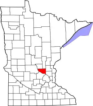 Location within the U.S. state of Minnesota | |
 Minnesota's location within the U.S. | |
| Coordinates: 45°26′N 93°46′W | |
| Country | |
| State | |
| Founded | February 25, 1856[1] |
| Named for | Moses Sherburne |
| Seat | Elk River |
| Largest city | Elk River |
| Area | |
| • Total | 451 sq mi (1,170 km2) |
| • Land | 433 sq mi (1,120 km2) |
| • Water | 18 sq mi (50 km2) 4.0%% |
| Population (2010) | |
| • Total | 88,499 |
| • Estimate (2020) | 98,589 |
| • Density | 222/sq mi (86/km2) |
| Time zone | UTC−6 (Central) |
| • Summer (DST) | UTC−5 (CDT) |
| Congressional district | 6th |
| Website | www |
Sherburne County is included in the Minneapolis-St. Paul-Bloomington, MN-WI Metropolitan Statistical Area.
History
The Wisconsin Territory was established by the federal government effective 3 July 1836, and existed until its eastern portion was granted statehood (as Wisconsin) in 1848. Therefore, the federal government set up the Minnesota Territory effective March 3, 1849. The newly organized territorial legislature created nine counties across the territory in October of that year. One of those original counties, Benton, had its southern section partitioned off on 25 February 1856 to form a new county. It was named Sherburne, to recognize Moses Sherburne (1808-1868), a prominent area attorney, associate justice of the Supreme Court of the Minnesota Territory (1853-1857), who retired to the county and spent his final year of life there (in Orono).
The area now delineated by Big Lake Township was first settled in 1848; the small village was named Humboldt. When the county creation was announced in 1856, Humboldt was named the county seat. The area now covered by Elk River was also first settled in 1848. Two villages grew up, fairly close together: Orono (platted 1855); and Elk River Village (platted 1865). Their growth was such that by 1867 a county vote moved the county seat from Humboldt to Elk River (designated as "The Lower Town" in the vote, to distinguish it from nearby Orono. The two villages merged under the name 'Elk River' in 1881). Also in 1867, the village of Humboldt changed its name to Big Lake.
The boundaries of Sherburne County have remained as created since 1856.[4]
Geography
The Mississippi River flows southeast along the county's south border. The Rum River flows southeast through the county's upper east portion. The Elk River rises in nearby Benton County, and flows south-southeast through the western and southern part of Sherburne County, discharging into the Mississippi at Elk River. The Saint Francis River also rises in Benton and flows southward through the central part of Sherburne County, discharging into the Elk just north of Big Lake.
The terrain of Sherburne County consists of low rolling hills, partially wooded, heavily sprinkled with lakes, ponds and depressions.[6] The soil of Sherburne County contains considerable sand and gravel due to glacial activity in past epochs, and thus is less suitable for agriculture than much of Minnesota.[7] The county terrain slopes to the south and east.[8] The county's highest point lies 3 miles (5 km) east-southeast of Saint Cloud, at 1,110' (338m) ASL.[9] The county has a total area of 451 square miles (1,170 km2), of which 433 square miles (1,120 km2) is land and 18 square miles (47 km2) (4.0%) is water.[10]
Major highways
 U.S. Highway 10
.svg.png.webp) U.S. Highway 169
U.S. Highway 169 Minnesota State Highway 24
 Minnesota State Highway 25
 Minnesota State Highway 101
 Minnesota State Highway 301
Airports
- Leaders Clear Lake Airport (8Y6) - one mile (1.6 km) east of Clear Lake
- Princeton Municipal Airport (PNM) - at SW edge of Princeton (on border between Mille Lacs and Sherburne counties)
- St. Cloud Regional Airport (STC) - two miles (3 km) east of Saint Cloud
Adjacent counties
- Mille Lacs County - north
- Isanti County - northeast
- Anoka County - southeast
- Hennepin County - south
- Wright County - southwest
- Stearns County - west
- Benton County - northwest
Protected areas[6]
- Bridgeview Park Reserve[11]
- Clear Lake Scientific and Natural Area
- Fremont Wildlife Management Area
- Grams Regional Park[11]
- Harry W. Cater Homestead Prairie Scientific and Natural Area
- Island View Regional Park[11]
- Oak Savanna Park[11]
- Rice Lake Savanna Scientific and Natural Area
- Sand Dunes State Forest
- Sand Prairie Wildlife Management Area
- Sherburne National Wildlife Refuge
- Uncas Dunes Scientific and Natural Area
- William H. Houlton Conservation Area
Demographics
| Historical population | |||
|---|---|---|---|
| Census | Pop. | %± | |
| 1860 | 723 | — | |
| 1870 | 2,050 | 183.5% | |
| 1880 | 3,855 | 88.0% | |
| 1890 | 5,908 | 53.3% | |
| 1900 | 7,281 | 23.2% | |
| 1910 | 8,136 | 11.7% | |
| 1920 | 9,651 | 18.6% | |
| 1930 | 9,709 | 0.6% | |
| 1940 | 10,456 | 7.7% | |
| 1950 | 10,661 | 2.0% | |
| 1960 | 12,861 | 20.6% | |
| 1970 | 18,344 | 42.6% | |
| 1980 | 29,908 | 63.0% | |
| 1990 | 41,945 | 40.2% | |
| 2000 | 64,417 | 53.6% | |
| 2010 | 88,499 | 37.4% | |
| 2020 (est.) | 98,589 | [12] | 11.4% |
| US Decennial Census[13] 1790-1960[14] 1900-1990[15] 1990-2000[16] 2010-2019[2] | |||
2000 census
At the 2000 United States Census, there were 64,417 people, 21,581 households and 16,746 families in the county. The population density was 148/sq mi (57.4/km2). There were 22,827 housing units at an average density of 52.7/sq mi (20.4/km2). The county's racial makeup was 96.73% White, 0.85% Black or African American, 0.45% Native American, 0.58% Asian, 0.02% Pacific Islander, 0.43% from other races, and 0.95% from two or more races. 1.10% of the population were Hispanic or Latino of any race. 40.1% were of German, 13.6% Norwegian, 7.5% Swedish and 6.2% Irish ancestry.
There were 21,581 households, of which 44.90% had children under the age of 18 living with them, 66.20% were married couples living together, 7.50% had a female householder with no husband present, and 22.40% were non-families. 15.70% of all households were made up of individuals, and 5.20% had someone living alone who was 65 years of age or older. The average household size was 2.91 and the average family size was 3.27.
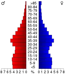
The county population contained 30.9% under the age of 18, 9.60% from 18 to 24, 33.90% from 25 to 44, 18.40% from 45 to 64, and 7.10% who were 65 years of age or older. The median age was 31 years. For every 100 females there were 104.30 males. For every 100 females age 18 and over, there were 103.20 males.
The median household income was $57,014 and the median family income was $61,790. Males had a median income of $41,601 and females $27,689. The per capita income for the county was $21,322. About 2.30% of families and 4.40% of the population were below the poverty line, including 3.50% of those under age 18 and 10.10% of those age 65 or over.
Communities
Cities
Politics
Sherburne County has traditionally voted Republican. Since 1980 the county has selected the Republican Party candidate in 80% of national elections (as of 2020).
| Year | Republican | Democratic | Third parties |
|---|---|---|---|
| 2020 | 65.1% 36,222 | 32.5% 18,065 | 2.4% 1,325 |
| 2016 | 64.3% 31,053 | 27.5% 13,293 | 8.2% 3,937 |
| 2012 | 59.9% 27,848 | 37.8% 17,597 | 2.3% 1,064 |
| 2008 | 58.1% 26,140 | 39.9% 17,957 | 2.0% 893 |
| 2004 | 60.8% 25,182 | 38.2% 15,816 | 1.1% 456 |
| 2000 | 54.5% 16,813 | 39.3% 12,109 | 6.2% 1,913 |
| 1996 | 37.4% 8,699 | 45.3% 10,551 | 17.3% 4,025 |
| 1992 | 33.6% 7,339 | 35.9% 7,843 | 30.5% 6,659 |
| 1988 | 50.7% 8,360 | 48.2% 7,959 | 1.1% 183 |
| 1984 | 55.4% 7,738 | 44.0% 6,140 | 0.6% 82 |
| 1980 | 44.3% 6,035 | 45.7% 6,229 | 10.0% 1,356 |
| 1976 | 38.1% 4,361 | 58.4% 6,678 | 3.5% 403 |
| 1972 | 50.0% 4,332 | 47.0% 4,070 | 3.0% 256 |
| 1968 | 41.5% 2,737 | 52.8% 3,481 | 5.7% 375 |
| 1964 | 35.9% 2,132 | 63.8% 3,787 | 0.4% 21 |
| 1960 | 52.4% 2,837 | 47.4% 2,568 | 0.2% 12 |
| 1956 | 59.8% 2,681 | 40.0% 1,796 | 0.2% 10 |
| 1952 | 63.4% 2,839 | 36.4% 1,630 | 0.2% 9 |
| 1948 | 46.9% 1,828 | 50.3% 1,958 | 2.8% 109 |
| 1944 | 58.2% 2,046 | 41.1% 1,447 | 0.7% 25 |
| 1940 | 60.6% 2,450 | 38.9% 1,570 | 0.5% 20 |
| 1936 | 43.4% 1,623 | 50.3% 1,881 | 6.2% 233 |
| 1932 | 44.2% 1,601 | 53.5% 1,938 | 2.4% 86 |
| 1928 | 69.1% 2,437 | 30.2% 1,064 | 0.8% 27 |
| 1924 | 63.7% 1,961 | 5.8% 180 | 30.5% 940 |
| 1920 | 85.2% 2,747 | 9.5% 307 | 5.3% 171 |
| 1916 | 54.1% 965 | 41.0% 731 | 4.9% 88 |
| 1912 | 22.1% 335 | 23.7% 360 | 54.2% 823 |
| 1908 | 67.8% 1,002 | 24.8% 366 | 7.4% 109 |
| 1904 | 82.7% 1,165 | 13.2% 186 | 4.1% 58 |
| 1900 | 68.5% 931 | 27.4% 373 | 4.1% 56 |
| 1896 | 63.9% 1,008 | 34.0% 536 | 2.1% 33 |
| 1892 | 53.9% 632 | 24.7% 290 | 21.4% 251 |
See also
References
- "Minnesota Place Names". Minnesota Historical Society. Archived from the original on June 20, 2012. Retrieved March 19, 2014.
- "State & County QuickFacts". United States Census Bureau. Retrieved September 1, 2013.
- "Find a County". National Association of Counties. Retrieved June 7, 2011.
- Upham, Warren (1920). Minnesota Geographic Names: Their Origin and Historic Significance. Minnesota Historical Society. pp. 513–514. Retrieved 25 April 2019.
- Nelson, Steven (2011). Savanna Soils of Minnesota. Minnesota: Self. pp. 61-64. ISBN 978-0-615-50320-2.
- Sherburne County MN Google Maps (accessed 25 April 2019)
- Soil Survey of Sherburne County, Minnesota (USDA, n.d.) Accessed 25 April 2019
- "Find an Altitude/Sherburne County MN" Google Maps (accessed 25 April 2019)
- Sherburne County High Point - PeakBagger.com (accessed 25 April 2019)
- "2010 Census Gazetteer Files". US Census Bureau. August 22, 2012. Archived from the original on September 21, 2013. Retrieved October 25, 2014.
- Sherburne County - Parks & Recreation (accessed April 25, 2019)
- "Population and Housing Unit Estimates". Retrieved March 26, 2020.
- "US Decennial Census". US Census Bureau. Retrieved October 25, 2014.
- "Historical Census Browser". University of Virginia Library. Retrieved October 25, 2014.
- "Population of Counties by Decennial Census: 1900 to 1990". US Census Bureau. Retrieved October 25, 2014.
- "Census 2000 PHC-T-4. Ranking Tables for Counties: 1990 and 2000" (PDF). US Census Bureau. Retrieved October 25, 2014.
- Leip, David. "Atlas of US Presidential Elections". uselectionatlas.org. Retrieved October 10, 2018.
External links
Places adjacent to Sherburne County, Minnesota | ||||||||||
|---|---|---|---|---|---|---|---|---|---|---|
| ||||||||||
Municipalities and communities of Sherburne County, Minnesota, United States | ||
|---|---|---|
| Cities | Map of Minnesota highlighting Sherburne County | |
| Townships | ||
| Unincorporated communities | ||
| Footnotes | ‡This populated place also has portions in an adjacent county or counties | |
| ||

| Authority control |
|---|