List of Minnesota state parks
This is a list of Minnesota state parks. There are 67 state parks, nine state recreation areas, nine state waysides, and 23 state trails in the Minnesota state park system, totaling approximately 267,000 acres (1,080 km2).[1][2] A Minnesota state park is an area of land in the U.S. state of Minnesota preserved by the state for its natural, historic, or other resources. Each was created by an act of the Minnesota Legislature and is maintained by the Minnesota Department of Natural Resources. The Minnesota Historical Society operates sites within some of them. The park system began in 1891 with Itasca State Park when a state law was adopted to "maintain intact, forever, a limited quantity of the domain of this commonwealth...in a state of nature."[3] Minnesota's state park system is the second oldest in the United States, after New York's.[4]:2
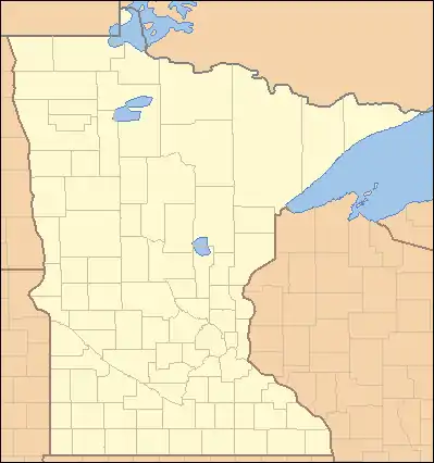
Hold cursor over locations to display park name;
click to go to park article.
Minnesota's state parks are spread across the state in such a way that there is a state park within 50 miles (80 km) of every Minnesotan.[5] The most recent park created is Lake Vermilion State Park, created in 2010. The parks range in size from Franz Jevne State Park with 118 acres (48 ha) to Saint Croix State Park with 34,037 acres (13,774 ha). Two parks include resources listed as National Natural Landmarks (Big Bog State Recreation Area and Itasca State Park) and six parks encompass National Historic Landmarks (Charles A. Lindbergh, Fort Snelling, Mille Lacs Kathio, St. Croix, Soudan Underground Mine, and Split Rock Lighthouse State Parks). 52 sites or districts across 34 Minnesota state parks are on the National Register of Historic Places (NRHP), including 22 parks with developments constructed by New Deal-era job creation programs in the 1930s.[6]
History
Minnesota's first attempt to create a state park came in 1885, when a 173-acre (70 ha) park was authorized to preserve Minnehaha Falls. The effort was delayed by legal appeals from the various landowners of the desired parkland, and by the time those were settled in favor of the state in 1889, Minnesota no longer had the money to purchase the land. Instead the city of Minneapolis fronted the cash. Owned and operated by Minneapolis, Minnehaha State Park was ultimately absorbed as a city park.[4]:3
Minnesota tried again in 1891, authorizing a state park around Lake Itasca both for its recreational opportunities and to protect the source of the Mississippi River. Interstate Park on the St. Croix River was created in 1895. Other sites were added over the next two decades, but with an inconsistent vision. Modest tracts of scenic land were acquired in Minneopa and Jay Cooke State Parks, but much effort was also expended on creating historical monuments relating to the Dakota War of 1862 and the Great Hinckley Fire. Moreover, most of the sites were being administered by the state auditor, who had many other duties. Itasca State Park, meanwhile, was being administered as a state forest. In 1923, state auditor Ray P. Chase excoriated this situation, calling for wiser selection of park lands and a dedicated commissioner. Chase's comments had an impact, and two years later the Department of Conservation was created to manage the state's natural resources, including the state parks. Originally part of the forestry division, the state parks received their own division in 1935 to take advantage of federal programs such as the Civilian Conservation Corps (CCC).[4]:82[7] In 1971, the department became the Minnesota Department of Natural Resources.[8]
The state parks were closed for almost three weeks in July 2011 due to a shutdown of the state government.
State parks and recreation areas
| Park name | County or Counties | Size[9] | Year Established[4] | Water Body(s) | Coordinates | Remarks | Image | |
|---|---|---|---|---|---|---|---|---|
| acres | ha | |||||||
| Afton State Park | Washington | 1,600 | 650 | 1969 | St. Croix River | 44.8624675°N 92.7835367°W | Lies on a glacial moraine with deep ravines that drop 300 feet (91 m) down to the St. Croix River.[10] |  |
| Banning State Park | Pine | 5,597 | 2,265 | 1963 | Kettle River | 46.1707812°N 92.8440889°W | Contains 1.5 miles (2.4 km) of whitewater rapids and the remains of a historic quarry operation.[11] |  |
| Bear Head Lake State Park | St. Louis | 3,013 | 1,219 | 1961 | Bear Head Lake | 47.7963051°N 92.0768231°W | Provides road access and modern camping facilities in an environment similar to the nearby Boundary Waters Canoe Area Wilderness.[12] |  |
| Beaver Creek Valley State Park | Houston | 715 | 289 | 1937 | East Beaver Creek | 43.6427458°N 91.5818101°W | Showcases the rugged topography of the Driftless Area in a narrow valley carved by a trout stream.[13] | 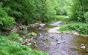 |
| Big Bog State Recreation Area | Beltrami | 9,170 | 3,710 | 2000[9] | Red Lake, Tamarac River | 48.172761°N 94.512033°W | Encompasses part of the largest peatland in the Lower 48 states (a National Natural Landmark) and a prime walleye fishery.[14] | 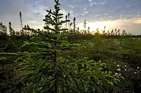 |
| Big Stone Lake State Park | Big Stone | 980 | 400 | 1961 | Big Stone Lake | 45.3824644°N 96.5131148°W | Protects two sections of shoreline on Big Stone Lake, the source of the Minnesota River.[15] | 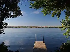 |
| Blue Mounds State Park | Rock | 1,567 | 634 | 1937 | Mound Creek | 43.7069134°N 96.1869728°W | Protects an escarpment of Sioux Quartzite and Minnesota's only public bison herd.[16] A district of WPA structures is on the NRHP.[17] |  |
| Buffalo River State Park | Clay | 1,068 | 432 | 1937 | Buffalo River | 46.8655165°N 96.4678474°W | Preserves part of one of the state's largest and best tallgrass prairies.[18] A district of WPA structures is on the NRHP.[19] | 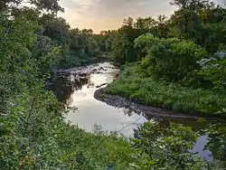 |
| Camden State Park | Lyon | 1,855 | 751 | 1935 | Redwood River | 44.362462°N 95.9250247°W | Preserves a forested river valley in the midst of prairie and farm country.[20] A district of VCC and WPA structures is on the NRHP.[21] | 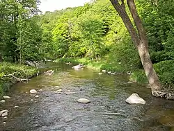 |
| Carley State Park | Wabasha | 209 | 85 | 1949 | Whitewater River | 44.1166318°N 92.1760002°W | Donated by State Senator James A. Carley to protect a stand of white pines. Used as an overflow campground for nearby Whitewater State Park.[22] | 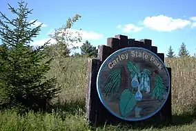 |
| Cascade River State Park | Cook | 2,867 | 1,160 | 1957 | Lake Superior and Cascade River | 47.7097222°N 90.5222222°W | Stretches along 10.5 miles (16.9 km) of Lake Superior coastline in land rehabilitated after construction of Minnesota State Highway 61.[23] A WPA highway wayside is on the NRHP.[6] | .JPG.webp) |
| Charles A. Lindbergh State Park | Morrison | 417 | 169 | 1931 | Mississippi River | 45.9588545°N 94.3952813°W | Contains the restored home of Congressman Charles August Lindbergh and his son Charles Lindbergh, the famous aviator.[24] The house is a National Historic Landmark, and a district of WPA structures is on the NRHP.[25] |  |
| Crow Wing State Park | Crow Wing, Cass, and Morrison | 2,335 | 945 | 1959 | Mississippi and Crow Wing Rivers | 46.2722222°N 94.3333333°W | Interprets the site of Old Crow Wing, an important town and trading center in the mid-19th century. The town site and a section of the Red River Trails are both on the NRHP.[6][26] |  |
| Cuyuna Country State Recreation Area | Crow Wing | 6,850 | 2,770 | 1993 | Chain of small lakes and streams, filled pit mines | 46.489550°N 93.977500°W | In development as the land is rehabilitated from open-pit iron mining. Includes Portsmouth Mine Pit Lake, the state's deepest lake.[27] | 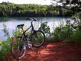 |
| Father Hennepin State Park | Mille Lacs | 275 | 111 | 1941 | Mille Lacs Lake | 46.1446779°N 93.4880157°W | Provides lakeside recreation in the region visited by Father Louis Hennepin during a French expedition in 1680.[28] | 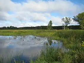 |
| Flandrau State Park | Brown | 840 | 340 | 1937 | Cottonwood River | 44.2882956°N 94.4735837°W | Created to provide water recreation near New Ulm.[29] Entire park is a district of CCC and WPA structures on the NRHP.[30] | 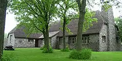 |
| Forestville/Mystery Cave State Park | Fillmore | 3,163 | 1,280 | 1963 | South Branch Root River and tributaries | 43.6255204°N 92.247388°W | Encompasses the historic townsite of Forestville, the state's longest explored cave, and three blue-ribbon trout streams.[31] |  |
| Fort Ridgely State Park | Nicollet and Renville | 537 | 217 | 1911 | Fort Ridgely Creek | 44.4524621°N 94.7308199°W | Surrounds Fort Ridgely, site of the Battle of Fort Ridgely during the Dakota War of 1862. The fort and a large district of CCC structures are both on the NRHP.[32][33] | 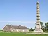 |
| Fort Snelling State Park | Ramsey, Hennepin, and Dakota | 1,825 | 739 | 1961 | Mississippi and Minnesota Rivers | 44.8857988°N 93.1779985°W | Contains historic Fort Snelling, built in 1819, and floodplain forest in the heart of Minneapolis – Saint Paul. The fort is a National Historic Landmark and the entire park is part of the Mississippi National River and Recreation Area.[34] | 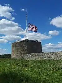 |
| Franz Jevne State Park | Koochiching | 118 | 48 | 1967 | Rainy River | 48.642240°N 94.080410°W | Features scenic property on the Canada–United States border, donated by the sons of Franz Jevne, a lawyer, on the condition that the park be named after their father.[35] | 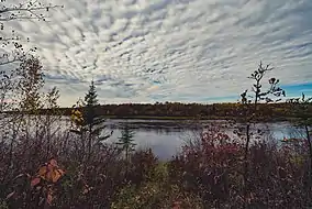 |
| Frontenac State Park | Goodhue | 2,226 | 901 | 1957 | Lake Pepin on Mississippi River | 44.5074677°N 92.3262914°W | Attracts 260 species of year-round and migrant birds with its variety of habitats. Includes a natural arch atop a 430-foot (130 m) bluff.[36] | 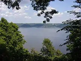 |
| Garden Island State Recreation Area | Lake of the Woods | 715 | 289 | 1998[9] | Lake of the Woods | 49.175335°N 94.834671°W | Comprises a nearly undeveloped island, 15 mi (24 km) from the closest mainland marinas, that once bore Native American gardens.[37] | |
| George H. Crosby Manitou State Park | Lake | 6,200 | 2,500 | 1955 | Manitou River | 47.506018°N 91.109045°W | Contains undeveloped North Woods wilderness geared towards backpackers.[38] | 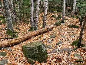 |
| Glacial Lakes State Park | Pope | 1,857 | 752 | 1963 | Several kettle lakes | 45.537461°N 95.521983°W | Preserves rolling tallgrass prairie amidst the glacial landforms of the Leaf Hills Moraines.[39] | 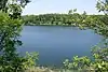 |
| Glendalough State Park | Otter Tail | 1,924 | 779 | 1991[9] | Six kettle lakes | 46.3333333°N 95.6666667°W | Developed from the former private retreat and game farm of the owners of the Star Tribune newspaper, with a heritage fishery of large game fish.[40] | 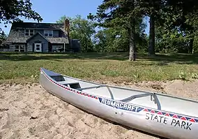 |
| Gooseberry Falls State Park | Lake | 1,741 | 705 | 1937 | Lake Superior, Gooseberry River | 47.1468715°N 91.4632289°W | Serves as the gateway to the scenic North Shore. Features five waterfalls, an agate beach, and a large district of CCC structures on the NRHP.[41][42] | 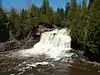 |
| Grand Portage State Park | Cook | 278 | 113 | 1989 | Pigeon River | 48.0101633°N 89.6120317°W | Features a 120-foot (37 m) waterfall, Minnesota's tallest, on the Canada–United States border. Co-managed with the Grand Portage Indian Reservation, the only state – tribal collaboration of a U.S. state park.[43] | 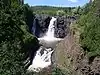 |
| Great River Bluffs State Park | Winona | 2,122 | 859 | 1963[44] | Mississippi River | 43.9463526°N 91.3993094°W | Features 500-foot-high (150 m) bluffs and steep goat prairies. Formerly named O.L. Kipp State Park.[45] | |
| Greenleaf Lake State Recreation Area | Meeker | 1,230 | 500 | 2004 | Greenleaf and Sioux Lakes | 45.01591°N 94.46671°W | In development and open for limited day-use recreation.[46] | 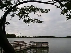 |
| Hayes Lake State Park | Roseau | 2,118 | 857 | 1967 | Hayes Lake, North Fork Roseau River | 48.623309°N 95.507753°W | Provides fishing and swimming opportunities in an exclusively recreational reservoir free of agricultural runoff or water level fluctuations for irrigation or power generation.[4]:250 | .jpg.webp) |
| Hill-Annex Mine State Park | Itasca | 634 | 257 | 1988 | Filled pit mine | 47.327490°N 93.277520°W | Offers tours of a former open-pit iron mine and fossil collecting. A district of mine structures is on the NRHP.[47] | 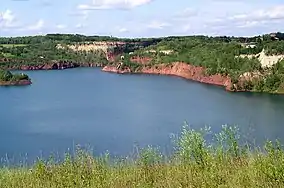 |
| Interstate State Park | Chisago | 288 | 117 | 1895 | St. Croix River | 45.3949622°N 92.6696521°W | Created in conjunction with a state park in Wisconsin to protect a basalt gorge and glacial potholes.[48] Two districts of CCC and WPA structures are on the NRHP.[49] | 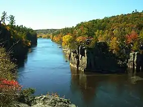 |
| Iron Range Off-Highway Vehicle State Recreation Area | St. Louis | 1,864 | 754 | 2002 | Lake Ore-be-gone | 47.48247°N 92.44349°W | Provides 36 miles (58 km) of trails for off highway vehicles.[50] | _Recreation_Area%252C_Minnesota_(28064197648).jpg.webp) |
| Itasca State Park | Hubbard, Clearwater, and Becker | 30,553 | 12,364 | 1891 | Lake Itasca | 47.1974579°N 95.2019642°W | Minnesota's oldest state park, which preserves the headwaters of the Mississippi River. The entire park and an individual archaeological site are on the NRHP, and a subsection is a National Natural Landmark.[51] | 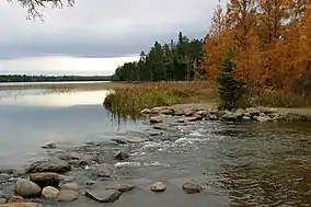 |
| Jay Cooke State Park | Carlton | 8,125 | 3,288 | 1915 | Saint Louis River | 46.6496646°N 92.330748°W | Showcases a rocky, whitewater-strewn river churning through the North Woods.[52] Three districts of CCC and WPA structures and a long-used portage route are on the NRHP.[53] | 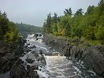 |
| John A. Latsch State Park | Winona | 409 | 166 | 1925 | Mississippi River | 44.1619082°N 91.8220997°W | Features three steep river bluffs.[54] | 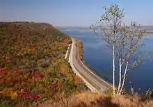 |
| Judge C. R. Magney State Park | Cook | 4,323 | 1,749 | 1957 | Lake Superior, Brule River | 47.8512799°N 90.0584299°W | Contains the Devil's Kettle, a large glacial kettle into which half of the Brule River disappears.[55] | 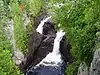 , [56] , [56] |
| Kilen Woods State Park | Jackson | 202 | 82 | 1945 | Des Moines River | 43.7266244°N 95.0630473°W | Preserves a riverside parcel of forested hills on the Coteau des Prairies.[57] |  |
| La Salle Lake State Recreation Area | Hubbard | 1,000 | 400 | 2011 | Mississippi River, La Salle Lake | 47.33719°N 95.17061°W | In development around the second-deepest lake in Minnesota.[58] | 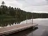 |
| Lac qui Parle State Park | Lac qui Parle and Chippewa | 897 | 363 | 1959 | Lac qui Parle, Minnesota and Lac qui Parle Rivers | 45.0205141°N 95.888921°W | Attracts thousands of migrating waterfowl, earning it the name "Lake that Speaks."[59] A district of WPA buildings is on the NRHP.[60] | 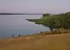 |
| Lake Bemidji State Park | Beltrami | 1,653 | 669 | 1923 | Lake Bemidji | 47.5363413°N 94.8227704°W | Features a recreational lakeshore and a spruce-tamarack bog.[61] A district of CCC and National Youth Administration structures is on the NRHP.[62] | 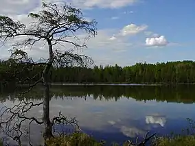 |
| Lake Bronson State Park | Kittson | 2,806 | 1,136 | 1937 | Lake Bronson, South Branch Two Rivers | 48.7247004°N 96.6033741°W | Features a reservoir created during a drought in the 1930s. A district of WPA structures is on the NRHP.[63] | 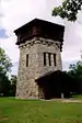 |
| Lake Carlos State Park | Douglas | 1,175 | 476 | 1937 | Lake Carlos | 45.9866293°N 95.3278143°W | Preserves diverse habitats from prairie to hardwood forest to tamarack bog in a transition zone.[64] Two districts of WPA structures are on the NRHP.[65] |  |
| Lake Louise State Park | Mower | 849 | 344 | 1963 | Lake Louise, Upper and Little Iowa Rivers | 43.5335762°N 92.5254538°W | Features a reservoir surrounded by oak savanna and patches of hardwood forest. Minnesota's oldest continuous recreation area, formerly a town park since the 1860s.[66] |  |
| Lake Maria State Park | Wright | 1,475 | 597 | 1963 | Several kettle lakes | 45.3138543°N 93.9572003°W | Provides a lightly developed wilderness area near Minneapolis – Saint Paul in a morainal landscape of Big Woods.[67] |  |
| Lake Shetek State Park | Murray County | 1,109 | 449 | 1937 | Lake Shetek | 44.1021838°N 95.6900114°W | Features remnants of pioneer history around the largest lake in southwestern Minnesota.[68] Two districts of WPA structures are on the NRHP.[69] |  |
| Lake Vermilion State Park | St. Louis | 2,875 | 1,163[9] | 2010[9] | Lake Vermilion | 47.83471°N 92.19812°W | Recently purchased and in development on the fifth-largest lake in Minnesota.[70] |  |
| Maplewood State Park | Otter Tail | 8,127 | 3,289 | 1963 | Several kettle lakes | 46.5335703°N 95.9492193°W | Preserves a forest/prairie transition zone in the Leaf Hills Moraines.[71] A Native American archaeological site is on the NRHP. |  |
| McCarthy Beach State Park | St. Louis | 1,908 | 772 | 1945 | Sturgeon and Side Lakes | 47.6727068°N 93.0301834°W | Features a .5-mile-long (0.80 km) beach on an isthmus between two lakes.[72] |  |
| Mille Lacs Kathio State Park | Mille Lacs | 9,786 | 3,960 | 1957 | Mille Lacs Lake, Rum River | 46.1288485°N 93.7405269°W | Preserves 19 identified archaeological sites dating back 9000 years. The entire park is a National Historic Landmark and four sites are individually listed on the NRHP.[6][73] |  |
| Minneopa State Park | Blue Earth | 1,617 | 654 | 1905 | Minnesota River, Minneopa Creek | 44.1621879°N 94.1021803°W | Showcases the largest waterfall in southern Minnesota. The 1864 Seppman Mill and a district of WPA structures are each on the NRHP.[74] | 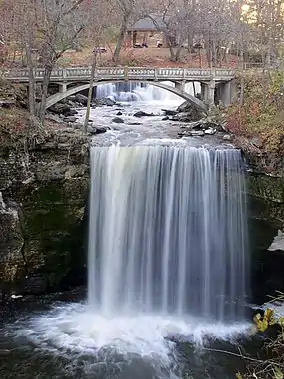 |
| Minnesota Valley State Recreation Area | Hennepin, Dakota, Scott, Carver, Sibley, and Le Sueur | 6,442 | 2,607 | 1969 | Minnesota River | 44.661999°N 93.703337°W | Comprises non-contiguous sections interspersed with units of the Minnesota Valley National Wildlife Refuge in the valley formed by Glacial River Warren.[75] | 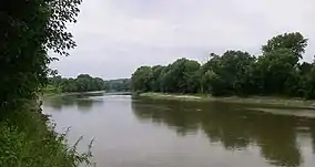 |
| Monson Lake State Park | Swift | 343 | 139 | 1937 | Monson and West Sunberg Lakes | 45.3205175°N 95.2750235°W | Established as a memorial to settlers who died in the Dakota War of 1862.[76] A district of CCC and WPA structures is on the NRHP.[77] | 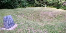 |
| Moose Lake State Park | Carlton | 829 | 335 | 1971 | Moosehead and Echo Lakes | 46.436319°N 92.72521°W | Provides water recreation and an exhibit hall on Lake Superior agates (the state gemstone) and the geology of Minnesota.[78] |  |
| Myre-Big Island State Park | Freeborn | 1,578 | 639 | 1947 | Albert Lea Lake | 43.6238465°N 93.2890959°W | Features two islands with old growth hardwood forest since they were out of reach of prairie fires. Also houses one of the state's largest research collections of Native American artifacts.[79] | 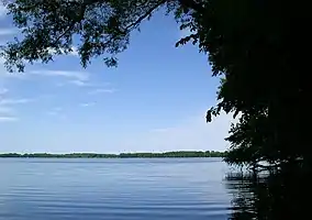 |
| Nerstrand-Big Woods State Park | Rice | 1,646 | 666 | 1945 | Prairie Creek | 44.3452425°N 93.1074337°W | Preserves a remnant stand of Big Woods.[80] | 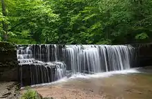 |
| Old Mill State Park | Marshall | 287 | 116 | 1951 | Middle River | 48.361364°N 96.5703288°W | Features two mills and a log cabin from the late 19th Century.[81] The Larson Mill and a district of WPA structures are each on the NRHP.[82] | 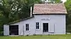 |
| Red River State Recreation Area | Polk | 104 | 42 | 1997 | Red River of the North and Red Lake River | 47.9327778°N 97.0355556°W | Reclaims land devastated by the 1997 Red River flood as part of the Greater Grand Forks Greenway, which serves the dual purpose of holding back river waters during floods and providing recreational opportunities.[83] | 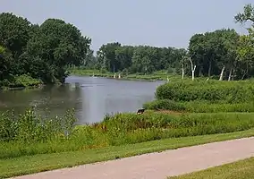 |
| Rice Lake State Park | Steele and Dodge | 712 | 288 | 1963 | Rice Lake | 44.0874639°N 93.061315°W | Surrounds a shallow lake which attracts migrating waterfowl.[84] | 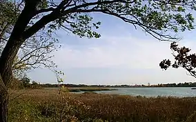 |
| St. Croix Islands State Recreation Area | Washington | 25 | 10 | 1935 | St. Croix River | 45.08524°N 92.78608°W | Comprises five islands near the St. Croix Boom Site that came under state control but were never developed. Leased to the Saint Croix National Scenic Riverway.[4]:318 | 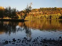 |
| St. Croix State Park | Pine | 31,775 | 12,859 | 1943 | St. Croix River | 45.9741154°N 92.5835304°W | Developed as a Recreational Demonstration Area by the CCC and the WPA to repurpose land too poor to farm. The entire park is a National Historic Landmark.[85] | 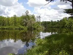 |
| Sakatah Lake State Park | Le Sueur and Rice | 810 | 330 | 1963 | Sakatah Lake on the Cannon River | 44.2210746°N 93.5357792°W | Features a transitional zone between prairie and Big Woods on a natural widening of the Cannon River.[86] | 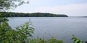 |
| Savanna Portage State Park | Aitkin and St. Louis | 15,277 | 6,182 | 1961 | East and West Savanna Rivers, numerous kettle lakes | 46.8374455°N 93.1566054°W | Preserves a historically important and legendarily difficult 6-mile (9.7 km) portage over a continental divide between the watersheds of the Mississippi River and Lake Superior.[87] The portage is on the NRHP.[6] | 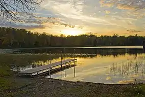 |
| Scenic State Park | Itasca | 2,370 | 960 | 1921 | Sandwick and Coon Lakes | 47.7157733°N 93.5629701°W | Features pristine lakes and old-growth pines. Two districts of structures built by the first CCC state park camp in Minnesota are on the NRHP.[88] | 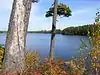 |
| Schoolcraft State Park | Cass and Itasca | 141 | 57 | 1959 | Mississippi River | 47.2249502°N 93.7999449°W | Honors Henry Schoolcraft, who charted the origins of the Mississippi River with the Ojibwe guide Ozawindib. Preserves virgin pine forest that includes a white pine over 300 years old.[89] | 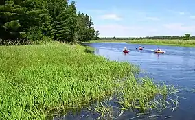 |
| Sibley State Park | Kandiyohi | 2,540 | 1,030 | 1919 | Lake Andrew and other kettle lakes | 45.3196867°N 95.0230696°W | Honors Henry Hastings Sibley, the first governor of Minnesota, with a popular recreational lakeshore and a morainal landscape.[90] A district of CCC structures is on the NRHP.[91] | 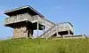 |
| Soudan Underground Mine State Park | St. Louis | 974 | 394 | 1963 | Lake Vermilion | 47.8246403°N 92.2562691°W | Offers tours of Minnesota's oldest, deepest, and richest iron mine and a modern high energy physics laboratory. The mine is a National Historic Landmark[92] and a row of 20th Century boathouses is on the NRHP. | 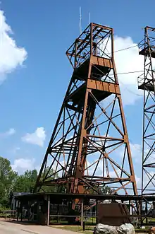 |
| Split Rock Creek State Park | Pipestone | 947 | 383 | 1937 | Split Rock Lake | 43.8980264°N 96.3642032°W | Features a recreational reservoir on the Coteau des Prairies.[93] |  |
| Split Rock Lighthouse State Park | Lake | 2,112 | 855 | 1945 | Lake Superior, Split Rock River | 47.1921472°N 91.3929484°W | Surrounds the clifftop Split Rock Lighthouse, one of the most photographed lighthouses in the United States.[94] The lighthouse is a National Historic Landmark. |  |
| Temperance River State Park | Cook | 1,134 | 459 | 1957 | Lake Superior, Temperance and Cross Rivers | 47.5543466°N 90.8723722°W | Showcases the deep, narrow gorge of the Temperance River (so named for its lack of a "bar" at its mouth) and Carlton Peak, a rock climbing area.[95] | 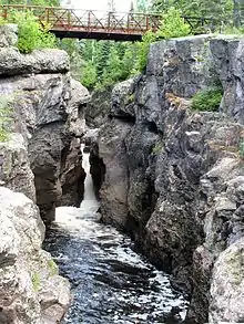 |
| Tettegouche State Park | Lake | 8,998 | 3,641 | 1979 | Lake Superior and Baptism River | 47.358806°N 91.2640506°W | Encompasses the tallest waterfall within the state's borders, the iconic headlands of Palisade Head and Shovel Point, and a historic fishing camp which is on the NRHP.[96] | .jpg.webp) |
| Upper Sioux Agency State Park | Yellow Medicine | 1,065 | 431 | 1963 | Minnesota and Yellow Medicine Rivers | 44.7380132°N 95.4539039°W | Interprets the site of the agency that administered a Dakota Indian reservation until it was destroyed during the Dakota War of 1862.[97] The agency is on the NRHP.[6] |  |
| Whitewater State Park | Winona | 1,672 | 677 | 1919 | Whitewater River | 44.058297°N 92.0587726°W | Showcases a popular steep-sided river valley in the Driftless Area.[98] A large district of CCC and WPA structures is on the NRHP.[99] | 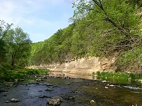 |
| Wild River State Park | Chisago | 6,574 | 2,660 | 1973 | St. Croix River | 45.5680159°N 92.8757696°W | Follows 18 miles (29 km) of one of the first waterways designated a National Wild and Scenic River.[100] A section of the Point Douglas to Superior Military Road is on the NRHP.[101] | 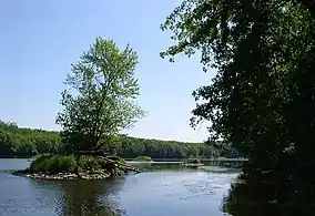 |
| William O'Brien State Park | Washington | 1,783 | 722 | 1947 | St. Croix River | 45.2194109°N 92.7660423°W | Provides outdoor recreation opportunities near Minneapolis – Saint Paul.[102] | 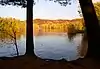 |
| Zippel Bay State Park | Lake of the Woods | 2,826 | 1,144 | 1959 | Lake of the Woods | 48.8638742°N 94.8593862°W | Provides water recreation and birdwatching opportunities on the shore of the country's sixth largest lake.[103] | 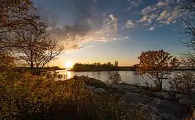 |
State waysides
The state park system includes nine waysides, most of them along Minnesota State Highway 61 on the North Shore.[104] These are parcels of land too small to be full-fledged parks, but with cultural or natural resources greater than would be overseen by the Minnesota Department of Transportation as highway waysides. Generally development is limited to a parking area and a short trail; sometimes there are sanitation facilities and picnic tables as well.[4]
| Wayside name | County | Date established[4]:299 | Coordinates | Remarks[105] | Image |
|---|---|---|---|---|---|
| Caribou Falls State Wayside | Lake | 1947 | 47.46452°N 91.03084°W | Includes a waterfall on the Caribou River. Formerly Caribou Falls State Park.[4]:166 | 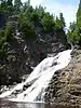 |
| Devils Track Falls State Wayside | Cook | 1961 | 47.77804°N 90.28273°W | A nearly inaccessible gorge on the Devil Track River within Superior National Forest. Formerly Devils Track Falls State Park.[4]:209 | 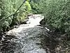 |
| Flood Bay State Wayside | Lake | 1965 | 47.03850°N 91.64254°W | A rocky Lake Superior beach just outside Two Harbors.[4]:248 | 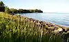 |
| Inspiration Peak State Wayside | Otter Tail | 1931 | 46.13714°N 95.57809°W | The highest point of the Leaf Hills Moraines.[4]:95 | 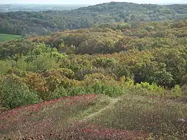 |
| Joseph R. Brown State Wayside | Renville | 1937 | 44.750328°N 95.324425°W | The ruins of Joseph R. Brown's three-story mansion, destroyed during the Dakota War of 1862.[4]:134 The ruins are on the NRHP.[6] | 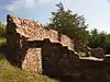 |
| Kadunce River State Wayside | Cook | 1947 | 47.79393°N 90.15414°W | Lake Superior shoreline around the mouth of the variably spelled Kadunce River. Formerly Kodonce River State Park.[4]:166 | .jpg.webp) |
| Ray Berglund State Wayside | Cook | 1951 | 47.60894°N 90.76943°W | A memorial at the mouth of the Onion River to a St. Paul businessman and conservationist, on land donated by his friends.[4]:173 | 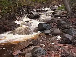 |
| St. Croix Boom Site State Wayside | Washington | 2016 | 45.08386°N 92.78731°W | Commemorates the site of a log boom where timber was sorted. Became a state wayside in 2016 following a facelift of facilities formerly owned by the Minnesota Department of Transportation.[106] | 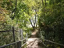 |
| Sam Brown Memorial State Wayside | Traverse | 1929 | 45.59616°N 96.84141°W | Created to honor Joseph R. Brown's son Samuel J. Brown, "the Paul Revere of the West," who rode 120 miles (190 km) through a storm on April 19, 1866 to warn of an expected Dakota attack. Formerly Sam Brown State Park.[4]:88 | 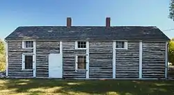 |
State trails
| Trail name | Trailheads[9] | Length in miles[9] | Length in kilometers[9] | Surface | Remarks |
|---|---|---|---|---|---|
| Arrowhead State Trail | Tower – International Falls | 135 | 217 | Unpaved | Serves primarily as a winter snowmobile route, branching off the Taconite State Trail.[107] |
| Blazing Star State Trail | Albert Lea – Myre-Big Island State Park | 6 | 9.7 | Paved | Planned to continue to Austin and connect with the Shooting Star State Trail.[108] |
| Blufflands State Trail: Harmony-Preston Valley Segment | Harmony – Preston | 18 | 29 | Paved | Climbs out of the Root River Valley.[109] |
| Blufflands State Trail: Root River Segment | Fountain – Houston | 42 | 68 | Paved | Extends along the Root River.[110] |
| Casey Jones State Trail | Pipestone – Murray County, Lake Shetek State Park – Currie | 19 | 31 | Partly paved | Invokes legendary train engineer Casey Jones in three unconnected segments that reflect railroad and pioneer history.[111] |
| Central Lakes State Trail | Osakis – Fergus Falls | 55 | 89 | Paved | Skirts a series of glacially formed lakes in Central Minnesota and connects to the Lake Wobegon Trails.[112] |
| Cuyuna Lakes State Trail | Cuyuna Country State Recreation Area | 6 | 9.7 | Paved | Wends through a regenerating open-pit mining area and connects with several mountain biking trails.[113] |
| Douglas State Trail | Pine Island – Rochester | 13 | 21 | Parallel paved and unpaved | Stretches through the rural scenery of a rich agricultural region.[114] |
| Gateway State Trail | St. Paul – Pine Point Regional Park | 18 | 29 | Paved with 10 miles (16 km) of parallel unpaved | Extends from an urban setting to a rural park near Stillwater.[115] |
| Gitchi-Gami State Trail | Gooseberry Falls State Park – Beaver Bay, Schroeder – Tofte | 25 | 40 | Paved | Runs along the shore of Lake Superior in multiple unconnected segments. Planned to run continuously from Two Harbors to Grand Marais.[116] |
| Glacial Lakes State Trail | Hawick – Willmar | 22 | 35 | Parallel paved and unpaved | Traverses gently rolling glacial landforms.[117] |
| Goodhue Pioneer State Trail | Red Wing – Hay Creek Township, Zumbrota | 10 | 16 | Paved with some parallel unpaved | Exists in two sections, but planned to run from Red Wing to Pine Island.[118] |
| Great River Ridge State Trail | Plainview – Eyota | 13 | 21 | Paved with some parallel unpaved | Wends past the river bluffs of the Driftless Area.[119] |
| Heartland State Trail | Park Rapids – Cass Lake | 49 | 79 | Paved with some parallel unpaved | Passes through mixed northern forests, intersecting with the Paul Bunyan State Trail.[120] |
| Luce Line State Trail | Plymouth – Cosmos | 63 | 101 | Partly paved with some parallel unpaved[121] | Stretches from the Minneapolis suburbs out to a rural landscape.[122] |
| Mill Towns State Trail | Northfield – Dundas | 3 | 4.8 | Paved | Planned to connect the Sakatah Singing Hills State Trail in Faribault to the Cannon Valley Trail in Cannon Falls[123] |
| Minnesota Valley State Trail | Shakopee – Belle Plaine | 42 | 68 | Mostly unpaved | Follows the Minnesota River.[124] |
| North Shore State Trail | Duluth – Grand Marais | 146 | 235 | Unpaved | Traverses the inland backcountry of the North Shore, primarily as a winter snowmobile route.[125] |
| Paul Bunyan State Trail | Brainerd – Lake Bemidji State Park | 112 | 180 | Paved | Comprises one of the country's longest continuously paved trails, with a planned extension to Crow Wing State Park. Intersects with the Heartland State Trail.[126] |
| Sakatah Singing Hills State Trail | Faribault – Mankato | 39 | 63 | Paved with some parallel unpaved | Follows the Cannon River and passes through Sakatah Lake State Park.[127] |
| Shooting Star State Trail | LeRoy – Adams | 14 | 23 | Paved | Crosses open country and passes through Lake Louise State Park.[128] |
| Taconite State Trail | Grand Rapids – Ely | 155 | 249 | Mostly unpaved | Serves primarily as a winter snowmobile route, intersecting with the Arrowhead State Trail.[129] |
| Willard Munger State Trail | Hinckley – Duluth, Wrenshall – Carlton, Chengwatana State Forest – Holyoke | 76 | 122 | Paved | Honors state legislator and trail advocate Willard Munger with a trail system of three segments.[130] |
Future trails
Since Minnesota state parks and trails are authorized by the state legislature, some trails have been established in state statute, yet no usable mileage has been constructed.[131]
| Trail name | South/West terminus | North/East terminus | Remarks |
|---|---|---|---|
| Camp Ripley/Veterans State Trail | Little Falls | Crow Wing State Park | A segment is planned to split to the west of Camp Ripley and serve Pillager. Planned to connect the Soo Line Off-Highway Vehicle Trail with the Paul Bunyan State Trail. |
| Des Moines River Valley State Trail | Iowa border in Jackson County | Casey Jones State Trail in Murray County | Planned to connect with the Iowa Great Lakes regional trail in Mini-Wakan State Park. Also planned to go through Kilen Woods State Park. |
| Minnesota River State Trail | Big Stone Lake State Park | Le Sueur | Planned to connect with the Minnesota Valley State Trail in Le Sueur. |
| Mississippi Blufflands State Trail | Lake City | Red Wing | To connect with the Cannon Valley Trail and the Rattlesnake Bluff Trail. |
| Prairie Wildflower State Trail | Austin | Faribault | To follow an abandoned railroad grade. |
| Stagecoach State Trail | Owatonna | Rochester | To pass through Rice Lake State Park on the historic Stagecoach Trail. |
| Superior Vista State Trail | Duluth | Two Harbors | To follow the Lake Superior shoreline via abandoned railroad grades. |
Former parks
Several units added to the Minnesota state park system over the years have since been redesignated or transferred to other agencies, including the system's very first unit, Camp Release State Memorial Wayside, created in 1889. In most cases these decisions were due to the unit being too small for a state park with little chance of expansion, or largely local use rather than attracting visitors from all over the state and beyond.[4] Four of these units were redesignated as state waysides and are listed above.[4][105] The other former units were:
| Former name | Date established |
Date redesignated |
Result | Image |
|---|---|---|---|---|
| Alexander Ramsey State Park[4]:43[132] | 1911 | 1957 | Transferred to Redwood Falls as a city park. | 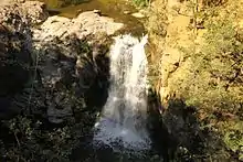 |
| Birch Cooley Battle Field State Memorial Park[4]:15 | 1929 | 1976 | Transferred to Minnesota Historical Society. | 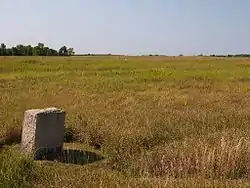 |
| Camp Release State Memorial Wayside[4]:337 | 1889 | 1975 | Redesignated Camp Release State Monument. | 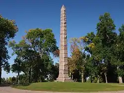 |
| Chippewa Mission State Memorial Wayside[4]:94 | 1931 | 1973 | Transferred to Minnesota Historical Society. | 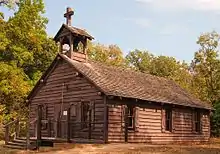 |
| Horace Austin State Park[4]:44[133] | 1913 | 1949 | Transferred to Austin as a city park. |  |
| Garvin Heights State Park[4]:76 | 1922 | 1961 | Transferred to Winona as a city park. | 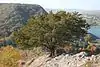 |
| Kaplan Woods State Park[4]:98[134] | 1935 | 1963 | Part demolished to build a highway, remainder transferred to Owatonna as a city park. |  |
| Little Elbow Lake State Park[4]:230 | 1963 | 1989 | Transferred to White Earth Indian Reservation. | |
| Old Crossing Treaty Historic Wayside[4]:96 | 1931 | 1987 | Parts transferred to Red Lake County and University of Minnesota Crookston, remainder added to Huot Wildlife Management Area. |  |
| Oronoco Park (later Oronoco State Scenic Reserve)[4]:130[135] | 1937 | 1965 | Transferred to Olmsted County. |  |
| Pine Tree State Park[4]:165 | 1947 | 1965 | Transferred to Blackduck as a city park. | |
| Pomme de Terre Recreational Reserve[4]:122 | 1937 | 1965 | Transferred to Morris as a city park. |  |
| Sleepy Eye State Park[4]:70 | 1921 | 1965 | Transferred to Sleepy Eye as a city park. | |
| Toqua Lakes State Park[4]:51 | 1921 | 1965 | Transferred to Big Stone County as a county park. | |
| Traverse des Sioux State Park[4]:29 | 1905 | 1981 | Transferred to Minnesota Historical Society and city of St. Peter. | 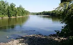 |
| Watson State Wayside[4]:136 | 1941 | 1959 | Transferred to Watson as a city park. |
See also
- List of hiking trails in Minnesota
- List of Minnesota state forests
- List of U.S. national parks
References
- "Welcome to Minnesota State Parks". Minnesota Department of Natural Resources. 2007. Retrieved 2007-09-22.
- "Proposed Lake Vermilion State Park". Minnesota Department of Natural Resources. 2007. Retrieved 2007-09-22.
- "Itasca State Park National Register Listing". Minnesota Historical Society (May 1992 Update). May 1973. Retrieved 2007-09-22.
- Meyer, Roy Willard (1991). Everyone's Country Estate: A History of Minnesota's State Parks. Minnesota Historical Society Press. ISBN 0-87351-266-9.
- "Minnesota Traveler" (PDF). Minnesota State Parks Newsletter. Minnesota Department of Natural Resources. Summer 2007. Archived from the original (PDF) on 2007-06-30. Retrieved 2007-09-22., p. 16.
- "Minnesota's National Register Properties". Minnesota Historical Society. Retrieved 2012-10-31.
- Remington, Harry (March 10, 1935). "CCC Program Spurs Work in State Forest Parks". Star Tribune. p. 28. Retrieved January 9, 2021.
- "Minnesota's Submerged Cultural Resources Preservation Plan". Minnesota Historical Society. June 1997. Retrieved June 7, 2011.
- "Guide to Minnesota State Parks and Trails 2011". Minnesota Department of Natural Resources. 2011. Cite journal requires
|journal=(help) - "Afton State Park". Minnesota Department of Natural Resources. Retrieved 2010-08-22.
- "Banning State Park". Minnesota Department of Natural Resources. Retrieved 2010-08-22.
- "Bear Head Lake State Park". Minnesota Department of Natural Resources. Retrieved 2010-08-22.
- "Beaver Creek Valley State Park". Minnesota Department of Natural Resources. Retrieved 2010-08-22.
- "Big Bog State Recreation Area". Minnesota Department of Natural Resources. Retrieved 2010-08-22.
- "Big Stone Lake State Park". Minnesota Department of Natural Resources. Retrieved 2010-08-22.
- "Blue Mounds State Park". Minnesota Department of Natural Resources. Retrieved 2010-08-22.
- "Blue Mounds State Park". Rustic Style Resources in Minnesota State Parks. Minnesota Historical Society. Retrieved 2011-07-09.
- "Buffalo River State Park". Minnesota Department of Natural Resources. Retrieved 2010-08-22.
- "Buffalo River State Park". Rustic Style Resources in Minnesota State Parks. Minnesota Historical Society. Retrieved 2011-07-09.
- "Camden State Park". Minnesota Department of Natural Resources. Retrieved 2010-08-22.
- "Camden State Park". Rustic Style Resources in Minnesota State Parks. Minnesota Historical Society. Retrieved 2011-07-09.
- "Carley State Park". Minnesota Department of Natural Resources. Retrieved 2010-08-22.
- "Cascade River State Park". Minnesota Department of Natural Resources. Retrieved 2010-08-22.
- "Charles A. Lindbergh State Park". Minnesota Department of Natural Resources. Retrieved 2010-08-22.
- "Charles A. Lindbergh State Park". Rustic Style Resources in Minnesota State Parks. Minnesota Historical Society. Retrieved 2011-07-09.
- "Crow Wing State Park". Minnesota Department of Natural Resources. Retrieved 2010-08-22.
- "Cuyuna Country State Recreation Area". Minnesota Department of Natural Resources. Retrieved 2010-08-22.
- "Father Hennepin State Park". Minnesota Department of Natural Resources. Retrieved 2010-08-22.
- "Afton State Park". Minnesota Department of Natural Resources. Retrieved 2010-08-22.
- "Flandrau State Park". Rustic Style Resources in Minnesota State Parks. Minnesota Historical Society. Retrieved 2011-07-09.
- "Forestville/Mystery Cave State Park". Minnesota Department of Natural Resources. Retrieved 2010-08-22.
- "Fort Ridgely State Park". Minnesota Department of Natural Resources. Retrieved 2010-08-22.
- "Fort Ridgely State Park". Rustic Style Resources in Minnesota State Parks. Minnesota Historical Society. Retrieved 2011-07-09.
- "Fort Snelling State Park". Minnesota Department of Natural Resources. Retrieved 2010-08-22.
- "Franz Jevne State Park". Minnesota Department of Natural Resources. Retrieved 2010-08-22.
- "Frontenac State Park". Minnesota Department of Natural Resources. Retrieved 2010-08-22.
- "Garden Island State Recreation Area". Minnesota Department of Natural Resources. Retrieved 2010-08-22.
- "George H. Crosby Manitou State Park". Minnesota Department of Natural Resources. Retrieved 2010-08-22.
- "Glacial Lakes State Park". Minnesota Department of Natural Resources. Retrieved 2010-08-22.
- "Glendalough State Park". Minnesota Department of Natural Resources. Retrieved 2010-08-22.
- "Gooseberry Falls State Park". Minnesota Department of Natural Resources. Retrieved 2010-08-22.
- "Gooseberry Falls State Park". Rustic Style Resources in Minnesota State Parks. Minnesota Historical Society. Retrieved 2011-07-09.
- "Grand Portage State Park". Minnesota Department of Natural Resources. Retrieved 2010-08-22.
- http://www.dnr.state.mn.us/faq/mnfacts/state_parks.html
- "Great River Bluffs State Park". Minnesota Department of Natural Resources. Retrieved 2010-08-22.
- "Greenleaf Lake State Recreation Area". Minnesota Department of Natural Resources. Retrieved 2010-08-22.
- "Hill-Annex Mine State Park". Minnesota Department of Natural Resources. Retrieved 2010-08-22.
- "Interstate State Park". Minnesota Department of Natural Resources. Retrieved 2010-08-22.
- "Interstate State Park". Rustic Style Resources in Minnesota State Parks. Minnesota Historical Society. Retrieved 2011-07-09.
- "Iron Range Off-Highway Vehicle State Recreation Area". Minnesota Department of Natural Resources. Retrieved 2010-08-22.
- "Itasca State Park". Minnesota Department of Natural Resources. Retrieved 2010-08-22.
- "Jay Cooke State Park". Minnesota Department of Natural Resources. Retrieved 2010-08-22.
- "Jay Cooke State Park". Rustic Style Resources in Minnesota State Parks. Minnesota Historical Society. Retrieved 2011-07-09.
- "John A. Latsch State Park". Minnesota Department of Natural Resources. Retrieved 2010-08-22.
- "Judge C. R. Magney State Park". Minnesota Department of Natural Resources. Retrieved 2010-08-22.
- Zeppelin, Cheri (March–April 2017). "Scientists Solve Geological Puzzle". Minnesota Conservation Volunteer. Retrieved 2017-09-07.
- "Kilen Woods State Park". Minnesota Department of Natural Resources. Retrieved 2010-08-22.
- "La Salle Lake State Recreation Area". Minnesota Department of Natural Resources. Retrieved 2011-11-14.
- "Lac qui Parle State Park". Minnesota Department of Natural Resources. Retrieved 2010-08-22.
- "Lac qui Parle State Park". Rustic Style Resources in Minnesota State Parks. Minnesota Historical Society. Retrieved 2011-07-09.
- "Lake Bemidji State Park". Minnesota Department of Natural Resources. Retrieved 2010-08-22.
- "Lake Bemidji State Park". Rustic Style Resources in Minnesota State Parks. Minnesota Historical Society. Retrieved 2011-07-09.
- "Lake Bronson State Park". Rustic Style Resources in Minnesota State Parks. Minnesota Historical Society. Retrieved 2011-07-09.
- "Lake Carlos State Park". Minnesota Department of Natural Resources. Retrieved 2010-08-22.
- "Lake Carlos State Park". Rustic Style Resources in Minnesota State Parks. Minnesota Historical Society. Retrieved 2011-07-09.
- "Lake Louise State Park". Minnesota Department of Natural Resources. Retrieved 2010-08-22.
- "Lake Maria State Park". Minnesota Department of Natural Resources. Retrieved 2010-08-22.
- "Lake Shetek State Park". Minnesota Department of Natural Resources. Retrieved 2010-08-22.
- "Lake Shetek State Park". Rustic Style Resources in Minnesota State Parks. Minnesota Historical Society. Retrieved 2011-07-09.
- "Lake Vermilion State Park". Minnesota Department of Natural Resources. Retrieved 2010-08-22.
- "Maplewood State Park". Minnesota Department of Natural Resources. Retrieved 2010-08-22.
- "McCarthy Beach State Park". Minnesota Department of Natural Resources. Retrieved 2010-08-22.
- "Mille Lacs Kathio State Park". Minnesota Department of Natural Resources. Retrieved 2010-08-22.
- "Minneopa State Park". Minnesota Department of Natural Resources. Retrieved 2010-08-22.
- "Minnesota Valley State Recreation Area". Minnesota Department of Natural Resources. Retrieved 2010-08-22.
- "Monson Lake State Park". Minnesota Department of Natural Resources. Retrieved 2010-08-22.
- "Monson Lake State Park". Rustic Style Resources in Minnesota State Parks. Minnesota Historical Society. Retrieved 2011-07-09.
- "Moose Lake State Park". Minnesota Department of Natural Resources. Retrieved 2010-08-22.
- "Myre-Big Island State Park". Minnesota Department of Natural Resources. Retrieved 2010-08-22.
- "Nerstrand-Big Woods State Park". Minnesota Department of Natural Resources. Retrieved 2010-08-22.
- "Old Mill State Park". Minnesota Department of Natural Resources. Retrieved 2010-08-22.
- "Old Mill State Park". Rustic Style Resources in Minnesota State Parks. Minnesota Historical Society. Retrieved 2011-07-09.
- "Red River State Recreation Area". Minnesota Department of Natural Resources. Retrieved 2010-08-22.
- "Rice Lake State Park". Minnesota Department of Natural Resources. Retrieved 2010-08-22.
- "St. Croix State Park". Minnesota Department of Natural Resources. Retrieved 2010-08-22.
- "Sakatah Lake State Park". Minnesota Department of Natural Resources. Retrieved 2010-08-22.
- "Savanna Portage State Park". Minnesota Department of Natural Resources. Retrieved 2010-08-22.
- "Scenic State Park". Rustic Style Resources in Minnesota State Parks. Minnesota Historical Society. 2001. Retrieved 2007-09-22.
- "Schoolcraft State Park". Minnesota Department of Natural Resources. Retrieved 2010-08-22.
- "Sibley State Park". Minnesota Department of Natural Resources. Retrieved 2010-08-22.
- "Sibley State Park". Rustic Style Resources in Minnesota State Parks. Minnesota Historical Society. Retrieved 2011-07-09.
- "Soudan Underground Mine State Park". Minnesota Department of Natural Resources. Retrieved 2010-08-22.
- "Split Rock Creek State Park". Minnesota Department of Natural Resources. Retrieved 2010-08-22.
- "Split Rock Lighthouse State Park". Minnesota Department of Natural Resources. Retrieved 2010-08-22.
- "Temperance River State Park". Minnesota Department of Natural Resources. Retrieved 2010-08-22.
- "Tettegouche State Park". Minnesota Department of Natural Resources. Retrieved 2010-08-22.
- "Upper Sioux Agency State Park". Minnesota Department of Natural Resources. Retrieved 2010-08-22.
- "Whitewater State Park". Minnesota Department of Natural Resources. Retrieved 2010-08-22.
- "Whitewater State Park". Rustic Style Resources in Minnesota State Parks. Minnesota Historical Society. Retrieved 2011-07-09.
- "Wild River State Park". Minnesota Department of Natural Resources. Retrieved 2010-08-22.
- "Wild River State Park Management Plan" (PDF). Minnesota Department of Natural Resources. February 2007. Retrieved 2012-05-08.
- "William O'Brien State Park". Minnesota Department of Natural Resources. Retrieved 2010-08-22.
- "Zippel Bay State Park". Minnesota Department of Natural Resources. Retrieved 2010-08-22.
- "State Park Waysides: Minnesota DNR". Minnesota Department of Natural Resources. Retrieved June 7, 2011.
- Minnesota Statute § 85.013, Minnesota Revisor of Statutes.
- Devine, Mary (2016-06-30). "Scenic St. Croix River park reopening after 2-month takeover". St. Paul Pioneer Press. Retrieved 2016-09-03.
- "Arrowhead State Trail". Minnesota Department of Natural Resources. Retrieved 2010-08-22.
- "Blazing Star State Trail". Minnesota Department of Natural Resources. Retrieved 2010-08-22.
- "Harmony-Preston Valley Segment". Minnesota Department of Natural Resources. Retrieved 2010-08-22.
- "Root River Segment". Minnesota Department of Natural Resources. Retrieved 2010-08-22.
- "Casey Jones State Trail". Minnesota Department of Natural Resources. Retrieved 2010-08-22.
- "Central Lakes State Trail". Minnesota Department of Natural Resources. Retrieved 2010-08-22.
- "Cuyuna Lakes State Trail". Minnesota Department of Natural Resources. Retrieved 2010-08-22.
- "Douglas State Trail". Minnesota Department of Natural Resources. Retrieved 2010-08-22.
- "Gateway State Trail". Minnesota Department of Natural Resources. Retrieved 2010-08-22.
- "Gitchi-Gami State Trail". Minnesota Department of Natural Resources. Retrieved 2010-08-22.
- "Glacial Lakes State Trail". Minnesota Department of Natural Resources. Retrieved 2010-08-22.
- "Goodhue Pioneer State Trail". Minnesota Department of Natural Resources. Retrieved 2010-08-22.
- "Great River Ridge State Trail". Minnesota Department of Natural Resources. Retrieved 2010-08-22.
- "Heartland State Trail". Minnesota Department of Natural Resources. Retrieved 2010-08-22.
- Steve Brandt (2015-10-09). "Section by section, Luce Line Trail dream realized". Star Tribune. Retrieved 2016-09-13.
- "Luce Line State Trail". Minnesota Department of Natural Resources. Retrieved 2010-08-22.
- Brad Phenow. "DNR continues to negotiate land purchase for Mill Towns Trail in Rice County". Faribault Daily News. Retrieved 2015-01-28.
- "Minnesota Valley State Trail". Minnesota Department of Natural Resources. Retrieved 2010-08-22.
- "North Shore State Trail". Minnesota Department of Natural Resources. Retrieved 2010-08-22.
- "Paul Bunyan State Trail". Minnesota Department of Natural Resources. Retrieved 2010-08-22.
- "Sakatah Singing Hills State Trail". Minnesota Department of Natural Resources. Retrieved 2010-08-22.
- "Shooting Star State Trail". Minnesota Department of Natural Resources. Retrieved 2010-08-22.
- "Taconite State Trail". Minnesota Department of Natural Resources. Retrieved 2010-08-22.
- "Willard Munger State Trail". Minnesota Department of Natural Resources. Retrieved 2010-08-22.
- "Statute 85.015". Minnesota Legislature. Retrieved 2016-02-24.
- "1957 Minn. Laws ch. 230". 2006 Minnesota Statutes sec. 810. Office of the Revisor of Statutes. Retrieved 2007-09-22.
- "1949 Minn. Laws ch. 425, sec. 1; 1959 Minn. Laws ch. 4, secs. 1,2". 2006 Minnesota Statutes sec. 812. Office of the Revisor of Statutes. Retrieved 2007-09-22.
- "Kaplan Woods Parkway". Parks & Recreation. City of Owatonna. Archived from the original on 2007-09-16. Retrieved 2007-09-22.
- "1965 Minn. Laws ch. 810, sec. 9". 2006 Minnesota Statutes sec. 816. Office of the Revisor of Statutes. Retrieved 2007-09-22.
Further reading
External links
| Wikimedia Commons has media related to State parks of Minnesota. |
- Minnesota State Parks on the Department of Natural Resources website
- 2006 Minnesota Statute sec. 85.012 State parks—statutory list
- Minnesota State Park System—Legislative Auditor Report
