Carver County, Minnesota
Carver County is a county in the U.S. state of Minnesota. As of the 2010 United States Census, the population was 91,042.[2] Its county seat is Chaska.[3] Carver County is named for explorer Jonathan Carver, who in 1766–67, traveled from Boston to the Minnesota River, and wintered among the Sioux near the site of New Ulm.[4] Carver County is part of the Minneapolis-St. Paul-Bloomington, MN-WI Metropolitan Statistical Area.
Carver County | |
|---|---|
.jpg.webp) Carver County Sheriff's Office and Justice Center in Chaska, Minnesota | |
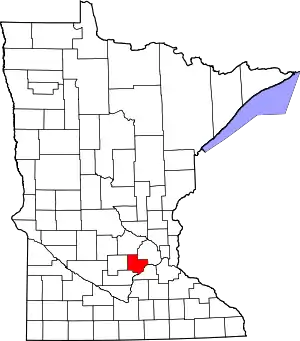 Location within the U.S. state of Minnesota | |
 Minnesota's location within the U.S. | |
| Coordinates: 44°49′N 93°48′W | |
| Country | |
| State | |
| Founded | February 20, 1855[1] |
| Named for | Jonathan Carver |
| Seat | Chaska |
| Largest city | Chaska |
| Area | |
| • Total | 376 sq mi (970 km2) |
| • Land | 354 sq mi (920 km2) |
| • Water | 22 sq mi (60 km2) 5.8%% |
| Population (2010) | |
| • Total | 91,042 |
| • Estimate (2020) | 106,691 |
| • Density | 288/sq mi (111/km2) |
| Time zone | UTC−6 (Central) |
| • Summer (DST) | UTC−5 (CDT) |
| Congressional districts | 3rd, 6th |
| Website | www.co.carver.mn.us |
Statistics
In 2017, Carver County was ranked by the Robert Wood Johnson Foundation as the healthiest county in the State of Minnesota for the fifth year in a row.[5][6][7][8][9][10] The foundation explained health outcomes represent “how healthy counties are within the state,” whereas health factors represent “an estimate of the future health of counties as compared with other counties within a state,” based on health behaviors, clinical care, and other environmental factors.[10] Carver County continued to rank as the number one healthiest county throughout the state for 2018,[11] 2019,[12] and 2020.[13]
In 2018, Carver County was ranked as the #1 "Happiest Place in America" according to a study conducted by the data firm Smart Asset.[14] Carver County was one of three United States counties to receive a top 5 ranking for the third straight year.[14] The other two counties were Loudoun and Fairfax counties in Virginia.[14] The study compared counties across the country using the following eight factors: unemployment rate, poverty rate, affordability ratio, marriage rate, divorce rate, bankruptcy rate, life expectancy, and physical activity rate.[14] In particular, Carver County scored well thanks to strong economic conditions with an unemployment rate of only 3.1% and a poverty rate of only 4.1%.[14] Additionally, according to the data, 62% of residents were married and only 8% divorced.[14] In each of those metrics, Carver ranked in the top 40 across the nation.[14]
Geography
The Minnesota River flows east-northeasterly along the county's southern border. The South Fork of the Crow River flows northeasterly through the upper western and central portions of the county. Carver Creek flows southeasterly from the county's central area, discharging into the Minnesota at the county's southern border. The terrain consists of low rolling hills, dotted with lakes in the eastern portion. The area is devoted to agriculture.[15]
The terrain slopes to the east and south, with its northwest corner at 1,024' (312m) ASL.[17] A small hill 1.6 miles (2.6 km) northeast of Miller Lake[15] rises to 1,080' (329m) ASL, for the county's highest point.[18]
The county has a total area of 376 square miles (970 km2), of which 354 square miles (920 km2) is land and 22 square miles (57 km2) (5.8%) is water.[19] It is Minnesota's second-smallest county by land area and third-smallest by total area.
Carver is one of seven southern Minnesota counties with no forest soils; only prairie ecosystems of savannas and prairies can be found in Carver County. It is also one of 17 Minnesota counties where savanna soils dominate.
Lakes
Carver County is home to seven lakes of 235 acres or larger. The largest is Lake Waconia, Minnesota's 73rd largest lake and the Twin Cities' second largest lake, with an area of 2,996 acres.[20]

| Township | Lakes |
|---|---|
| Benton Township | Barlous Lake, Benton Lake, Maria Lake, Meuwissen Lake, Myers Lake, Rice Lake, Winkler Lake |
| Camden Township | Berliner Lake, Eagle Lake, Smith Lake |
| Dahlgren Township | Aue Lake |
| Hancock Township | Assumption Lake, Gaystock Lake, Maria Lake, Miller Lake, |
| Hollywood Township | Lippert Lake |
| Laketown Township | Carl Krey Lake, Lake Auburn, Lake Virginia, Lake Waconia, Lake Zumbra, Lunsten Lake, Marsh Lake, Parley Lake, Piersons Lake, Reitz Lake, Schutz Lake, Stieger Lake, Sunny Lake, Turbid Lake, Wasserman Lake, Lake Bavaria |
| San Francisco Township | Hallquist Lake, Kelly Lake, Long Lake, Scott Lake, |
| Waconia Township | Burandt Lake, Donders Lake, Goose Lake, Hydes Lake, Lake Minnewashta, Lake Patterson, Lake Waconia, Rutz Lake, Swan Lake |
| Watertown Township | Buck Lake, Goose Lake, Lippert Lake, Mud Lake, Oak Lake, Swede Lake |
| Young America Township | Barnes Lake, Brand Lake, Braunworth Lake, Tiger Lake, Young America Lake |
Major highways
.svg.png.webp) U.S. Highway 212
U.S. Highway 212 Minnesota State Highway 5
 Minnesota State Highway 7
 Minnesota State Highway 25
 Minnesota State Highway 41
 Minnesota State Highway 284
- Carver County Road 10
- Carver County Road 11
- Carver County Road 33
- Other county roads
Adjacent counties
- Wright County – north
- Hennepin County – northeast
- Scott County – southeast
- Sibley County – southwest
- McLeod County – west
Protected areas[15]
- Assumption State Wildlife Management Area
- Carver Park Preserve
- Gravel Pit State Wildlife Management Area
- Lake Minnewashta Regional Park
- Minnesota Landscape Arboretum
- Minnesota Valley National Wildlife Refuge (part)
- Minnesota Valley State Recreation Area (part)
- Waconia State Wildlife Management Area
Climate and weather
In recent years, average temperatures in the county seat of Chaska have ranged from a low of 4 °F (−16 °C) in January to a high of 81 °F (27 °C) in July, although a record low of −41 °F (−41 °C) was recorded in January 1970 and a record high of 105 °F (41 °C) was recorded in July 1988. Average monthly precipitation ranged from 0.66 inches (17 mm) in February to 5.05 inches (128 mm) in August.[21]
Climate chart for Carver County, Minnesota | ||||||||||||||||||||||||||||||||||||||||||||||||||||||||||||||||||||||||||||||||||||||||||||||||||||||||||||||||||||||||||||
|---|---|---|---|---|---|---|---|---|---|---|---|---|---|---|---|---|---|---|---|---|---|---|---|---|---|---|---|---|---|---|---|---|---|---|---|---|---|---|---|---|---|---|---|---|---|---|---|---|---|---|---|---|---|---|---|---|---|---|---|---|---|---|---|---|---|---|---|---|---|---|---|---|---|---|---|---|---|---|---|---|---|---|---|---|---|---|---|---|---|---|---|---|---|---|---|---|---|---|---|---|---|---|---|---|---|---|---|---|---|---|---|---|---|---|---|---|---|---|---|---|---|---|---|---|
| ||||||||||||||||||||||||||||||||||||||||||||||||||||||||||||||||||||||||||||||||||||||||||||||||||||||||||||||||||||||||||||
Demographics
| Historical population | |||
|---|---|---|---|
| Census | Pop. | %± | |
| 1860 | 5,106 | — | |
| 1870 | 11,586 | 126.9% | |
| 1880 | 14,140 | 22.0% | |
| 1890 | 16,532 | 16.9% | |
| 1900 | 17,544 | 6.1% | |
| 1910 | 17,455 | −0.5% | |
| 1920 | 16,946 | −2.9% | |
| 1930 | 16,936 | −0.1% | |
| 1940 | 17,606 | 4.0% | |
| 1950 | 18,155 | 3.1% | |
| 1960 | 21,358 | 17.6% | |
| 1970 | 28,331 | 32.6% | |
| 1980 | 37,046 | 30.8% | |
| 1990 | 47,915 | 29.3% | |
| 2000 | 70,205 | 46.5% | |
| 2010 | 91,042 | 29.7% | |
| 2020 (est.) | 106,691 | [22] | 17.2% |
| US Decennial Census[23] 1790–1960[24] 1900–1990[25] 1990–2000[26] 2010–2019[2] | |||
2010
The ethnic makeup of the county, according to the 2010 census, was the following:
- 93.7% White
- 1.5% Black
- 0.3% American Indian
- 2.9% Asian
- 0.0% Native Hawaiian or Pacific Islander
- 1.6% Two or more races
- 0.3% Other races
- 4.1% Hispanic or Latino (of any race)
There were 33,486 households, out of which 42.1% had children under the age of 18 living with them, 62.9% were married couples living together, 7.6% had a female householder with no husband present, and 25.9% were non-families. 21.0% of all households were made up of individuals, and 6.9% had someone living alone who was 65 years of age or older. The average household size was 2.74 and the average family size was 3.22.
The median income for a household in the county was $83,773, and the median income for a family was $96,913. Males had a median income of $66,150 versus $46,696 for females. The per capita income for the county was $37,457. About 3.3% of families and 4.9% of the population were below the poverty line, including 5.5% of those under age 18 and 7.8% of those age 65 or over.[27]
2000
As of the 2000 United States Census, there were 70,205 people, 24,356 households, and 18,778 families in the county. The population density was 198/sqmi (76.6/km2). There were 24,883 housing units at an average density of 70.3/sqmi (27.1/km2). The racial makeup of the county was 95.95% White, 0.59% Black or African American, 0.18% Native American, 1.56% Asian, 0.01% Pacific Islander, 0.87% from other races, and 0.82% from two or more races. 2.55% of the population were Hispanic or Latino of any race. 44.3% were of German, 12.1% Norwegian, 7.1% Irish and 6.2% Swedish ancestry.
There were 24,356 households, out of which 45.20% had children under the age of 18 living with them, 66.40% were married couples living together, 7.30% had a female householder with no husband present, and 22.90% were non-families. 18.10% of all households were made up of individuals, and 6.10% had someone living alone who was 65 years of age or older. The average household size was 2.84 and the average family size was 3.26.
The county population contained 31.50% under the age of 18, 6.90% from 18 to 24, 34.70% from 25 to 44, 19.50% from 45 to 64, and 7.50% who were 65 years of age or older. The median age was 34 years. For every 100 females there were 100.00 males. For every 100 females age 18 and over, there were 98.00 males.
The median income for a household in the county was $65,540, and the median income for a family was $73,577 (these figures had risen to $78,035 and $89,100 respectively as of a 2007 estimate). Males had a median income of $47,271 versus $32,107 for females. The per capita income for the county was $28,486. About 2.30% of families and 3.50% of the population were below the poverty line, including 3.60% of those under age 18 and 6.90% of those age 65 or over.
Government and politics
Government
Like all counties in Minnesota, Carver is governed by an elected and nonpartisan board of commissioners. Each commissioner represents a district of approximately equal population.
County commissioners
The county commission elects a chair who presides at meetings. Commissioners as of January 2020:[28]
| District | Commissioner | In office since | Next election | Area served |
|---|---|---|---|---|
| 1st | Gayle O. Degler (Vice Chair)[29] | 2002 | 2022 | Chaska, Chanhassen |
| 2nd | Tom Workman[30] | 2002 | 2022 | Chanhassen, Victoria |
| 3rd | Matt Udermann[31][32] | 2020 | 2024 | Chaska, Victoria |
| 4th | Tim Lynch (Chairperson)[33] | 2004 | 2022 | Hollywood Twp, Watertown Twp, Waconia Twp, Mayer, Waconia, Watertown |
| 5th | John P. Fahey[32][34] | 2020 | 2024 | Benton Twp, Camden Twp, Dalgren Twp, Hancock Twp, Laketown Twp, San Francisco Twp, Young America Twp, Carver, Cologne, Hamburg, New Germany, Norwood Young America |
Politics
As Carver County becomes more suburban and less rural in character, with 90% of its residents now living in its cities, it is becoming more of a battleground territory, especially in the eastern half of the county and in its two largest cities, Chaska and Chanhassen. Traditionally, the county has tended to vote for Republicans. Since World War II, the county has never voted for a Democratic candidate for president. The last time Carver County voted for a Democrat was in 1932, Franklin D. Roosevelt's landslide win against incumbent Herbert Hoover,[35] and the only other occurrence since 1896 was Woodrow Wilson in 1912, when the Republicans were bitterly divided. Since 1944, the only time Carver County voted for a non-Republican candidate in a gubernatorial race was in 1998, Jesse Ventura’s third-party upset.[36] Since 1932, a Democrat has only won as much as 40 percent of the vote five times.
Carver County is split between two congressional districts. The eastern area, adjacent to Hennepin County and Scott County and including Chaska and Chanhassen, is in Minnesota's 3rd congressional district (CPVI D+1); the remainder of the county is in Minnesota's 6th congressional district (CPVI R+12).
| Year | Republican | Democratic | Third parties |
|---|---|---|---|
| 2020 | 51.3% 34,009 | 46.4% 30,774 | 2.3% 1,578 |
| 2016 | 52.2% 29,056 | 38.6% 21,508 | 9.2% 5,132 |
| 2012 | 58.9% 31,155 | 39.2% 20,745 | 1.9% 999 |
| 2008 | 56.7% 28,156 | 41.6% 20,654 | 1.8% 873 |
| 2004 | 62.8% 28,510 | 36.2% 16,456 | 1.0% 445 |
| 2000 | 59.4% 20,790 | 35.6% 12,462 | 5.1% 1,769 |
| 1996 | 44.0% 12,380 | 41.0% 11,554 | 15.0% 4,234 |
| 1992 | 38.3% 10,201 | 31.4% 8,349 | 30.3% 8,054 |
| 1988 | 59.2% 12,560 | 39.8% 8,439 | 1.1% 229 |
| 1984 | 63.6% 11,963 | 35.8% 6,725 | 0.6% 121 |
| 1980 | 53.6% 9,909 | 35.8% 6,621 | 10.6% 1,951 |
| 1976 | 50.2% 8,199 | 46.3% 7,574 | 3.5% 574 |
| 1972 | 61.5% 8,546 | 34.9% 4,852 | 3.7% 507 |
| 1968 | 56.4% 6,649 | 39.0% 4,590 | 4.6% 541 |
| 1964 | 51.4% 5,424 | 48.5% 5,123 | 0.1% 11 |
| 1960 | 60.9% 6,231 | 38.9% 3,982 | 0.1% 14 |
| 1956 | 72.5% 6,226 | 27.2% 2,334 | 0.3% 29 |
| 1952 | 75.4% 6,674 | 24.4% 2,159 | 0.2% 15 |
| 1948 | 61.2% 4,582 | 37.6% 2,816 | 1.1% 84 |
| 1944 | 78.4% 5,823 | 21.1% 1,565 | 0.5% 39 |
| 1940 | 78.6% 6,528 | 21.1% 1,753 | 0.3% 22 |
| 1936 | 42.4% 3,095 | 38.6% 2,814 | 19.0% 1,383 |
| 1932 | 36.3% 2,508 | 62.7% 4,328 | 1.0% 66 |
| 1928 | 57.7% 3,983 | 41.8% 2,885 | 0.5% 33 |
| 1924 | 40.2% 2,214 | 6.5% 358 | 53.3% 2,936 |
| 1920 | 87.3% 5,073 | 9.7% 562 | 3.0% 175 |
| 1916 | 65.6% 1,950 | 32.3% 960 | 2.2% 64 |
| 1912 | 26.9% 742 | 36.5% 1,008 | 36.6% 1,012[38] |
| 1908 | 60.0% 1,739 | 38.0% 1,101 | 2.0% 57 |
| 1904 | 70.4% 1,735 | 27.3% 672 | 2.3% 56 |
| 1900 | 59.5% 1,775 | 38.4% 1,146 | 2.0% 60 |
| 1896 | 58.3% 1,856 | 39.8% 1,268 | 2.0% 62 |
| 1892 | 40.4% 1,191 | 49.5% 1,462 | 10.1% 299 |
| Position | Name | Affiliation | District | |
|---|---|---|---|---|
| Senate | David Osmek[39] | Republican | District 33 | |
| Senate | Scott Jensen[40] | Republican | District 47 | |
| House of Representatives | Kelly Morrison[41] | Democrat | District 33B | |
| House of Representatives | Jim Nash[42] | Republican | District 47A | |
| House of Representatives | Greg Boe[43] | Republican | District 47B | |
| Position | Name | Affiliation | District | |
|---|---|---|---|---|
| House of Representatives | Dean Phillips[44] | Democrat | 3rd | |
| House of Representatives | Tom Emmer[45] | Republican | 6th | |
| Senate | Amy Klobuchar[46] | Democrat | N/A | |
| Senate | Tina Smith[47] | Democrat | N/A | |
Communities
Cities
Unincorporated communities[15]
- Assumption
- Augusta
- Bongards
- Coney Island
- Crown College
- Dahlgren
- East Union
- Gotha
- Hazelton
- Hollywood
- Maple
- Oster
- San Francisco (ghost town)
Notable residents
- Arc Carnes (artist) -
References
- "Minnesota Place Names". Minnesota Historical Society. Archived from the original on June 20, 2012. Retrieved March 17, 2014.
- "State & County QuickFacts". United States Census Bureau. Archived from the original on July 8, 2011. Retrieved August 31, 2013.
- "Find a County". National Association of Counties. Archived from the original on May 31, 2011. Retrieved June 7, 2011.
- Gannett, Henry (1905). The Origin of Certain Place Names in the United States. Govt. Print. Off. p. 70.
- "Minnesota Health Outcomes - Overall Rank". County Health Rankings & Roadmaps. County Health Rankings. 2017. Retrieved November 19, 2020.
- "Minnesota Health Outcomes - Overall Rank". County Health Rankings & Roadmaps. County Health Rankings. 2016. Retrieved November 19, 2020.
- "Minnesota Health Outcomes - Overall Rank". County Health Rankings & Roadmaps. County Health Rankings. 2015. Retrieved November 19, 2020.
- "Minnesota Health Outcomes - Overall Rank". County Health Rankings & Roadmaps. County Health Rankings. 2014. Retrieved November 19, 2020.
- "Minnesota Health Outcomes - Overall Rank". County Health Rankings & Roadmaps. County Health Rankings. 2013. Retrieved November 19, 2020.
- Raddatz, Kate (March 29, 2017). "Carver County Ranked As Minnesota's Healthiest". CBS Local. CBS Minnesota. Retrieved November 19, 2020.
- "Minnesota Health Outcomes - Overall Rank". County Health Rankings & Roadmaps. County Health Rankings. 2018. Retrieved November 19, 2020.
- "Minnesota Health Outcomes - Overall Rank". County Health Rankings & Roadmaps. County Health Rankings. 2019. Retrieved November 19, 2020.
- "Minnesota Health Outcomes - Overall Rank". County Health Rankings & Roadmaps. County Health Rankings. 2020. Retrieved November 19, 2020.
- Miller, Derek (June 12, 2018). "The Happiest Places in America – 2018 Edition". Smart Asset. Smart Asset. Retrieved November 19, 2020.
- Carver County MN Google Maps (accessed 6 March 2019)
- Nelson, Steven (2011). Savanna Soils of Minnesota. Minnesota: Self. pp. 49–52. ISBN 978-0-615-50320-2.
- ""Find an Altitude/Carver County MN" Google Maps (accessed 6 March 2019)". Archived from the original on May 21, 2019. Retrieved March 6, 2019.
- Carver County High Point, Minnesota. PeakBagger.com (accessed May 5, 2019)
- "2010 Census Gazetteer Files". US Census Bureau. August 22, 2012. Archived from the original on October 6, 2014. Retrieved October 6, 2014.
- "Fisheries Lake Surveys – MN Dept of Natural Resources". www.dnr.state.mn.us. Retrieved April 17, 2018.
- "Monthly Averages for Chaska MN". The Weather Channel. Retrieved November 6, 2011.
- "Population and Housing Unit Estimates". Retrieved March 26, 2020.
- "US Decennial Census". US Census Bureau. Archived from the original on April 12, 2013. Retrieved October 6, 2014.
- "Historical Census Browser". University of Virginia Library. Retrieved October 6, 2014.
- "Population of Counties by Decennial Census: 1900 to 1990". US Census Bureau. Retrieved October 6, 2014.
- "Census 2000 PHC-T-4. Ranking Tables for Counties: 1990 and 2000" (PDF). US Census Bureau. Retrieved October 6, 2014.
- "Archived copy". Archived from the original on June 7, 2011. Retrieved December 8, 2018.CS1 maint: archived copy as title (link)
- "County Board of Commissioners". Carver County, MN. Retrieved January 16, 2020.
- "Gayle Degler, Vice Chair (District 1)". Carver County, MN. Retrieved January 16, 2020.
- "Tom Workman (District 2)". Carver County, MN. Retrieved January 16, 2020.
- "Matt Udermann, (District 3)". Carver County, MN. Retrieved January 16, 2020.
- "2020 Primary Election Results". Retrieved January 16, 2020.
- "Tim Lynch, Chair (District 4)". Carver County, MN. Retrieved January 16, 2020.
- "John P. Fahey, (District 5)". Carver County, MN. Retrieved January 16, 2020.
- Sullivan, Robert David; ‘How the Red and Blue Map Evolved Over the Past Century’; America Magazine in The National Catholic Review; June 29, 2016
- "Election Results – Minnesota Legislative Reference Library". www.leg.state.mn.us. Retrieved April 17, 2018.
- Leip, David. "Atlas of US Presidential Elections". uselectionatlas.org. Retrieved April 17, 2018.
- The leading "other" candidate, Progressive Theodore Roosevelt, received 933 votes, while Socialist candidate Eugene Debs received 41 votes, Prohibition candidate Eugene Chafin received 30 votes, and Socialist Labor candidate Arthur Reimer received 8 votes.
- "MN State Senate". www.senate.mn. Retrieved June 25, 2020.
- "MN State Senate". www.senate.mn. Retrieved June 25, 2020.
- "Rep. Kelly Morrison (33B) – Minnesota House of Representatives". www.house.leg.state.mn.us. Retrieved June 25, 2020.
- "Rep. Jim Nash (47A) – Minnesota House of Representatives". www.house.leg.state.mn.us. Retrieved June 25, 2020.
- "Rep. Greg Boe (47B) – Minnesota House of Representatives". www.house.leg.state.mn.us. Retrieved June 25, 2020.
- "Representative Dean Phillips". Representative Dean Phillips. Retrieved June 25, 2020.
- "Congressman Tom Emmer". Congressman Tom Emmer. Retrieved June 25, 2020.
- "U.S. Senator Amy Klobuchar". www.klobuchar.senate.gov. Retrieved June 24, 2020.
- "Home". Senator Tina Smith. Retrieved June 24, 2020.
External links
| Wikimedia Commons has media related to Carver County, Minnesota. |
Places adjacent to Carver County, Minnesota | ||||||||||
|---|---|---|---|---|---|---|---|---|---|---|
| ||||||||||
Municipalities and communities of Carver County, Minnesota, United States | ||
|---|---|---|
| Cities | Map of Minnesota highlighting Carver County | |
| Townships | ||
| Unincorporated communities | ||
| Ghost town | ||
| Footnotes | ‡This populated place also has portions in an adjacent county or counties | |
| ||

| Authority control |
|---|