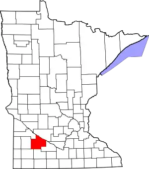
Redwood County, Minnesota
Redwood County is a county in the U.S. state of Minnesota. As of the 2010 United States Census the population was 16,059.[1] Its county seat is Redwood Falls, along the Redwood River near its confluence with the Minnesota River.[2]
Redwood County | |
|---|---|
 Location within the U.S. state of Minnesota | |
 Minnesota's location within the U.S. | |
| Coordinates: 44°24′N 95°15′W | |
| Country | |
| State | |
| Founded | February 6, 1862 |
| Named for | Redwood River |
| Seat | Redwood Falls |
| Largest city | Redwood Falls |
| Area | |
| • Total | 882 sq mi (2,280 km2) |
| • Land | 879 sq mi (2,280 km2) |
| • Water | 3.2 sq mi (8 km2) 0.4%% |
| Population (2010) | |
| • Total | 16,059 |
| • Estimate (2019) | 15,170 |
| • Density | 17.4/sq mi (6.7/km2) |
| Time zone | UTC−6 (Central) |
| • Summer (DST) | UTC−5 (CDT) |
| Congressional district | 7th |
| Website | www |
The Lower Sioux Indian Reservation (also known as the Mdewakankton Tribal Reservation) is entirely within the county, along the southern bank of the Minnesota River in Paxton and Sherman townships. In the 2000 census it had a population of 335.
History
The Minnesota Legislature created the county on February 8, 1862, with Redwood Falls as the county seat. It was named for the Redwood River, which flows eastward through the county.[3]
Geography
The Minnesota River flows southeast along the county's northeastern border. The Redwood River flows east through the upper part of the county, draining into the Minnesota near Redwood Falls. The Cottonwood River flows east through the lower part of the county, entering adjacent Brown County before discharging into the Minnesota. The county terrain consists of rolling hills, carved with drainages and sprinkled with lakes.[4] The largely rural area is devoted to commodity crops of corn and soybeans. The terrain slopes to the east, with its highest point in the southwest corner at 1,450' (442m) ASL.[5] The county has a total area of 882 square miles (2,280 km2), of which 879 square miles (2,280 km2) is land and 3.2 square miles (8.3 km2) (0.4%) is water.[6]
Airports[4]
- Redwood Falls Municipal Airport (RWF)
Major highways
 U.S. Highway 14
 U.S. Highway 71
 Minnesota State Highway 19
 Minnesota State Highway 67
 Minnesota State Highway 68
 Minnesota State Highway 330
Adjacent counties
- Renville County - northeast
- Brown County - east
- Cottonwood County - south
- Murray County - southwest
- Lyon County - west
- Yellow Medicine County - northwest
Lakes[4]
- Daubs Lake
- Gales Lake
- Lake Francis
- Lake Redwood
- Long Lake
- Three Lakes
- Tiger Lake
Protected areas[4]
- Alexander Ramsey State Park
- Cedar Mountain Scientific and Natural Area
- Cedar Rock Scientific and Natural Area
- Daubs Lake State Wildlife Management Area
- Delhi State Wildlife Management Area
- Gales State Wildlife Management Area
- Honner State Wildlife Management Area
- Klabunde State Wildlife Management Area
- Luescher-Barnum State Wildlife Management Area
- Mammenga State Wildlife Management Area
- Paul State Wildlife Management Area
- Rohlik State Wildlife Management Area
- Swedes Forest Scientific and Natural Area (part)
- Waterbury State Wildlife Management Area
- Westline State Wildlife Management Area
- Willow Lake State Wildlife Management Area
Demographics
| Historical population | |||
|---|---|---|---|
| Census | Pop. | %± | |
| 1870 | 1,829 | — | |
| 1880 | 5,375 | 193.9% | |
| 1890 | 9,886 | 83.9% | |
| 1900 | 17,261 | 74.6% | |
| 1910 | 18,425 | 6.7% | |
| 1920 | 20,908 | 13.5% | |
| 1930 | 20,620 | −1.4% | |
| 1940 | 22,290 | 8.1% | |
| 1950 | 22,127 | −0.7% | |
| 1960 | 21,718 | −1.8% | |
| 1970 | 20,024 | −7.8% | |
| 1980 | 19,341 | −3.4% | |
| 1990 | 17,254 | −10.8% | |
| 2000 | 16,815 | −2.5% | |
| 2010 | 16,059 | −4.5% | |
| 2019 (est.) | 15,170 | [8] | −5.5% |
| US Decennial Census[9] 1790-1960[10] 1900-1990[11] 1990-2000[12] 2010-2019[1] | |||
2000 census
As of the 2000 United States Census, the county had 16,815 people, 6,674 households, and 4,524 families. The population density was 19.1/sqmi (7.39/km2). There were 7,230 housing units at an average density of 8.23/sqmi (3.18/km2). The county's racial makeup was 94.97% White, 0.13% Black or African American, 3.24% Native American, 0.32% Asian, 0.07% Pacific Islander, 0.43% from other races, and 0.85% from two or more races. 1.14% of the population were Hispanic or Latino of any race. 55.8% were of German and 13.7% Norwegian ancestry.
There were 6,674 households, of which 31.50% had children under the age of 18 living with them, 57.30% were married couples living together, 7.10% had a female householder with no husband present, and 32.20% were non-families. 28.80% of all households were made up of individuals, and 14.70% had someone living alone who was 65 years of age or older. The average household size was 2.44 and the average family size was 3.02.
26.50% of the county's population was under age 18, 6.60% was from age 18 to 24, 24.80% was from age 25 to 44, 22.70% was from age 45 to 64, and 19.30% was age 65 or older. The median age was 40 years. For every 100 females there were 99.70 males. For every 100 females age 18 and over, there were 96.50 males.
The county's median household income was $37,352, and the median family income was $46,250. Males had a median income of $30,251 versus $21,481 for females. The county's per capita income was $18,903. About 5.50% of families and 7.70% of the population were below the poverty line, including 8.30% of those under age 18 and 8.80% of those age 65 or over.
Communities
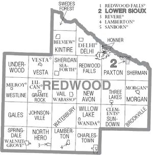
Cities
Townships
- Brookville Township
- Charlestown Township
- Delhi Township
- Gales Township
- Granite Rock Township
- Honner Township
- Johnsonville Township
- Kintire Township
- Lamberton Township
- Morgan Township
- New Avon Township
- North Hero Township
- Paxton Township
- Redwood Falls Township
- Sheridan Township
- Sherman Township
- Springdale Township
- Sundown Township
- Swedes Forest Township
- Three Lakes Township
- Underwood Township
- Vail Township
- Vesta Township
- Waterbury Township
- Westline Township
- Willow Lake Township
Politics
Redwood County is a reliably Republican precinct. In only one national election since 1948 has the county selected the Democratic Party candidate (as of 2016).
| Year | Republican | Democratic | Third parties |
|---|---|---|---|
| 2016 | 67.5% 5,137 | 24.8% 1,887 | 7.7% 587 |
| 2012 | 58.7% 4,570 | 38.6% 3,008 | 2.7% 212 |
| 2008 | 55.2% 4,308 | 41.6% 3,250 | 3.2% 248 |
| 2004 | 60.2% 4,898 | 38.1% 3,104 | 1.7% 137 |
| 2000 | 59.2% 4,589 | 34.6% 2,681 | 6.2% 478 |
| 1996 | 47.1% 3,700 | 38.2% 2,997 | 14.7% 1,154 |
| 1992 | 38.2% 3,408 | 30.7% 2,740 | 31.0% 2,765 |
| 1988 | 60.7% 5,076 | 38.0% 3,178 | 1.2% 104 |
| 1984 | 66.5% 6,020 | 32.6% 2,957 | 0.9% 82 |
| 1980 | 61.8% 5,993 | 30.4% 2,952 | 7.8% 754 |
| 1976 | 50.2% 4,926 | 46.1% 4,525 | 3.8% 371 |
| 1972 | 62.4% 5,776 | 34.3% 3,177 | 3.2% 299 |
| 1968 | 55.3% 5,134 | 39.6% 3,680 | 5.1% 471 |
| 1964 | 49.0% 4,546 | 50.9% 4,722 | 0.1% 9 |
| 1960 | 60.5% 5,893 | 39.4% 3,839 | 0.1% 14 |
| 1956 | 66.1% 5,956 | 33.7% 3,039 | 0.1% 11 |
| 1952 | 72.3% 7,093 | 27.5% 2,695 | 0.2% 22 |
| 1948 | 49.3% 4,160 | 49.5% 4,182 | 1.2% 103 |
| 1944 | 65.1% 5,428 | 34.6% 2,886 | 0.4% 29 |
| 1940 | 62.4% 6,105 | 37.2% 3,637 | 0.4% 40 |
| 1936 | 36.6% 3,286 | 55.3% 4,965 | 8.0% 721 |
| 1932 | 35.2% 2,634 | 63.2% 4,727 | 1.6% 119 |
| 1928 | 63.2% 5,111 | 35.8% 2,899 | 1.0% 79 |
| 1924 | 50.7% 3,342 | 6.7% 443 | 42.6% 2,812 |
| 1920 | 83.1% 5,589 | 13.1% 880 | 3.9% 259 |
| 1916 | 57.0% 2,029 | 38.2% 1,361 | 4.8% 171 |
| 1912 | 17.1% 542 | 35.5% 1,126 | 47.4% 1,506 |
| 1908 | 59.9% 1,821 | 35.4% 1,076 | 4.8% 145 |
| 1904 | 79.6% 2,194 | 16.8% 462 | 3.6% 99 |
| 1900 | 66.5% 2,127 | 28.7% 918 | 4.9% 156 |
| 1896 | 60.6% 1,818 | 37.4% 1,123 | 2.0% 59 |
| 1892 | 43.5% 1,155 | 24.3% 645 | 32.2% 853 |
Footnotes
- "State & County QuickFacts". United States Census Bureau. Retrieved September 1, 2013.
- "Find a County". National Association of Counties. Retrieved June 7, 2011.
- Upham, Warren (1920). Minnesota Geographic Names: Their Origin and Historic Significance. Minnesota Historical Society. p. 448. Retrieved April 5, 2019.
- Redwood County MN Google Maps (accessed 5 April 2019)
- Find an Altitude/Redwood County MN" Google Maps (accessed April 5, 2019)
- "2010 Census Gazetteer Files". US Census Bureau. August 22, 2012. Archived from the original on September 21, 2013. Retrieved October 24, 2014.
- Nelson, Steven (2011). Savanna Soils of Minnesota. Minnesota: Self. pp. 69-70. ISBN 978-0-615-50320-2.
- "Population and Housing Unit Estimates". Retrieved March 26, 2020.
- "US Decennial Census". US Census Bureau. Retrieved October 24, 2014.
- "Historical Census Browser". University of Virginia Library. Retrieved October 24, 2014.
- "Population of Counties by Decennial Census: 1900 to 1990". US Census Bureau. Retrieved October 24, 2014.
- "Census 2000 PHC-T-4. Ranking Tables for Counties: 1990 and 2000" (PDF). US Census Bureau. Retrieved October 24, 2014.
- Leip, David. "Atlas of US Presidential Elections". uselectionatlas.org. Retrieved October 10, 2018.
Further reading
- Franklyn Curtiss-Wedge, The History of Redwood County, Minnesota. In Two Volumes. Chicago: H.C. Cooper Jr. and Co., 1916. Volume 1 | Volume 2
External links
Places adjacent to Redwood County, Minnesota | ||||||||||
|---|---|---|---|---|---|---|---|---|---|---|
| ||||||||||
Municipalities and communities of Redwood County, Minnesota, United States | ||
|---|---|---|
| Cities | Map of Minnesota highlighting Redwood County | |
| Townships | ||
| Unincorporated communities | ||
| Indian reservation | ||
| Footnotes | ‡This populated place also has portions in an adjacent county or counties | |
| ||

| Authority control |
|---|